
Cloud forest route — vs sunrise ridge and cloud-sea trek
Which Chieu Lau Thi access suits you, fitness required, and storm-season policy.
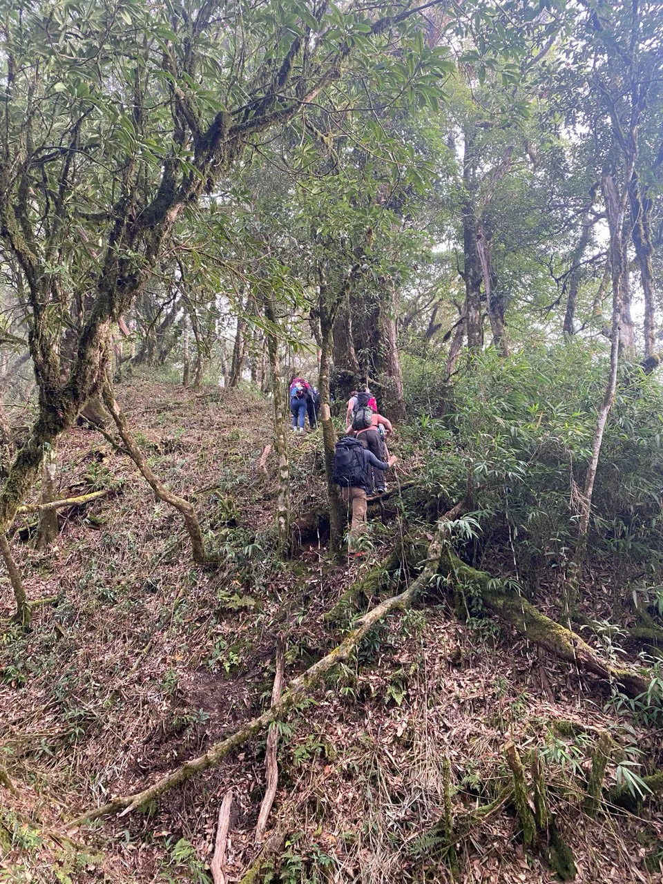
Compare Cao Bo and Tung San.
Two Tay Con Linh 2D1N programmes operate on Ridge & Cloud — this practical guide compares them. The former three-day journey on /tours/tay-con-linh-summit is retired. Chieu Lau Thi (2,402 m) is a separate mountain with its own bookable programmes.
Read the Tay Con Linh trekking guide first if you are choosing by start geography — Hoang Su Phi / Nam Hong / Tung San vs Cao Bo / Thuong Son.
- Tay Con Linh trekking guide
Primary route chooser — two operating 2D1N corridors and retired 3-day context.
- Tay Con Linh — cloud forest (2 days)
Cao Bo → Thuong Son — southern corridor, lower viewpoint (not the 2,428 m marker).
- Tay Con Linh from Tung San (2 days)
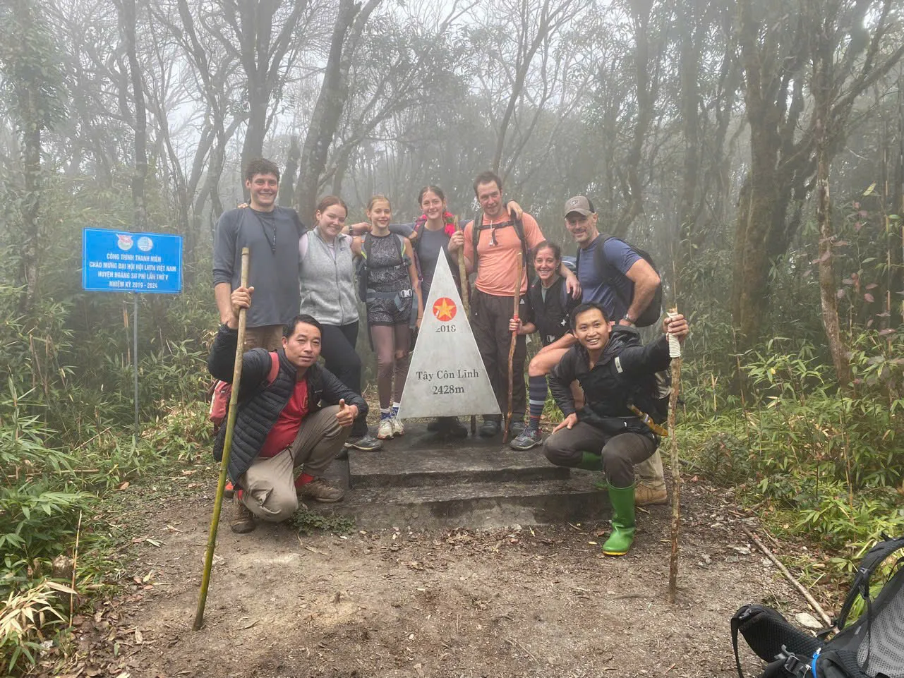
Tung Quan Lin access — forest shelter Night 1 (~1,850 m), 2,428 m marker Day 2 when safe, ~18 km walking.
Tay Con Linh 2D1N — practical comparison.
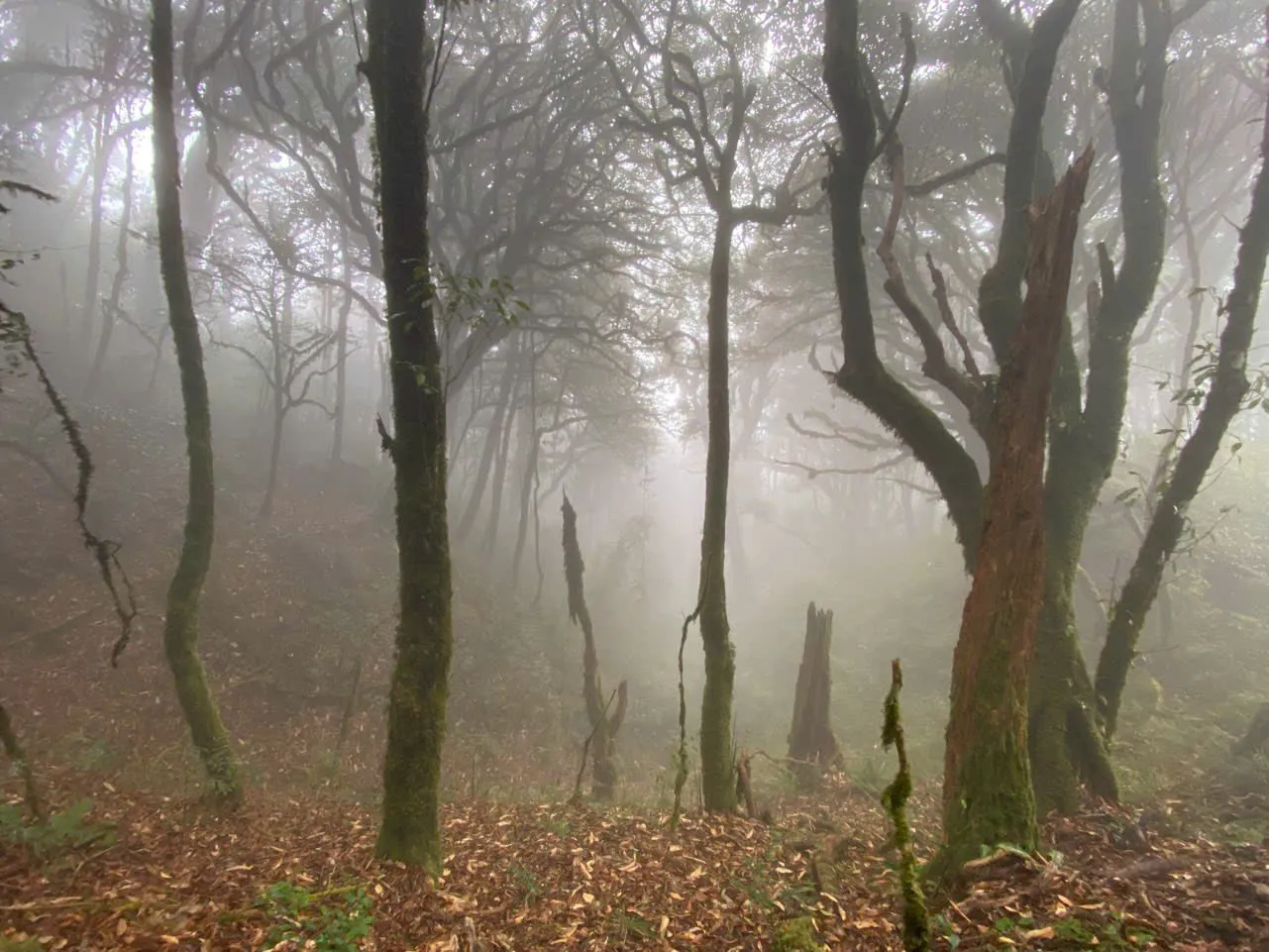
Cao Bo cloud forest (RCE · 02) is a southern point-to-point: Cao Bo through Shan tea and cloud forest to Thuong Son, with a lower ridge viewpoint — not the 2,428 m marker. From Tung San (RCE · 04) starts from the Nam Hong area, uses vehicle access toward Tung Quan Lin, walks to a local-house lunch and a forest shelter on Night 1 (~1,850 m), then climbs to the 2,428 m marker on Day 2 when the guide judges it safe — approximately 18 km walking over two days plus road / motorbike access.
Distances and hours on programme pages are operational averages — not GPX measurements. From Tung San we do not currently publish a verified GPX track. Both routes are Demanding: mountain trekking, forest terrain and simple overnight shelters — but day rhythm and walking totals differ sharply between corridors.
October through April is the practical massif window; storm-season months are not routine operating months. Maximum group size six on Ridge & Cloud programmes.
- Tay Con Linh — cloud forest (2 days)
Cao Bo → Thuong Son — southern corridor, lower viewpoint (not the 2,428 m marker).
- Tay Con Linh from Tung San (2 days)
Tung Quan Lin access — forest shelter Night 1 (~1,850 m), 2,428 m marker Day 2 when safe, ~18 km walking.
- Tay Con Linh trekking guide
Primary route chooser — two operating 2D1N corridors and retired 3-day context.
Who each corridor suits.
Choose Cao Bo cloud forest if you want the southern Vi Xuyen-side crossing to Thuong Son — Shan tea, cloud forest, ridge shelter and Red Dao village finish — without the 2,428 m marker attempt.
Choose from Tung San if you are already planning around Nam Hong / Hoang Su Phi and want the marker on Day 2 when conditions allow — accepting shelter Night 1, ~18 km walking and that the marker is not guaranteed.
Not ideal for either corridor if you need lodge comfort, guaranteed summit access, short walking days or minimal steep forest — both are simple-shelter mountain treks.
Ha Giang city is the usual base before Cao Bo; Nam Hong homestay context fits the Tung San corridor.
- Tay Con Linh — cloud forest (2 days)
Cao Bo → Thuong Son — southern corridor, lower viewpoint (not the 2,428 m marker).
- Tay Con Linh from Tung San (2 days)
Tung Quan Lin access — forest shelter Night 1 (~1,850 m), 2,428 m marker Day 2 when safe, ~18 km walking.
Two-day schedule.
- Day 1 · 11 km · Cao Bo → ridge shelter · ~6 h · lunch in clearing
- Day 2 · 11 km · Sunrise viewpoint → Thuong Son · ~5–6 h · hosted lunch
Transfers to Cao Bo on Day 1 morning and from Thuong Son on Day 2 afternoon are included. Most guests overnight in Ha Giang city the night before — not Hoang Su Phi town.
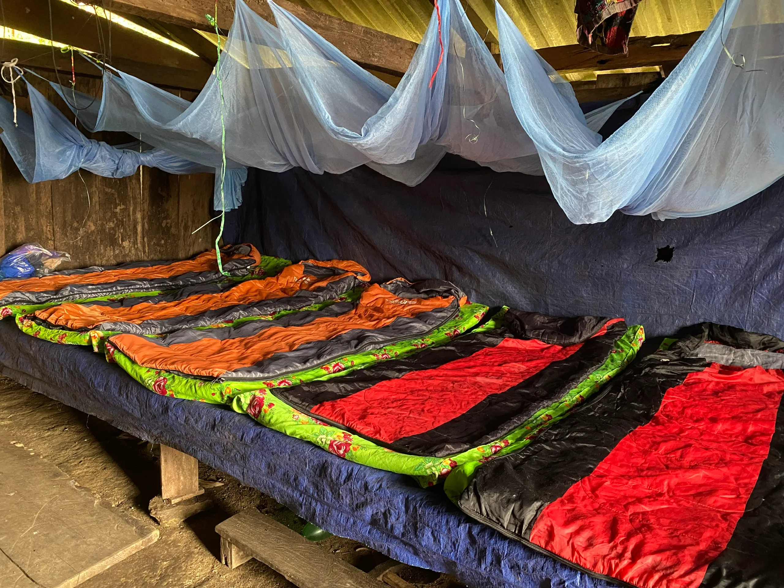
Meals included from Day 1 lunch through Day 2 lunch. Sleeping bag, mat and shelter night included. Maximum group size six trekkers.
- Tay Con Linh — cloud forest (2 days)
Cao Bo → Thuong Son — southern corridor, lower viewpoint (not the 2,428 m marker).
Fitness required.
Day 1 is six hours uphill with seven hundred metres gain. Day 2 adds pre-dawn walking and five to six hours descent on mossy steps. Comfortable with uneven terrain for six hours on consecutive days is the baseline.
This is not the eight- to nine-hour exposed spine day of Kieu Lieu Ti Day 2 — cloud forest spreads effort differently. Guests in their fifties complete this route regularly with trekking poles and sensible pacing.
Common mistake: assuming Day 2 is easy because sunrise is early — knees work harder on descent than lungs did on ascent.
- Tay Con Linh — cloud forest (2 days)
Cao Bo → Thuong Son — southern corridor, lower viewpoint (not the 2,428 m marker).
- Kieu Lieu Ti — three-day traverse
Three days across the upper spine from Ta Su Choong to Cao Bo.
Trekking operations on this route are currently unavailable, and we are not accepting bookings for it at present.
What to bring.
- Waterproof trekking boots (broken in)
- Daypack 25–30 L
- Warm hat, gloves, fleece, insulated jacket
- Thermal base layer + spare dry socks
- Light rain shell, headlamp, spare batteries
- Trekking poles strongly recommended
Cao Bo cloud forest: sleeping bag provided at the ridge shelter — rated to 0 °C on that corridor. From Tung San: standard sleeping bags and blankets at the forest shelter — we do not publish a comfort temperature rating for Tung San bags.
You do not carry overnight gear beyond layers worn at altitude. Main bag is not transferred — pack two days in one daypack.
- Packing for trekking in Ha Giang
Layering, footwear and daypack sizing for northern Vietnam.
Seasons and storm policy.
October and November: prime window — cold mornings, best cloud-sea probability, book early. December through February: freezing shelter nights, excellent visibility, empty trails — full winter kit essential.
March and April: warmer days, rhododendron on upper slopes, occasional fog — summit views less guaranteed than autumn. June through September: we do not depart — daily rain, lightning risk, slippery paths above 1,800 m.
Even in winter we monitor weather daily and postpone if storms make the ridge unsafe. Full refund or reschedule if we cancel before departure.
- Best time to trek Ha Giang
Month-by-month conditions across the province.
Cao Bo vs Tung San 2D1N.
Operating Tay Con Linh 2D1N comparison
| Cloud forest (Cao Bo) | From Tung San | |
|---|---|---|
| Approach | Southern / Vi Xuyen — Cao Bo | Hoang Su Phi — Tung Quan Lin vehicle access |
| Start → finish | Cao Bo → Thuong Son | Nam Hong area → Tung San (via Day 2 descent) |
| Summit status | Lower viewpoint — not 2,428 m marker | 2,428 m marker Day 2 when conditions allow |
| Day rhythm | Day 1 climb to shelter · Day 2 viewpoint + descent | Day 1 access + shelter · Day 2 summit + descent |
| Walking total | ~22 km (programme page) | ~18 km walking (operational average) |
| Overnight | Ridge / cloud-forest shelter | Forest shelter ~1,850 m (Night 1) |
| Route style | Point-to-point | Access + summit day via Tung Quan Lin |
| Best fit | Tea, villages, southern finish | Marker from Hoang Su Phi side when safe |
Approach
Cloud forest (Cao Bo)
Southern / Vi Xuyen — Cao Bo
From Tung San
Hoang Su Phi — Tung Quan Lin vehicle access
Start → finish
Cloud forest (Cao Bo)
Cao Bo → Thuong Son
From Tung San
Nam Hong area → Tung San (via Day 2 descent)
Summit status
Cloud forest (Cao Bo)
Lower viewpoint — not 2,428 m marker
From Tung San
2,428 m marker Day 2 when conditions allow
Day rhythm
Cloud forest (Cao Bo)
Day 1 climb to shelter · Day 2 viewpoint + descent
From Tung San
Day 1 access + shelter · Day 2 summit + descent
Walking total
Cloud forest (Cao Bo)
~22 km (programme page)
From Tung San
~18 km walking (operational average)
Overnight
Cloud forest (Cao Bo)
Ridge / cloud-forest shelter
From Tung San
Forest shelter ~1,850 m (Night 1)
Route style
Cloud forest (Cao Bo)
Point-to-point
From Tung San
Access + summit day via Tung Quan Lin
Best fit
Cloud forest (Cao Bo)
Tea, villages, southern finish
From Tung San
Marker from Hoang Su Phi side when safe
Both operating 2D1N corridors and Chieu Lau Thi programmes share October–April timing when departures run — Kieu Lieu Ti matched that calendar when it operated. Demanding difficulty holds across the comparison; rhythm, access valley and finish point differ.
- Tay Con Linh — cloud forest (2 days)
Cao Bo → Thuong Son — southern corridor, lower viewpoint (not the 2,428 m marker).
- Chieu Lau Thi — sunrise ridge (1 day)
Single demanding day — morning departure after breakfast, daylight ascent, meal on the ridge.
- Kieu Lieu Ti — three-day traverse
Three days across the upper spine from Ta Su Choong to Cao Bo.
Trekking operations on this route are currently unavailable, and we are not accepting bookings for it at present.
- Ridge & Cloud programmes
Compare routes, difficulty and seasons at this collection hub.
Booking and preparation.
Guests typically plan two to four weeks ahead for shoulder season and six to eight weeks for October and November when securing a place — availability is not guaranteed year-round.
Overnight in Ha Giang city before Day 1 for this route. Charge devices, lay out kit, eat a solid dinner — no alcohol excess before a six-hour climb.
Trekking accident insurance is included in the programme price — travel insurance for flights and transit to Ha Giang province is your responsibility.
The Kieu Lieu Ti three-day traverse remains unavailable — the booking and preparation notes above apply to the operating Cao Bo and Tung San 2D1N corridors when departures are offered.
- Tay Con Linh — cloud forest (2 days)
Cao Bo → Thuong Son — southern corridor, lower viewpoint (not the 2,428 m marker).
Field guides for this route.
Read the Day 1 tea ascent, shelter night, sunrise viewpoint and Red Dao descent guides before you pack — each covers one leg of the same programme with terrain-specific detail.
If you are comparing against Kieu Lieu Ti or the one-day ridge, read those practical guides too — choosing the wrong rhythm wastes a calendar day or breaks sleep.
- Climbing through Cao Bo Shan tea
Day 1 ascent through three-century tea trees to the ridge shelter.
- A night in the ridge shelter
Bunks, cold nights and wood-stove evenings at 2,100 m.
- Pre-dawn on the upper ridge
The 05:00 walk from shelter to the sunrise viewpoint.
- Red Dao descent to Thuong Son
Day 2 southern descent and hosted lunch.
Insurance, tips and transfers.
Trekking accident insurance is included in the programme price — travel insurance for flights and transit to Ha Giang province is your responsibility. Read policy boundaries before departure; altitude trekking may need explicit cover.
Tips for guides and Thuong Son host families are excluded — budget cash in small notes. Guides often split recognition between trail guide and driver at the end of Day 2 transfer.
Transfers from Ha Giang city to Cao Bo Day 1 and Thuong Son to city Day 2 are included. Transfers from Hanoi or Ha Giang airport are not — we can quote add-on transfers when you enquire.
- Tay Con Linh — cloud forest (2 days)
Cao Bo → Thuong Son — southern corridor, lower viewpoint (not the 2,428 m marker).
First ridge walk?
If this is your first walk above 2,000 m, cloud forest is the better entry than Kieu Lieu Ti or the one-day ridge — spine exposure and a full same-day climb are lower here. Terrace programmes like Nam Hong first help legs and homestay rhythm without altitude shock.
Previous trekking in Nepal or Peru does not automatically mean Tay Con Linh is easy — sleep management on the one-day route and mossy descents here have their own learning curve. Tell us your honest recent walking history.
Maximum group size six keeps pacing humane — we do not run large convoys on narrow cloud-forest steps.
- Kieu Lieu Ti — three-day traverse
Three days across the upper spine from Ta Su Choong to Cao Bo.
Trekking operations on this route are currently unavailable, and we are not accepting bookings for it at present.
- Chieu Lau Thi — sunrise ridge (1 day)
Single demanding day — morning departure after breakfast, daylight ascent, meal on the ridge.
- Ridge & Cloud programmes
Compare routes, difficulty and seasons at this collection hub.
Common questions.
How does this differ from Chieu Lau Thi sunrise ridge?
Different valley approach from Cao Bo, longer forest immersion, shelter night, and descent through Red Dao villages to Thuong Son — not a same-day return to Hoang Su Phi.
Where do I stay the night before?
Ha Giang city for most guests. Hoang Su Phi town is the base for Ta Su Choong routes.
Is summer ever possible?
No — we do not run from June through September.
Group size?
Two to six trekkers.
Published by Ha Giang Trekking — field knowledge from local trail guides on the routes described, checked against programme schedules and operating notes.
Journal pages are for route research and planning. Dates, prices, day-by-day schedules and enquiry sit on programme and tour pages.
Articles are published under Ha Giang Trekking. Named writer and guide bylines will be added when verified bios and consent are on file.
Operational details on programme and tour pages are published only after being checked against current operating information.
Compare published routes and open the programme or journey page when you are ready to enquire.
- Ridge & Cloud — compare summit programmes
Compare difficulty, seasons and walking style before you enquire.
- Tay Con Linh cloud forest (2 days)
Tay Con Linh cloud forest (2 days) — dates, pricing and enquiry.
- Tay Con Linh from Tung San (2 days)
Tay Con Linh from Tung San (2 days) — dates, pricing and enquiry.
- Tay Con Linh Summit
Trekking operations on this route are currently unavailable, and we are not accepting bookings for it at present.
Trekking operations on this route are currently unavailable, and we are not accepting bookings for it at present.
- Tay Con Linh: A Complete Guide for Trekkers
Main walking guide for Tay Con Linh.
- Hoang Su Phi Rice Terraces: A Complete Guide for Trekkers
Landscape, seasons and routes around Hoang Su Phi.
- Chieu Lau Thi: A Complete Guide for Trekkers
Neighbouring walking country linked to Tay Con Linh.
Ready to walk with local guides?
Dates, pricing and the day-by-day itinerary are on the programme page. Enquire about a departure when you are ready — we usually reply within 24 hours with availability, a clear price and what to pack.
Tay Con Linh — cloud forest (2 days) — dates, pricing and itinerary
