Climbing through Cao Bo Shan tea
Three-century tea trees, the long pull to the ridge shelter, and pacing on Day 1 of the cloud-forest route.
Cao Bo cloud forest 2D1N.
This field note supports the operating Tay Con Linh cloud-forest programme — Cao Bo → Thuong Son on the southern massif. It does not reach the 2,428 m summit marker (see Tay Con Linh from Tung San for that corridor).
- Tay Con Linh — cloud forest (2 days)
Cao Bo → Thuong Son — southern corridor, lower viewpoint (not the 2,428 m marker).
- Tay Con Linh trekking guide
Primary route chooser — two operating 2D1N corridors and retired 3-day context.
Climbing through Cao Bo Shan tea.
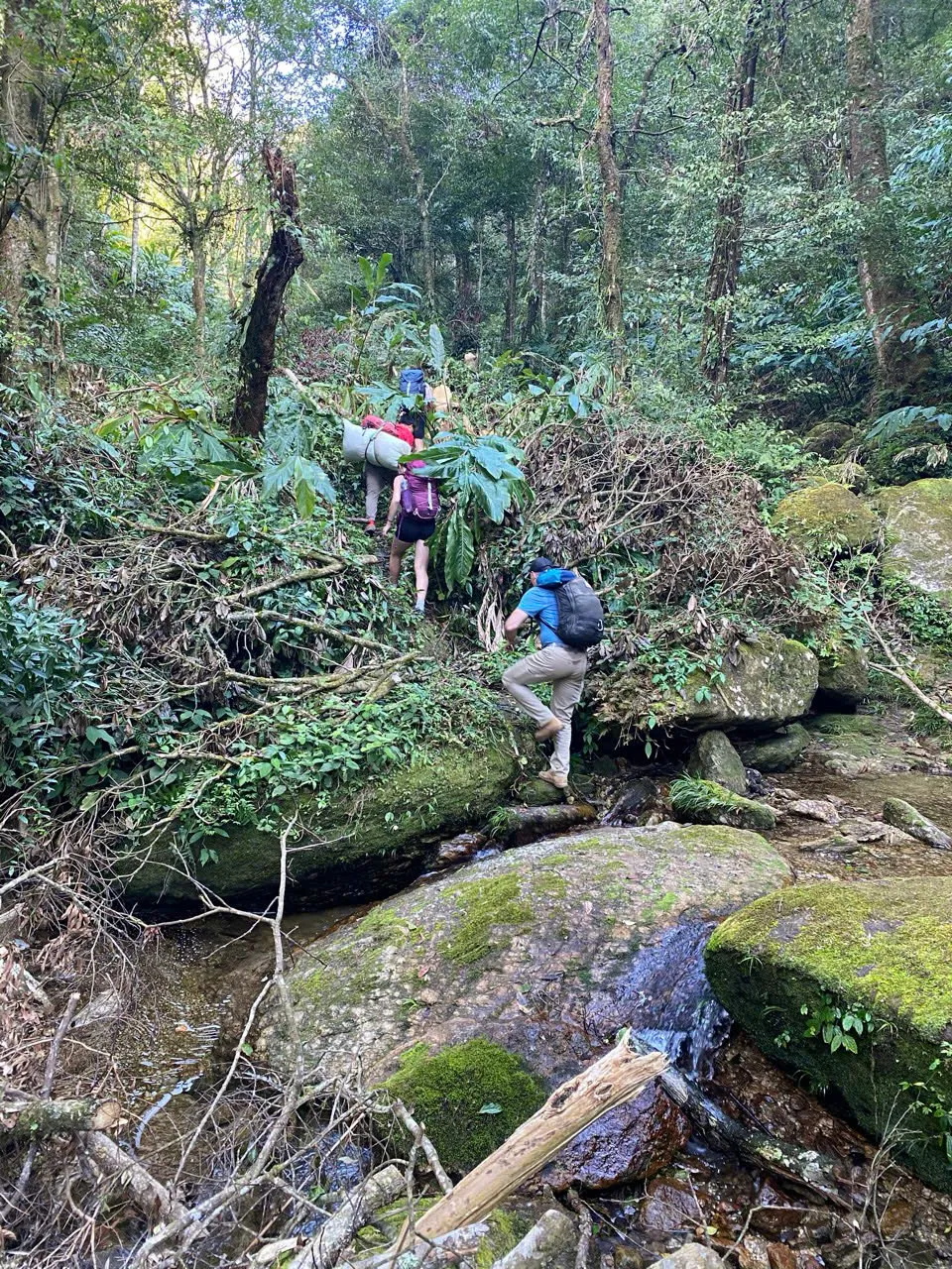
Day 1 of the Tay Con Linh cloud-forest route begins in Cao Bo commune on the southern slope of the massif — not in Hoang Su Phi town. You enter working Shan tea country where some trees are over three centuries old and still picked each spring. The path climbs steadily for six hours through farms, forest clearings and moss-hung cloud forest before you reach the wooden ridge shelter near 2,100 m by mid-afternoon.
This is the southern approach toward high-mountain country that Chieu Lau Thi programmes climb from Ta Su Choong on the Hoang Su Phi side. Chieu Lau Thi tops out at 2,402 m; Tay Con Linh (2,428 m) is a separate summit to the east. The valley culture, pacing and finish point on this route differ from the Ta Su Choong approach. Cao Bo guests overnight in Ha Giang city the night before; Hoang Su Phi guests sleep in town on the western approach. Chieu Lau Thi programmes and operating Tay Con Linh 2D1N corridors run October through April when departures are offered — not year-round. We do not run Tay Con Linh departures June through September. The Kieu Lieu Ti three-day traverse is not operating; its page is kept for research.
The Day 1 climb is the longest sustained uphill of the two-day programme. Distance is eleven kilometres with roughly seven hundred metres of gain. You carry a daypack with warm layers, water and camera; your guide carries lunch for a picnic in a forest clearing around midday. The goal is to arrive at the shelter with enough daylight to wash, layer up and eat before the temperature drops.
- Tay Con Linh — cloud forest (2 days)
Cao Bo → Thuong Son — southern corridor, lower viewpoint (not the 2,428 m marker).
- Ridge & Cloud programmes
Compare routes, difficulty and seasons at this collection hub.
Cao Bo commune.
Cao Bo sits in the Red River gorge system below Tay Con Linh's southern flanks. Morning briefing happens with a host family — tea, pack check, water refill — before you step onto farm paths that have carried tea pickers for generations. Corn stacks beside stilt houses, bamboo drying racks for Shan leaves, dogs that know every walker on the path.
Most guests reach Cao Bo by road from Ha Giang city, not from Hoang Su Phi. Allow ninety minutes on winding mountain roads the evening before. A late arrival from Hanoi makes an early Day 1 start unsafe — build in a rest night in the city or nearby.
The trailhead elevation is near 1,400 m. Valley mornings can feel mild; by the time you reach the upper tea belt at 1,700 m the air cools noticeably. Guides set a conversational pace on the lower farm sections — the long pull onto the ridge comes after lunch, not before.
- Tay Con Linh — cloud forest (2 days)
Cao Bo → Thuong Son — southern corridor, lower viewpoint (not the 2,428 m marker).
Three-century Shan tea.
Above the village fields the path enters old Shan tea — gnarled trunks, moss on bark, leaves picked by hand on steep terraces. Some specimens on this slope exceed three hundred years. They are not museum trees behind a fence; they are working capital for Red Dao and Hmong families who dry leaves on bamboo racks beside the path.
Harvest runs March through May. Autumn walks pass drying racks and stored leaf, not active picking. Guides explain which trees belong to which household and when photography of workers is welcome. Do not pick leaves or branches — forest-use agreements here predate tourism.
The tea belt is where guests first feel altitude on this route. Rhododendron and shaman trees appear between tea rows as you climb. Moss thickens on stone steps after rain. Trekking poles help on the upper mossy section even on Day 1 — you will want them again on Day 2 descent.
- Finishing in Cao Bo
Day 3 of the Kieu Lieu traverse returns to this same tea valley from the ridge.
Picnic lunch on the climb.
Lunch arrives in a forest clearing between eleven-thirty and twelve-thirty — timing depends on group pace and weather. Sticky rice, smoked pork, mountain greens and fruit. This is the last reliable water stop before the shelter unless a spring is running on the upper ridge; refill bottles here.
Guides do not rush lunch to gain altitude faster. The afternoon pull is long and the shelter is cold at arrival — arriving exhausted and dehydrated makes the evening harder than the climb itself. Eat fully, rest ten minutes, then layer for the upper section.
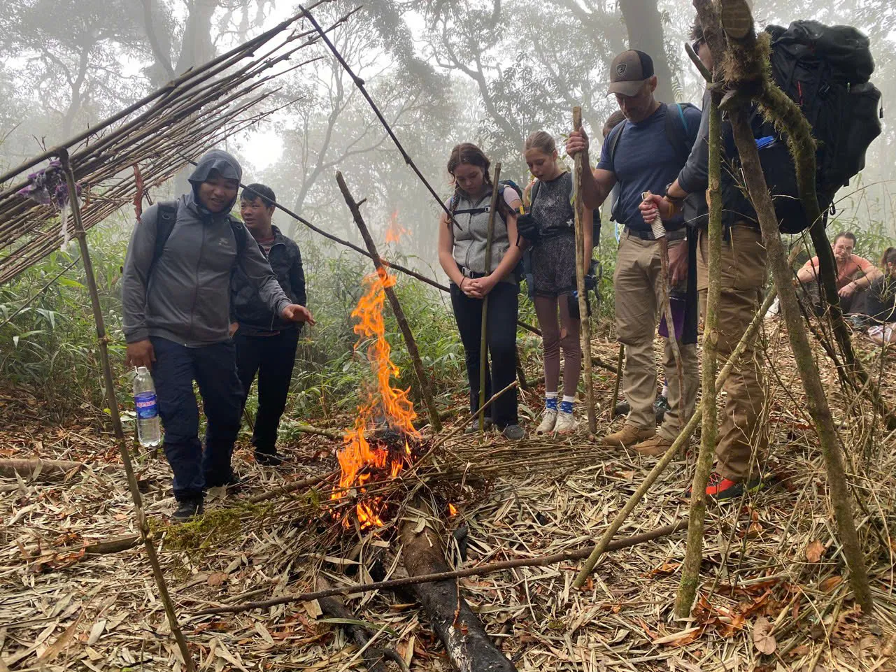
After lunch the path steepens through cloud forest. Bamboo replaces tea rows. Footing becomes rooty and mossy. The group spreads into single file on narrow sections where others cannot pass — breaks happen on wider benches, not on steps above drops.
- Tay Con Linh — cloud forest (2 days)
Cao Bo → Thuong Son — southern corridor, lower viewpoint (not the 2,428 m marker).
The long pull to the ridge.
The final two hours of Day 1 are the steepest and the most exposed to weather. Cloud can roll in from the east without warning in shoulder season. Rain on moss turns stone steps into slides — guides shorten stride and add pole use.
Guide field note: pacing slows deliberately on the mossy upper section after rain. Guests who push hard before the shelter arrive sweaty and lose heat fast when the sun drops behind the ridge. Steady beats fast on this pitch.
- Tay Con Linh — cloud forest (2 days)
Cao Bo → Thuong Son — southern corridor, lower viewpoint (not the 2,428 m marker).
Reaching the ridge shelter.
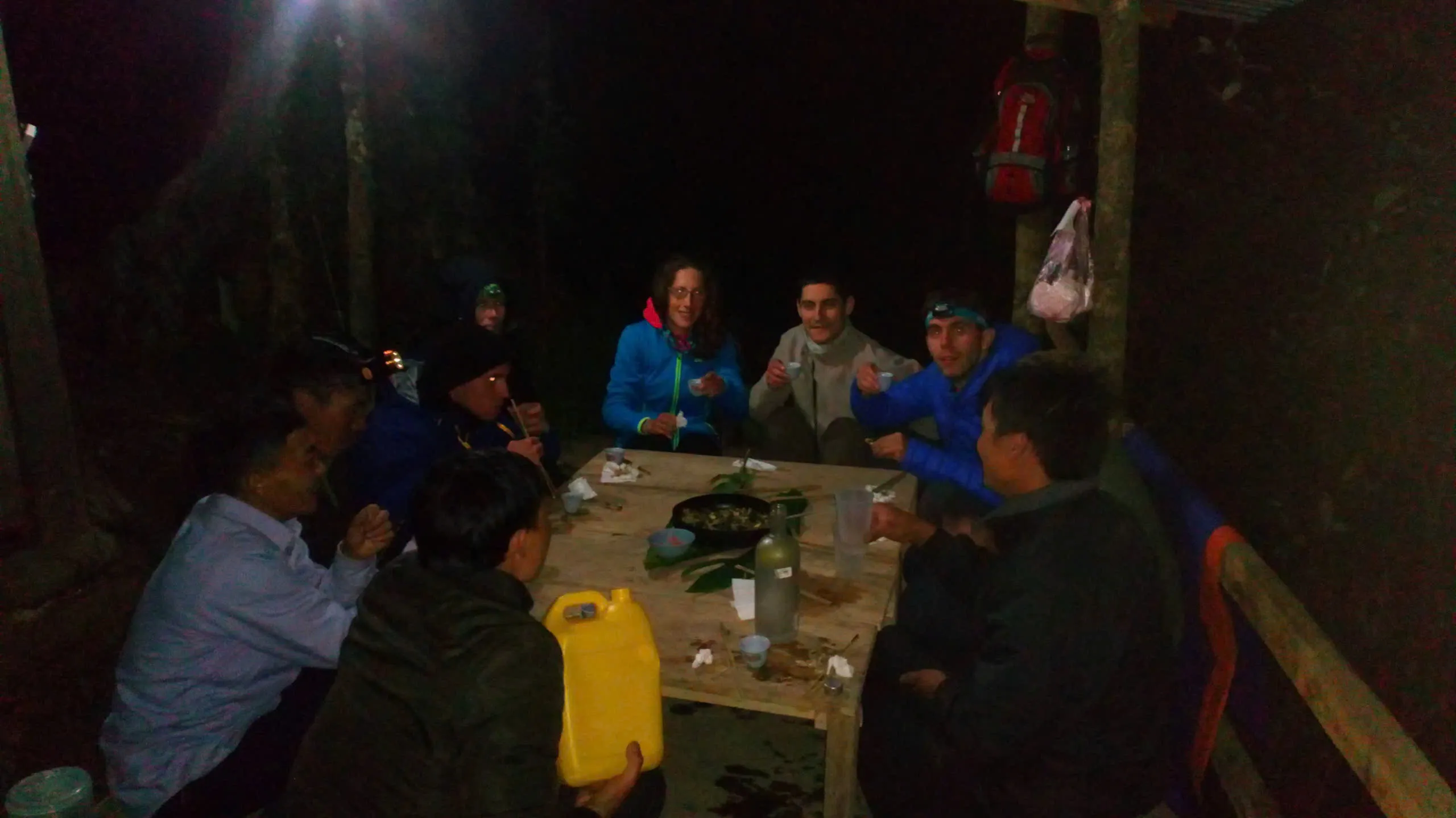
The wooden shelter sits near 2,100 m on the upper Tay Con Linh ridge — shared bunks, sleeping bags and mats provided, squat toilet outside, wood stove for evening meal. You arrive between fifteen and sixteen hundred hours on a normal pace day.
Hot wash if water is heated, then layer up immediately. The temperature drop when the sun leaves the ridge can be ten degrees in an hour. Fleece and insulated jacket belong on your body, not in the bottom of your pack, before dinner.
Evening is early: hot soup, rice, mountain greens, ginger tea around the stove. Lights out by twenty-one hundred is normal — Day 2 starts before dawn. Read the shelter-night guide for bunk etiquette, cold management and what no phone signal means for your plans.
- A night in the ridge shelter
Full guide to bunk life, cold nights and the wood stove.
Pacing and what to expect.
- Day 1 · ~11 km · ~6 h walking · ~700 m gain
- Previous multi-day trekking helps but is not mandatory
- Tell us knee or back concerns at booking — pace adjusts to slowest walker
Six hours uphill at altitude is Demanding in our scale — not because of exposure or technical ground, but because of sustained gain on uneven steps. Guests in their fifties complete this route regularly when they walk several times per week at home.
Common mistake: treating Day 1 as a race to the shelter. The cloud-forest programme spreads effort across two days precisely so Day 2 descent and sunrise are enjoyable, not survival. Save energy for the pre-dawn walk and the long Red Dao descent.
- Tay Con Linh — cloud forest (2 days)
Cao Bo → Thuong Son — southern corridor, lower viewpoint (not the 2,428 m marker).
Season and Day 1 kit.
October through April only. October and November offer the clearest ridge evenings; December through February bring freezing shelter nights and excellent visibility. March and April add rhododendron on the upper slopes and warmer afternoons — cloud-sea probability is slightly lower than autumn.
Day 1 kit: sturdy waterproof boots, daypack twenty-five to thirty litres, warm hat and gloves for the shelter, thermal base layer, light rain shell, headlamp with spare batteries, trekking poles strongly recommended. You do not need a sleeping bag — one rated to zero degrees is provided.
Valley morning temperature does not predict shelter evening temperature. Pack as if the day ends at five degrees Celsius even when Cao Bo felt mild at breakfast.
- Best time to trek Ha Giang
Month-by-month conditions across the province.
- Packing for trekking in Ha Giang
Layering, footwear and daypack sizing for northern Vietnam.
Cao Bo vs Ta Su Choong.
The Hoang Su Phi cloud-sea programme climbs the same massif from Ta Su Choong and returns to Hoang Su Phi town. This route climbs from Cao Bo and finishes at Thuong Son after a Red Dao village descent — different access, different culture on the trail, different road pickup.
The one-day Chieu Lau Thi sunrise ridge compresses the same massif into a single daylight climb from Hoang Su Phi after breakfast. This route sleeps high and walks twenty minutes to a viewpoint below the summit — no full daylight climb from town in one day.
Choose Cao Bo if you want Shan tea immersion on the ascent and a village homestay-style lunch finish on Day 2. Choose Ta Su Choong if Hoang Su Phi town is your base and you prefer the classic western approach. Choose Kieu Lieu Ti if you want three days and a full spine crossing end to end.
- Chieu Lau Thi — cloud sea (2 days)
Two-day walk from Ta Su Choong with lodge night at Chieu Lau Thi 2402m Lodge.
- Chieu Lau Thi — sunrise ridge (1 day)
Single demanding day — morning departure after breakfast, daylight ascent, meal on the ridge.
- Kieu Lieu Ti — three-day traverse
Three days across the upper spine from Ta Su Choong to Cao Bo.
Trekking operations on this route are currently unavailable, and we are not accepting bookings for it at present.
- Ridge & Cloud programmes
Compare routes, difficulty and seasons at this collection hub.
Water on Day 1.
Fill bottles at the Cao Bo briefing — last reliable tap before forest. Forest clearing lunch is the main refill when spring flows; upper ridge spring may be dry in late March.
Carry two litres minimum on Day 1 upper section — six hours uphill dehydrates even in cool air. Guides carry spare but not unlimited.
Water purification tablets optional backup — springs are used by local communities when running; guides know which sources are current.
- Tay Con Linh — cloud forest (2 days)
Cao Bo → Thuong Son — southern corridor, lower viewpoint (not the 2,428 m marker).
Common questions.
Where do I stay the night before Day 1?
Most guests overnight in Ha Giang city. We arrange road transfer to Cao Bo on trek morning. Hoang Su Phi town is the base for Ta Su Choong routes, not this one.
Can I see tea harvest on this route?
Active picking runs March through May. Autumn walks pass drying racks and stored leaf, not harvest work.
How heavy should my daypack be?
Keep it under ten kilograms with water. Warm layers, headlamp, spare socks and personal items — no overnight gear beyond what you wear at the shelter.
What if I struggle on the climb?
Guides pace to the slowest walker and can add rest stops in clearings. Tell us fitness concerns at booking so we allocate guide support appropriately.
Published by Ha Giang Trekking — field knowledge from local trail guides on the routes described, checked against programme schedules and operating notes.
Journal pages are for route research and planning. Dates, prices, day-by-day schedules and enquiry sit on programme and tour pages.
Articles are published under Ha Giang Trekking. Named writer and guide bylines will be added when verified bios and consent are on file.
Operational details on programme and tour pages are published only after being checked against current operating information.
Ready to walk with local guides?
Dates, pricing and the day-by-day itinerary are on the programme page. Enquire about a departure when you are ready — we usually reply within 24 hours with availability, a clear price and what to pack.
Tay Con Linh — cloud forest (2 days) — dates, pricing and itinerary