Skip to content
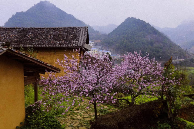
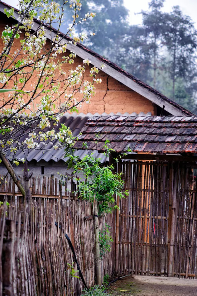
Lo Lo Chai homestay and mud-walled village houses on the northern plateau edge
Group A · Remote Village Treks

Ha Giang,
village to village on foot.

Village-to-village walking in Du Gia, Quan Ba and eastern limestone country — homestays, support-vehicle luggage on long eastern lines, and forest paths at a slower pace.

1 – 3 daysSmall groups · 2 – 8 trekkersLocal Dao · Hmong · Lo Lo guides
— Introduction

Ha Giang villages, on foot.

Beyond the loop road, Ha Giang is still linked by footpaths — Du Gia in the green south, Quan Ba in the first valley onto the plateau, and eastern limestone country where Lo Lo Chai, Dong Van and Meo Vac connect by village walking rather than viewpoint stops.

These routes suit travellers who want people and pace over altitude records. You eat in a Tay kitchen, walk through Lo Lo mud-walled houses, or arrive at the Lung Tam indigo cooperative on foot — not by minibus. The Lo Lo Chai to Then Pa programme sleeps a White Hmong ridge night, not one universal Lo Lo house pattern.

Du Gia is an easy single day. Lo Lo Chai–Then Pa adds northern atmosphere over two days. Nam Dam–Lung Tam is the full Quan Ba crossing, with two homestays and a long Day 2 ridge. For a west-to-east terrace-to-karst line with support-vehicle luggage and long Dong Van toward Meo Vac days, the flagship Private Hoang Su Phi to Dong Van Hiking Journey remains the commercial owner — linked below, not rewritten here.

— Who it suits

Travellers who care more about homestays, markets and village pace than summit altitude. This includes families with confident walkers in Du Gia, culture-focused couples and anyone wanting to reach Lung Tam’s indigo weaving on foot.

— Why trek here

Reasons to walk Ha Giang villages.

  • 01

    Village rhythm, not viewpoint tourism

    You walk at farming pace, pausing at irrigation channels, schoolyards and drying racks. Lunch is long because the host family is cooking, not because a schedule requires a break.

  • 02

    Ethnic diversity in close quarters

    Ha Giang holds more than twenty ethnic groups. These routes focus on Red Dao, Tay, Hmong, Lo Lo and Dao Cham communities, where homestay hosting remains a household decision rather than a district-wide contract.

  • 03

    Homestays with context

    The herbal bath in Nam Dam, the indigo courtyard at Lung Tam and the Lo Lo kitchen in Chai village all give each night a specific reason to be in that place. This is not a generic ‘village experience’.

  • 04

    Accessible effort, rich reward

    Only Nam Dam–Lung Tam Day 2 approaches a long ridge day. Du Gia is genuinely easy terrain. Lo Lo Chai–Then Pa adds northern atmosphere without extreme altitude. Multi-day eastern walking with 15–20 km plateau days belongs on the published Hoang Su Phi to Dong Van journey — Demanding grade, support vehicle for main luggage.

  • 05

    Walking-first eastern logistics

    On supported eastern lines you carry a daypack while main luggage moves by private support vehicle between accessible road points. The vehicle does not follow every trail — it enables the western Ha Giang → Lo Lo Chai transfer (departure from Ban Luoc in Hoang Su Phi, not an eastern village) and meets walkers where access permits.

— Landscape

Terrain and elevation.

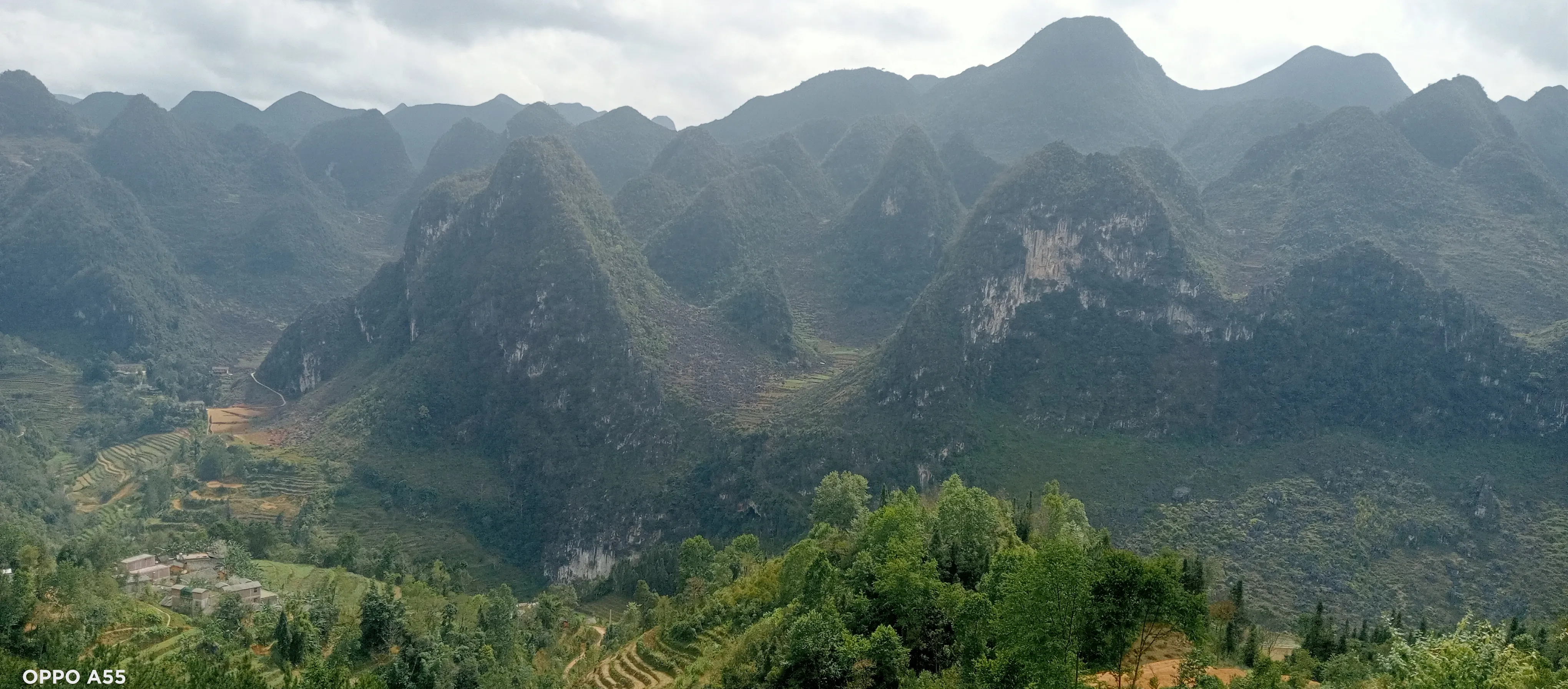
Du Gia lies in a forested southern valley, with rivers, bamboo, waterfalls and terraced fields between 700 and 1,050 m. The Quan Ba routes cross the Twin Mountains valley and forested ridges toward Yen Minh. Lo Lo Chai sits below the Lung Cu flagpole at the northern tip of the province, where buckwheat fields and karst outcrops replace the west’s deep terraces.

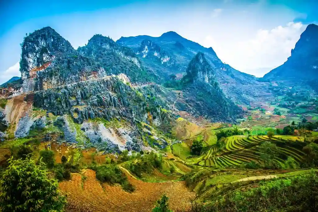
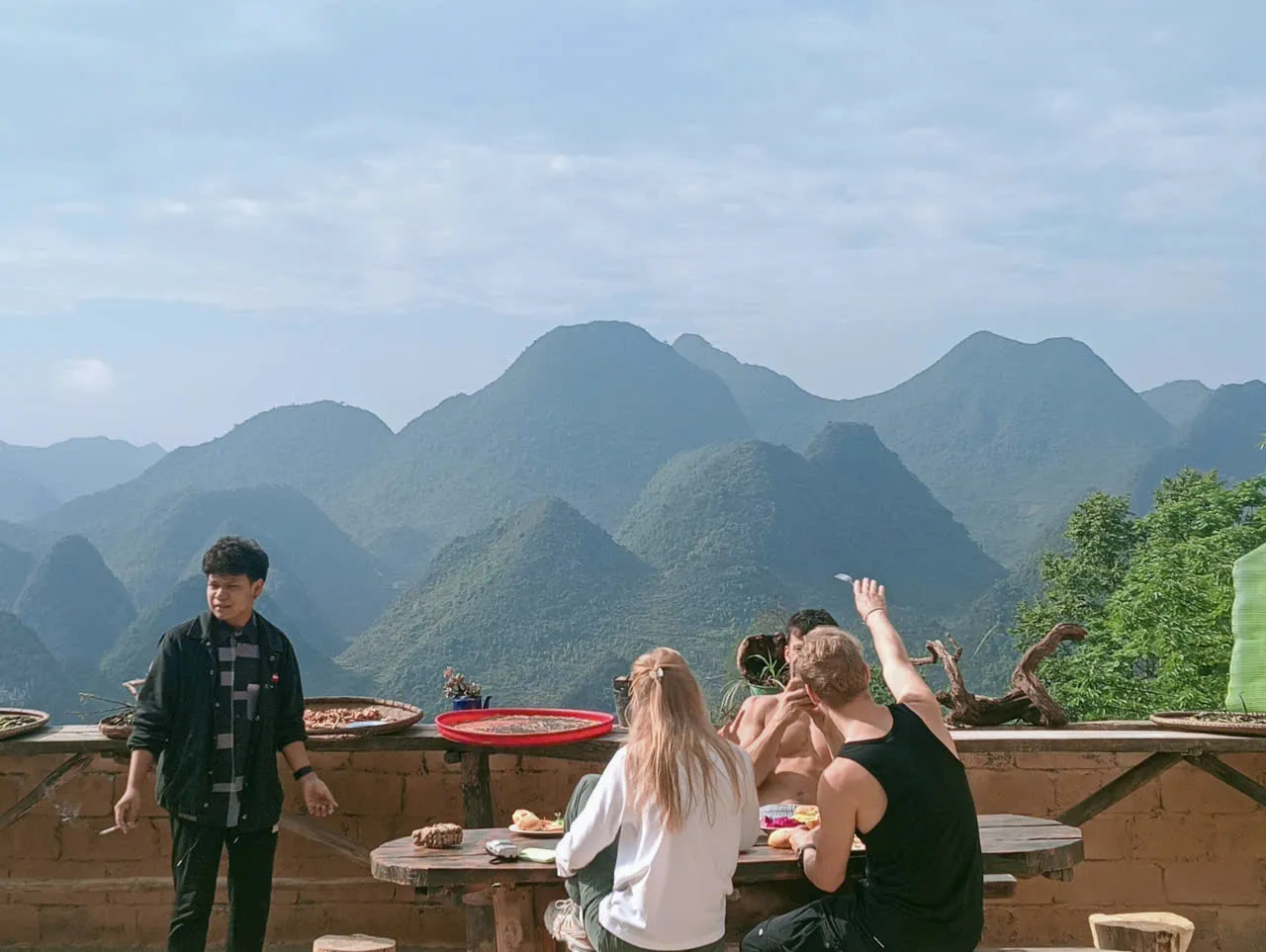
Eastward, Hoang Su Phi’s rice and forest country gives way to the Dong Van Karst Plateau — cone-karst hills, corn in small valleys, stone and concrete village paths, and long walking days toward Dong Van and Meo Vac. These landscapes are gentler than Tay Con Linh in the south-west programmes but no less specific. Each valley has its own water system, crop mix and path network, maintained by the people who live there.

— Culture

People on the path.

Tay villages in Du Gia farm rice and fish on the valley floor. Hmong communities above them grow corn and cassava on steep slopes. Lo Lo families in Chai village maintain mud-walled houses and a distinct language isolate that fascinates linguists and guests alike.

Dao Cham in Nam Dam are known for herbal medicine: gardens beside stilt houses, drying racks for roots and leaves, and a shrine calendar that marks planting and harvest. Lung Tam is a White Hmong weaving cooperative where indigo vats and looms run six days a week.

Markets matter here. Sunday markets at Meo Vac and Dong Van are reachable by road, while smaller commune markets — which your guide can identify — are where trade still happens on foot.

— Trekking styles

How people walk Ha Giang villages.

  • Style 01

    Single-day village circuits

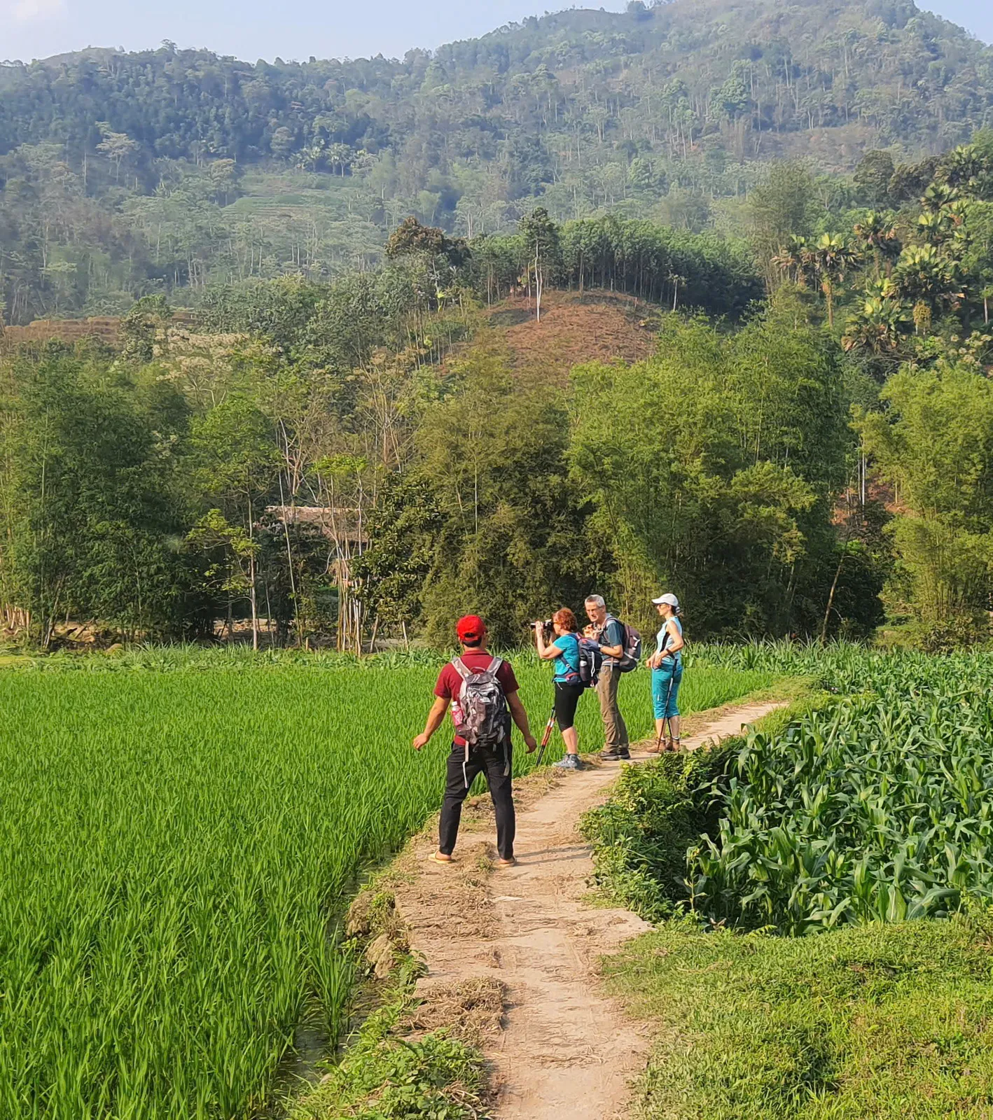
    Du Gia forest villages links Tay, Hmong and Dao hamlets in 11 – 13 km with a hosted lunch and optional swim at the waterfall — easy terrain, ideal for families with confident walkers.

  • Style 02

    Two-day northern villages

    Lo Lo Chai to Then Pa walks from the iconic northern village through buckwheat country to a Hmong homestay — moderate effort, strong sense of place at the edge of the plateau.

  • Style 03

    Three-day valley crossings

    Nam Dam to Lung Tam crosses Quan Ba on foot: a Dao Cham herbal homestay, a long forest ridge on Day 2 and the indigo cooperative on Day 3. Luggage moves by motorbike between villages.

  • Style 04

    Multi-day eastern village-to-village

    Lo Lo Chai homestay nights, limestone walking toward Dong Van, then Dong Van toward Meo Vac through Ma Pi Leng country — picnic lunches, daypacks and support-vehicle main luggage. The published 7-day Hoang Su Phi to Dong Van Hiking Journey holds this intent; enquire there before treating it as a generic village day trip.

— Best seasons

When to walk Ha Giang villages.

Conditions shift with elevation as much as month. Use this as a starting point — your guide confirms the final call.

  • Sept – Nov

    Harvest and buckwheat

    Conditions

    Dry, clear, buckwheat bloom on the northern plateau in October – November.

    Our recommendation

    Best all-round window for every village route.

  • Mar – Apr

    Blossom

    Conditions

    Plum and pear blossom, warming days, occasional rain.

    Our recommendation

    Good for Du Gia and Quan Ba homestays.

  • Dec – Feb

    Cold north

    Conditions

    Frost possible in Lo Lo Chai and Lung Cu area. Quiet trails.

    Our recommendation

    Pack warm layers for northern homestays.

  • May – Aug

    Green rains

    Conditions

    Lush valleys, daily showers, slippery paths.

    Our recommendation

    Du Gia and Nam Dam still walk well — we adjust pace and routes.

— Route comparison

Choose your programme.

Every route below is a commercial booking page — pricing, itinerary and enquiry on each programme.

— Difficulty guide

What Moderate and Demanding mean here.

  • Easy

    5 – 6 hours on village paths with gentle climbs. Regular stops. Suitable for first-time trekkers.

    Examples · Du Gia forest villages

  • Moderate

    Full days on uneven terrain, homestay nights, possible cold evenings.

    Examples · Lo Lo Chai–Then Pa, Nam Dam–Lung Tam

— Featured stories

Read before you walk.

Field guides and practical notes — separate from programme booking pages.

— What to do next

Compare routes above, read a field story, then enquire about a departure with your dates. We usually reply within 24 hours with availability, a clear price and what to pack.

Enquire about a departure
— FAQ

Planning your Ha Giang villages trek.

Are these routes suitable for children?
Du Gia is suitable from about 10 years old with a confident walker. Multi-day homestay routes are better for teenagers and adults who are comfortable with shared accommodation.
How basic are the homestays?
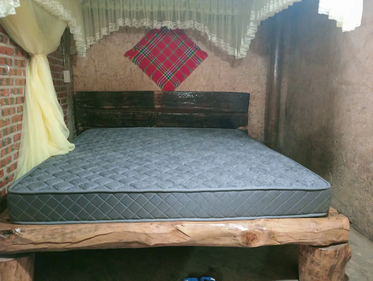
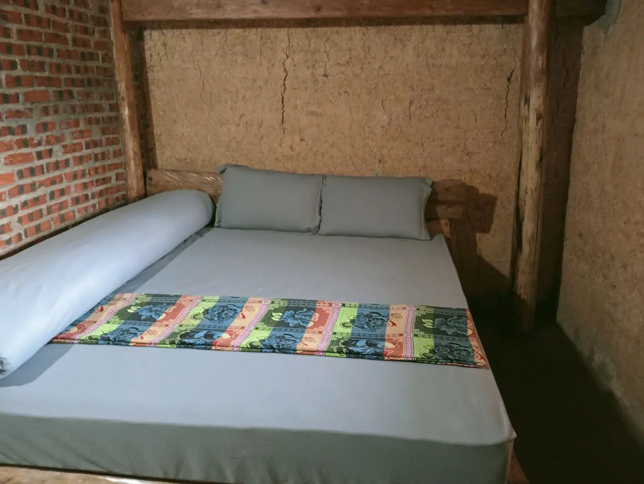
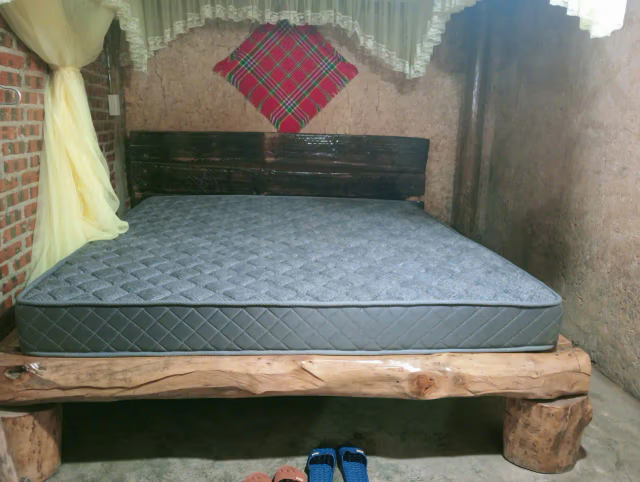
Simple and clean — mattress on a wooden floor, bedding and mosquito net, shared room, squat toilet often in a separate building. Wood-fired hot water where available.
Can I visit Lung Tam without the three-day trek?
The cooperative is open to day visitors by road. The three-day route earns the arrival — you walk in through two valleys and a forest ridge first.
Do I need the Dong Van loop permit?
Foreign travellers need a Ha Giang province entry permit for the northern plateau. We include permit guidance in your booking confirmation — bring your passport.
Which village route suits a first trek?
Du Gia for one Easy day with hosted lunch. Lo Lo Chai for northern atmosphere with one Moderate homestay night. Nam Dam when you want three days, herbal baths and Lung Tam indigo — compare difficulty on Plan Your Ha Giang Trek before you choose by duration alone.
How do Easy and Moderate village routes differ?
Du Gia stays on gentle valley paths with regular stops — rated Easy. Lo Lo Chai and Nam Dam are Moderate: longer days, homestay nights and, on Nam Dam Day 2, a forest ridge with no water for the first three hours.
Which route best combines with Hoang Su Phi?
Nam Dam–Lung Tam pairs well if you are crossing the plateau east to west. Du Gia fits a southern loop extension after Meo Vac. Plan Your Ha Giang Trek compares province-wide sequencing before you stack collections.
Is Lo Lo Chai very touristy?
The village sees day visitors from the flagpole road. Our route walks in from Chai at dusk and out toward Then Pa — quieter hours, hosted meals, no coach groups.
— Eastern Ha Giang

Village walking on the limestone plateau.

The eastern Ha Giang cluster begins at Lo Lo Chai — homestays, long Dong Van toward Meo Vac days and Ma Pi Leng country. Western Hoang Su Phi and Ban Luoc belong to terrace country; they are not eastern destinations. The published multi-day owner is the Private Hoang Su Phi to Dong Van Hiking Journey; this hub explains the eastern section without duplicating that sales page.

Private Hoang Su Phi to Dong Van Hiking Journey
— Western to eastern

From western Ha Giang to the eastern plateau

Western Ha Giang → Eastern Ha Giang transition

Leaving Ban Luoc — transfer toward Lo Lo Chai

Leaving Ban Luoc in Hoang Su Phi · western Ha Giang. Ban Luoc is western Hoang Su Phi terrace country — a departure point for this transfer, not part of the eastern village cluster. After substantial terrace trekking days, a private vehicle carries you east and north toward Lo Lo Chai while main luggage stays with the support vehicle.

As the private vehicle travels toward the plateau, Hoang Su Phi terraces, forest and cultivated mountains gradually gives way to Dong Van Karst Plateau limestone, rocky highlands and small cultivated valleys. Stops may be made for lunch, rest or photography when the day allows. Exact drive duration is not published.

Arrival in Lo Lo Chai marks the transition into the limestone world of the Dong Van Karst Plateau. From Lo Lo Chai onward, the journey enters the eastern Ha Giang walking section. If daylight permits, a short village or surrounding walk at Lo Lo Chai. Activity is a long mountain transfer with optional easy walking — not a Loop sightseeing day.
— Eastern walking

Eastern Ha Giang walking begins at Lo Lo Chai.

From Lo Lo Chai onward, the journey enters the eastern Ha Giang walking section.

Eastern walking begins

Lo Lo Chai toward Dong Van

From Lo Lo Chai onward, the journey enters the eastern Ha Giang walking section. The defining limestone day: Lo Lo Chai → Khia Lia / Khe Lia → Thai Phin Tung → Ha De → Dong Van. Reference walking 15–18 km, 6–8 hours, upper Moderate. Terrain mixes limestone trails, stone paths, dirt tracks, agricultural paths and sections of concrete village road — corn fields and small cultivated valleys instead of Hoang Su Phi’s extensive rice terraces.

Your English-speaking guide stays with you; the private support vehicle appropriate to the group size carries main luggage separately. You walk with a light daypack — water, camera, phone, personal essentials and picnic lunch when required. Overnight is a Dong Van hotel or guesthouse. This corridor is the published flagship’s Day 5 — not the Lo Lo Chai to Then Pa village programme.

Plateau traverse

Dong Van toward Meo Vac

A substantial point-to-point day through Dong Van → Ta Lung → Pai Lung Village → Cay Doi → Sky Path → Panorama → Meo Vac. Reference 15–20 km, 6–8 hours, upper Moderate. Terrain can include concrete village paths, dirt trails, rocky mountain tracks and uneven limestone sections — increasingly rugged as you leave Dong Van toward Pai Lung country, Cay Doi and the Ma Pi Leng mountain environment.

This is a walking corridor through part of the plateau — not the Ha Giang motorbike Loop walked kilometre-for-kilometre. The support vehicle does not accompany every footpath. It meets the route only where access permits. Lunch is normally picnic. Finish in Meo Vac after a long walking day.

Final morning

White Cliff and onward transfer

A shorter mountain walk on the White Cliff trail in the Ma Pi Leng area: reference 2–3 hours, Moderate on rocky, stone and dirt ground that can be narrow or uneven. Reference walking time only. Trailhead geometry is not published here.

Then you meet the vehicle; the English-speaking trekking guide finishes the walking programme. A private driver continues toward Cao Bang City with main luggage already aboard. the English-speaking trekking guide finishes the guided programme and a private driver continues toward Cao Bang onward connection only — not Cao Bang walking authority. Use White Cliff–specific imagery only when source evidence supports it — generic eastern landscape photos do not prove that trail.

— Logistics

Your private support vehicle

On supported eastern walking journeys, main luggage can travel separately by support vehicle while the walker carries a light daypack. The vehicle enables road transfers, luggage movement between accessible overnight points, the western ha giang → eastern ha giang transition (departure from Ban Luoc in western Ha Giang — not an eastern village), and access-point pickup where roads meet the line.

The support vehicle does not accompany every footpath. It meets the route only where access permits. Vehicle type depends on group size, luggage and road conditions — confirmed at quote, not assumed as one fixed model on this page.

  • Main luggage between accessible overnight / road points
  • Does not follow every walking trail
  • Daypack on the trail: water, camera, phone, essentials, picnic when required
  • Western Ha Giang → Lo Lo Chai transfer without carrying full packs
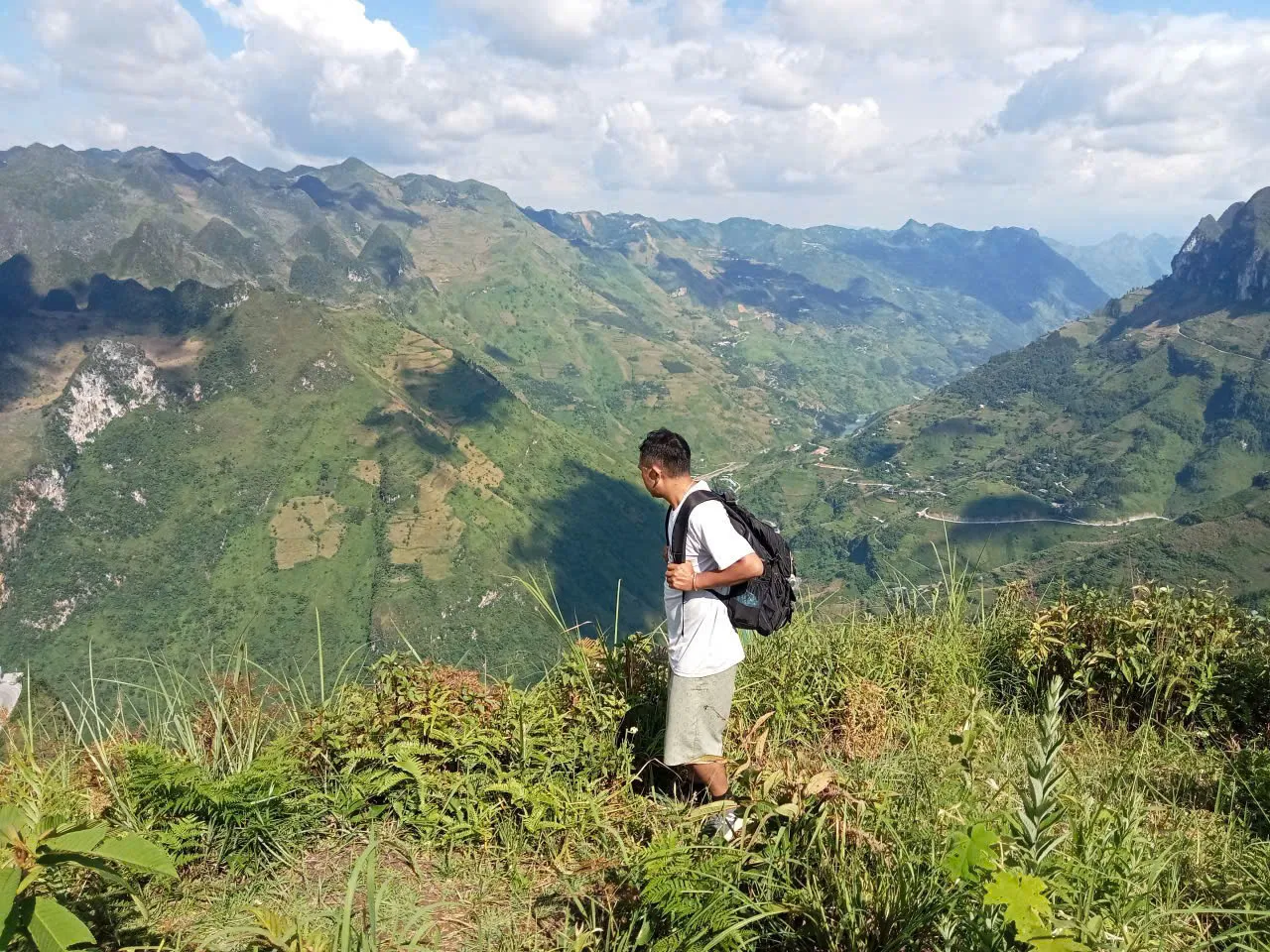
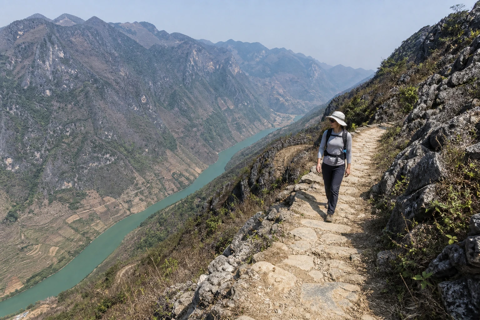
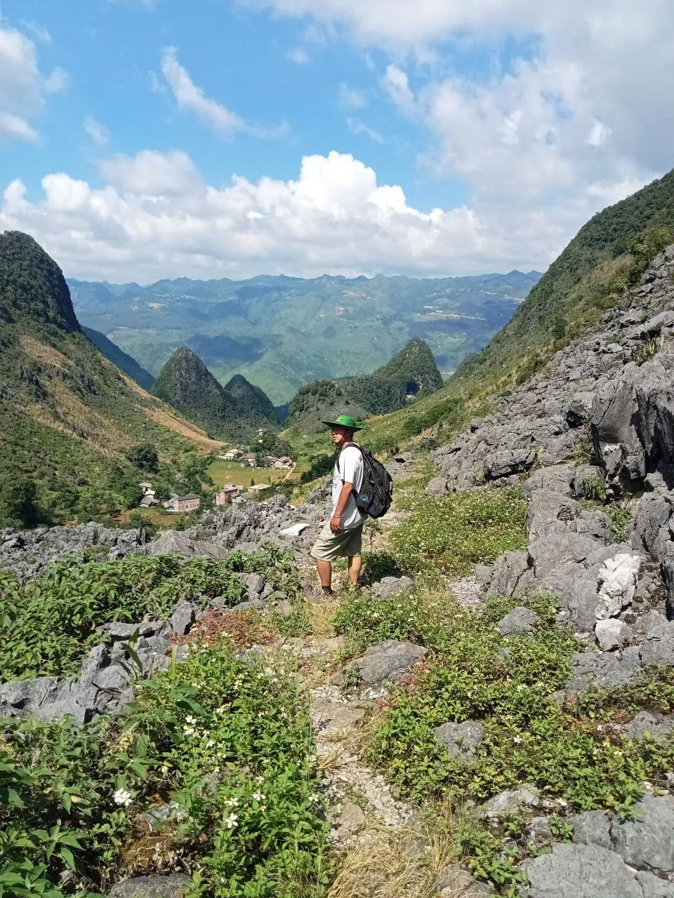
A walker with a light daypack on a rocky limestone path above a cultivated valley on the Dong Van Karst Plateau.
— Overnight

Lo Lo Chai homestay reality

Owner-supplied photos from a Lo Lo Chai homestay context show mud-walled architecture, village setting and simple overnight rooms — not a hotel standard. Lo Lo Chai is where the eastern Ha Giang walking section begins on the flagship line.

Do not assume private bathroom, heating, Wi-Fi or hot water unless confirmed for your departure. A private room can sometimes be arranged; wording stays conditional until the house is locked for your dates.

A Lo Lo Chai homestay building with mud-walled architecture in a highland village setting.
A simple homestay sleeping room with bedding in Lo Lo Chai — shared or private arrangement depends on the departure.
Lo Lo Chai village houses and lanes below karst hills on the northern plateau edge.
— Plateau

Dong Van area accommodation

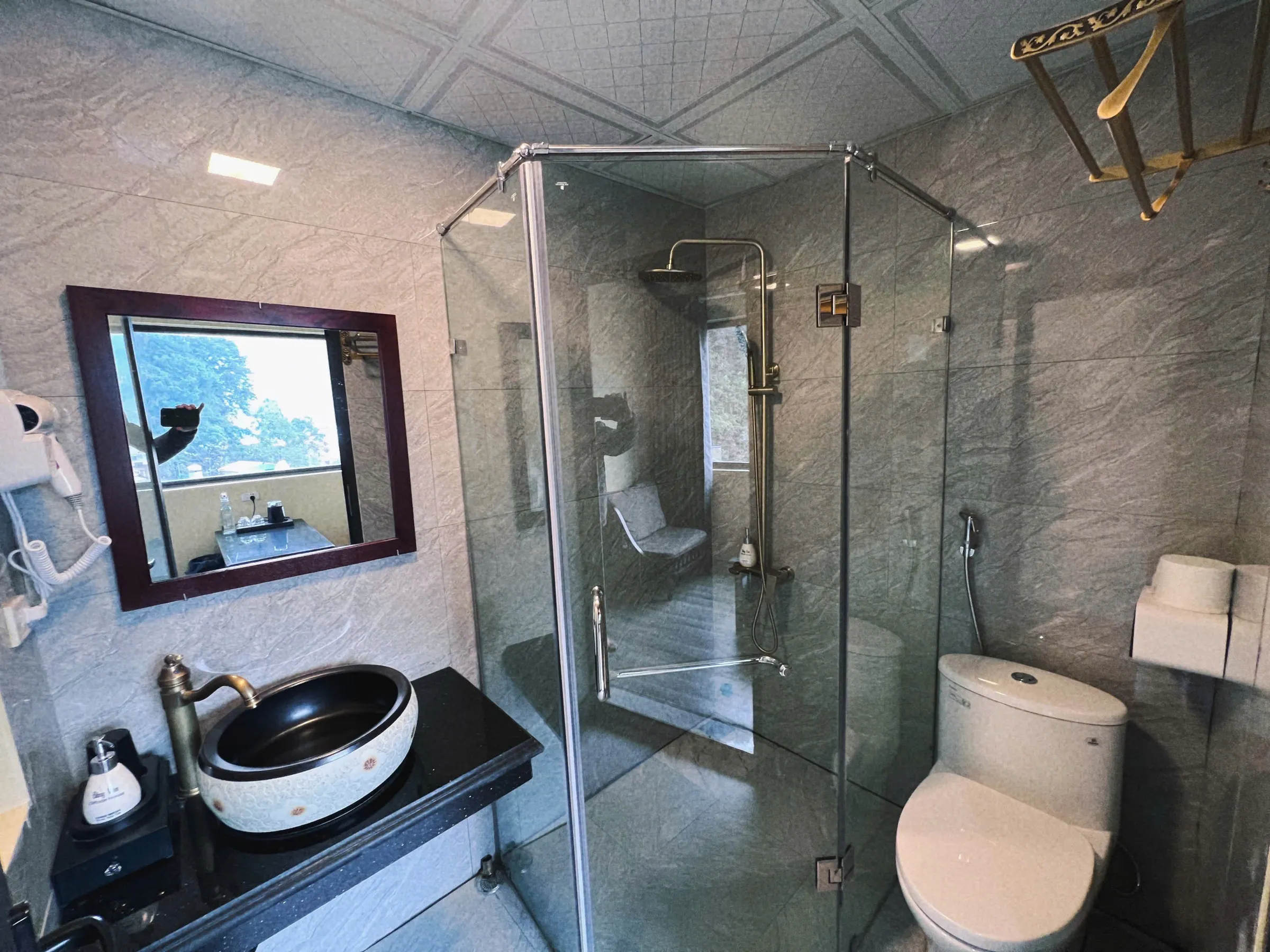
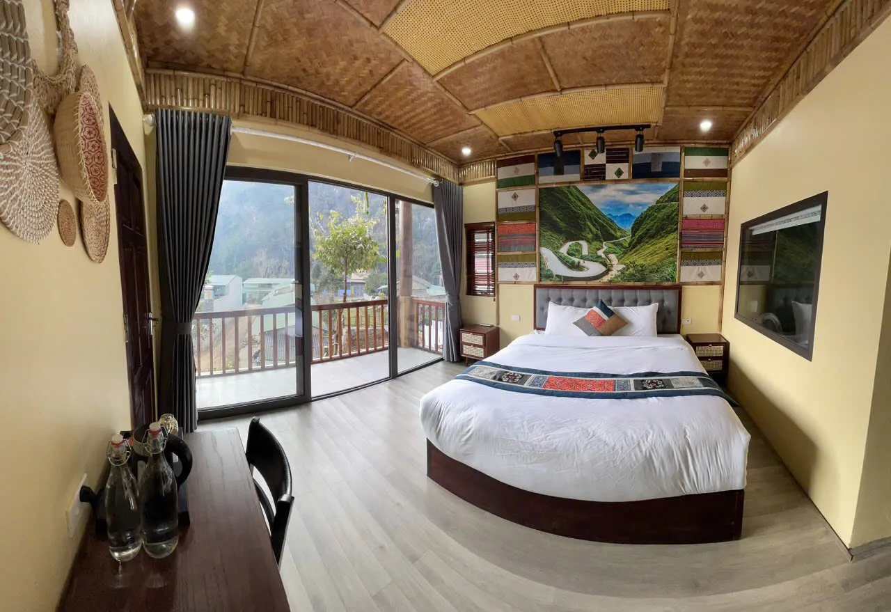
Example bungalow or guesthouse imagery illustrates the type of local accommodation that may be used in the Dong Van area after a long walking day — not a guarantee of one named property on every departure unless booked and quoted.

Private Hoang Su Phi to Dong Van Hiking Journey lists Dong Van hotel or guesthouse nights; room standard is confirmed for the departure.

Example guesthouse or bungalow interior in the Dong Van area — exact property confirmed at booking.
Example of a simple Dong Van area bungalow or guesthouse room — not a guaranteed property on every departure.
— Field

Frames from the route.

A Lo Lo Chai homestay building with mud-walled architecture in a highland village setting.
Lo Lo Chai homestay exterior — simple village overnight, not a hotel standard
Lo Lo Chai village houses and lanes below karst hills on the northern plateau edge.
Lo Lo Chai at the terrace-to-limestone transition
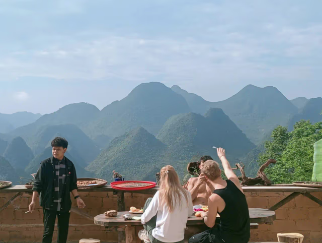
Cone-karst mountains and small cultivated valleys on the Dong Van Karst Plateau.
Walking terrain in the Dong Van Karst Plateau
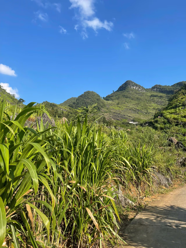
Limestone hills and a cultivated valley in eastern Ha Giang.
Paved village connector above farmed karst valleys
A walker with a light daypack on a rocky limestone path above a cultivated valley on the Dong Van Karst Plateau.
Rocky limestone walking path on the Dong Van Karst Plateau
Example of a simple Dong Van area bungalow or guesthouse room — not a guaranteed property on every departure.
Example Dong Van area accommodation after a long walking day
A walker with a daypack on a grassy ridge above a deep canyon and terraced slopes in the Ma Pi Leng area.
Rim walking uses grassy shoulders and side paths — not only the developed highway pullouts.
— Programmes
Ha Giang · Village circuits

Four ways to walk village to village.

From a single-day forest loop in Du Gia to a four-day eastern Ha Giang walk with trailhead transfers — Dao, Hmong, Lo Lo and Tay communities, linked on foot.

1 – 4 days
Small groups · 2 – 8 trekkers
— Booking

How departures are confirmed.

Every programme and extended journey on this site has its own pricing, itinerary and enquiry path. Journal articles are for research — dates, prices and confirmation sit on the commercial pages.

  1. Step 1

    Enquire

    Tell us your route, dates and group size — by WhatsApp from any programme or tour page.

  2. Step 2

    Confirm

    We reply with availability, a clear price and the logistics needed to confirm your departure.

  3. Step 3

    Prepare

    You receive what to pack and where to meet before you travel.

— Why book with us
  • Licensed local operator

    Hanoi Travel Mate Co., Ltd. (tax code 0110906485) runs every departure listed on this site — not a reseller or marketplace listing. Licensed Local Operator

  • Local trekking expertise

    Ha Giang has no marked national-park trail network. Paths follow irrigation channels, farm decisions, and weather calls made by people who live on the route. Local trail guides from each community negotiate homestay space, read fog on the ridge, and know when a bamboo bridge is safe after rain — alongside English-speaking trekking leads who handle logistics, pace and guest communication.

  • Transparent enquiry process

    No payment on this site. Enquire by WhatsApp; we usually reply within 24 hours with availability, a clear price and what to pack. Booking Terms

  • No payment on this site

    Every departure is confirmed after a direct conversation. Nothing is collected or stored here. Payment Policy

  • Safety and responsible travel

    Personal accident and trekking insurance is included on published hub programmes — see each programme's includes list. Extended journeys and custom expeditions do not include trekking insurance. Community and forest permit fees are included in programme prices where listed and paid to the communes on your behalf. Extended journey and custom permit requirements vary by route. Safety Policy

  • Community payments stay local

    Homestay payments go directly to host families — we do not take a margin on meals or overnight stays. Responsible Travel

— Deposit, cancellation & enquiry
  • Enquire by WhatsApp — we usually reply within 24 hours with availability, price and what to pack
  • No payment on this site — confirmation steps are shared directly after your enquiry
  • Published extended journeys: 30% deposit and free cancellation up to 14 days before departure — confirmed for your departure before you travel
  • If we cancel your departure for safety or weather before you travel, we offer a full refund or reschedule
  • Weather or safety may require a postponed or adjusted route — we confirm options with you, not through the website checkout
— Verified elsewhere

Independent profiles for the operating company — not on-site guest reviews.

— Trip shape

Which product line fits your dates?

Days alone do not define the trip. A three-day Ban Luoc hub programme and a four-day Hoang Su Phi extended journey cover overlapping geography but differ in pace, product line and booking page. Programme vs Extended Journey.

  • Hub programme

    One to three focused walking days in Hoang Su Phi, Village Treks or Ridge & Cloud — a defined route with schedule and price on the programme page.

    Browse programmes
  • Extended journey

    Four to seven days across wider geography on a published multi-day route — itinerary and pricing on each tour page under Extended Journeys.

    Extended journeys
  • Custom expedition

    Private dates, mixed regions or a route that does not match a published programme or tour — designed after enquiry on Custom Expeditions.

    Custom expeditions
Local guides

Local trail guides from the communities on the route, with English-speaking trekking leads on every departure. Guide roles & field notes

Community & permits

Homestay payments go directly to host families — we do not take a margin on meals or overnight stays. Community and forest permit fees are included in programme prices where listed and paid to the communes on your behalf. Extended journey and custom permit requirements vary by route.

Insurance & group size

Personal accident and trekking insurance is included on published hub programmes — see each programme's includes list. Extended journeys and custom expeditions do not include trekking insurance. Guide-led programmes run small groups — typically 2–8 trekkers; ridge routes cap at six.

Operator & enquiry

No payment on this site. Enquire by WhatsApp; we usually reply within 24 hours with availability, a clear price and what to pack. Licensed Local Operator · Safety Policy

— Begin a route

Walk the highland villages with the people
who live there.

Enquire about a departure