The complete guide to trekking Ha Giang
Province-wide map of Ha Giang trekking — regions, seasons, product types and logistics. Start from the homepage, then use Plan Your Ha Giang Trek to choose a route; programme pages hold schedules and enquiry.
Trekking Ha Giang, walked slowly.
This is the province-wide map of Ha Giang trekking — read it before you choose a route. Ha Giang Trekking organises walking and hiking across three collections (Hoang Su Phi, Village Treks, Ridge & Cloud), extended journeys, and field guides that go deeper on specific places. This page surveys the ground; it is not a booking itinerary and not the route chooser.
Start from the Ha Giang Trekking homepage when you need the province gateway — who runs departures and how collections fit together — then return here for terrain, product types, seasons and logistics order. When you know which landscape fits, open Plan Your Ha Giang Trek — the chooser page for collection, season window and difficulty. Programme pages then hold day-by-day schedule, price and enquiry.
Each linked guide below covers its own ground so you do not rebuild the same plan in five places. Place guides (Ban Phung terraces, Chieu Lau Thi mountain, Nam Hong Red Dao country) are for research; trek pages hold the day-by-day walk, price and enquiry.
- How to plan a Ha Giang trek
Planning process, checklist and timeline.
- Plan Your Ha Giang Trek
Next step — choose collection, season and difficulty.
- Best time to trek Ha Giang
Month-by-month once you know the region.
- Programme vs Extended Journey
Focused programmes vs multi-region tours.
- Village trekking in Ha Giang
Homestay pace and the Village Treks collection.
- Mountain trekking in Ha Giang
Ridge exposure and Ridge & Cloud programmes.
- Ha Giang trekking fitness and difficulty
Easy, Moderate and Demanding tiers before you book.
- Packing for Ha Giang trekking
Kit lists matched to programme type.
- Village Treks vs Ridge Treks vs Extended Journeys
Style compare before collection choice.
- Ethnic communities on the trail
Meals, homestays and etiquette on guided routes.
- Trekking logistics in Ha Giang
Arrival, permits and kit in order.
- Guide-led vs self-guided trekking in Ha Giang
Permit, homestay and navigation limits before you choose a route.
- Solo trekking in Ha Giang
One-person bookings on guided routes.
- Is Ha Giang trekking safe? A practical guide
Terrain, weather and route-fit planning.
- The Ha Giang loop on foot: trekking vs motorbike
Walking-first vs motorbike loop — day segments and extended journeys.
- Ha Giang vs Sapa trekking
Destination compare for walkers choosing between northern Vietnam trekking bases.
- Ha Giang trekking FAQ
Central FAQ hub — concise answers with links to every Wave 1 guide.
- Ha Giang Trekking homepage
Province gateway — operator overview and how collections fit together.
- Hoang Su Phi programmes
Compare routes, difficulty and seasons at this collection hub.
- Village treks
Compare routes, difficulty and seasons at this collection hub.
- Ridge & Cloud programmes
Compare routes, difficulty and seasons at this collection hub.
- Ha Giang trekking tours
Multi-day trekking routes across the wider province.
Survey the ground you want to walk.
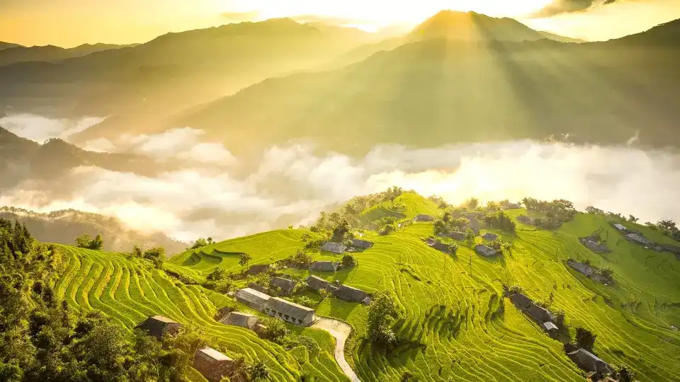
Hoang Su Phi is terrace country and homestay crossings west of the massif — La Chi walls at Ban Phung, Red Dao ridge culture at Nam Hong, multi-valley traverse at Ban Luoc, and Chieu Lau Thi approached from the Hoang Su Phi side. The district hub compares programmes; the Hoang Su Phi rice terraces guide and village articles cover farming and place research.
Village Treks covers valley pace across Du Gia, Quan Ba and the northern plateau — Easy forest villages, Moderate Lo Lo Chai beneath Lung Cu, three-day Nam Dam toward Lung Tam. Homestay rhythm and village paths matter more than summit altitude here.
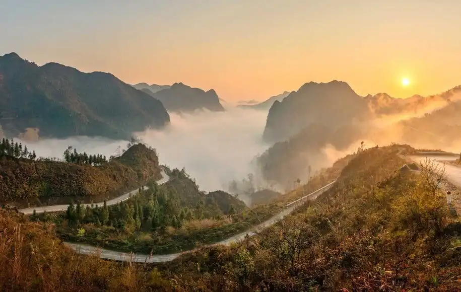
Ridge & Cloud is the upper Tay Con Linh massif — cloud forest, high-mountain walking and cold lodge or shelter nights depending on programme. All routes are Demanding and run October through April. Chieu Lau Thi mountain research lives on the trekking guide; sunrise and cloud-sea products live on their programme pages.
- Hoang Su Phi programmes
Compare routes, difficulty and seasons at this collection hub.
- Village treks
Compare routes, difficulty and seasons at this collection hub.
- Ridge & Cloud programmes
Compare routes, difficulty and seasons at this collection hub.
- Hoang Su Phi Rice Terraces guide
District terrace landscape and seasons.
- Quan Ba trekking guide
Twin Mountains and Nam Dam crossing district owner.
- Meo Vac trekking guide
Markets, canyon access and extended journey district owner.
- Village trekking in Ha Giang
Valley pace and Village Treks collection depth.
- Mountain trekking in Ha Giang
Ridge & Cloud and upper massif context.
- Ban Phung Rice Terraces guide
La Chi terrace country — research before booking.
- Nam Hong trekking guide
Red Dao homestay ridge country — research before booking.
- Ban Luoc trekking guide
Multi-valley traverse research before booking.
- Chieu Lau Thi Trekking Guide
Mountain research — exposure, seasons and massif context.
Programmes, tours and field guides.
Programmes are one to three focused days inside a single collection — defined routes with booking pages for schedule, includes and enquiry. Extended journeys on /tours link several regions over more days when geography, not duration alone, defines the trip.
Field guides and entity pages hold research — landscape, villages, culture, seasons — without day-by-day times or price. The planning spine (this overview, Plan Your Ha Giang Trek, Best time, Programmes vs Extended) helps you move between them without mistaking a journal article for a booking page.
When you are ready to book, open the programme or tour page. When you need to understand Ban Phung terraces, Chieu Lau Thi exposure or Nam Hong homestay culture first, read the place article, then return to the chooser or hub.
- Plan Your Ha Giang Trek
Route chooser — collection, season, difficulty.
- Programme vs Extended Journey
Trip shape before the exact route.
- Extended journeys
Six multi-day routes on the tours hub.
- Hoang Su Phi programmes
Compare routes, difficulty and seasons at this collection hub.
- Village treks
Compare routes, difficulty and seasons at this collection hub.
- Ridge & Cloud programmes
Compare routes, difficulty and seasons at this collection hub.
Plan in the order the journey happens.
If the guide question is still open, read Guide-led vs self-guided trekking in Ha Giang before the route chooser — permit, homestay and navigation limits differ from marked-trail regions. Overview first (this page), route choice second (Plan Your Ha Giang Trek), then logistics in sequence: arrival buffer, permits where the northern plateau applies, season check, kit and homestay preparation. Programme pages turn the outline into a specific departure — not this overview.
That order matters. A terrace programme can be a first trek; a ridge route needs a colder-season plan and earlier start; the northern plateau adds permit timing. Place articles answer landscape questions; programme pages answer booking questions.
Use the linked guides as a sequence rather than a reading list. Each one answers a different practical question without duplicating the chooser agenda.
- Plan Your Ha Giang Trek
Step 2 — choose collection, season and difficulty.
- Trekking logistics in Ha Giang
Full arrival → permits → kit sequence.
- Getting to Ha Giang for Trekkers
Road day, buffer night and onward transfer.
- Ha Giang trekking permits
Northern-plateau paperwork and checkpoints.
- Best time to trek Ha Giang
Match route and road days to the season.
- Guide-led vs self-guided trekking in Ha Giang
Guide decision before collection and logistics.
- Ha Giang trekking cost: what to budget
Published from-prices and sample trip stacks.
- Solo trekking in Ha Giang
Solo traveller join-in before you book.
Give arrival and paperwork their own space.
Allow six to seven hours by road from Hanoi to Ha Giang city, then plan the onward approach to your programme area. A buffer night in the city or programme town gives you a better first walking day than trying to turn a long road day into a trail day.
Foreign travellers on the northern plateau and Dong Van loop need a Ha Giang province entry permit. Programmes include the community and forest permissions required for their routes where they apply, but your confirmation is the current guide for dates and paperwork — read the Ha Giang trekking permits update for current foreign-traveller guidance.
Keep your passport and permit information in a dry daypack pocket on walking days. The arrival and permits guides cover the detailed route timing and checkpoint routine.
- Getting to Ha Giang for Trekkers
- Ha Giang trekking permits update
Current foreign-traveller permit guidance.
- Ha Giang trekking permits
Match the season and pack for elevation.
Ha Giang has different walking seasons, not a single best month. Terrace harvest, plateau buckwheat, cold ridge clarity and green monsoon paths each change which route makes sense and how much warmth or rain protection belongs in your bag.
Pack for layers rather than a town forecast. Valley warmth can become ridge cold quickly, and a headlamp, broken-in footwear and a dry daypack pocket matter as much as the outer layer.
A homestay is a household before it is a bed. The same careful pace that helps on the road also helps at the threshold, the table and a shared overnight stay.
- Best time to trek Ha Giang
- Green season trekking in Ha Giang
May – August deep-dive — planting water and monsoon pace.
- Packing for Ha Giang
- Homestay etiquette
- Ethnic communities on the trail
Who you meet on guided routes before your first homestay.
One, two or three walking days.
Programmes cluster by duration inside each collection — not as a universal ranking. One-day routes suit a focused introduction; two days add homestay or shelter rhythm; three days let valleys or ridges connect. Extended journeys on /tours span more days when the line crosses collection boundaries.
This overview does not hold distances, times or daily schedules — those live on programme and tour pages after you choose. Plan Your Ha Giang Trek maps duration to example routes per collection; each hub table compares fit inside the collection.
Book on the programme page. Read the place articles first when Ban Phung terrace season, Chieu Lau Thi exposure or Nam Hong homestay culture affects your choice.
- Plan Your Ha Giang Trek
Duration and difficulty by collection.
- Programme vs Extended Journey
When a longer tour fits better than a hub programme.
- Hoang Su Phi programmes
Compare routes, difficulty and seasons at this collection hub.
- Village treks
Compare routes, difficulty and seasons at this collection hub.
- Ridge & Cloud programmes
Compare routes, difficulty and seasons at this collection hub.
- Extended journeys
Multi-day regional lines.
Common questions.
How many days do I need for Ha Giang trekking?
One-day routes give a focused introduction. Two days add a homestay or shelter rhythm, while three days let a landscape connect across valleys or ridges. Allow road days around the walking days — the chooser page maps duration to collections.
Do I need a permit?
Foreign travellers on the northern plateau and Dong Van loop need a Ha Giang province entry permit. Read the permits guide and follow the current instructions in your booking confirmation.
Can I travel from Hanoi and trek on the same day?
It is not the steady plan. Allow six to seven hours by road to Ha Giang city, then the onward transfer to your programme area. A buffer night gives you a better first walking day.
Which region should I choose first?
Read this overview for the regional survey, then Plan Your Ha Giang Trek to choose collection, season and difficulty. Hub pages compare programmes inside each collection.
What is the difference between this guide, Plan Your Ha Giang Trek and a programme page?
This complete guide is the province-wide overview and logistics map. Plan Your Ha Giang Trek is the route chooser. Programme pages hold schedule, price and enquiry for a specific departure.
How do I book a trek?
Choose a route on the chooser or hub, then open the programme or tour page and send your dates through Contact. The team confirms availability and price before you decide.
Overview, then choose the route.
The best Ha Giang itinerary is rarely the one with the most stops. Use this overview to understand the province, then Plan Your Ha Giang Trek to pick collection, season and difficulty. Programme and tour pages carry schedule and enquiry.
When you are ready, send your dates and arrival plan through Contact. We will help match the right route, season and transfer rhythm before you walk.
- Plan Your Ha Giang Trek
Choose collection, season and difficulty.
- Best time to trek Ha Giang
Confirm the calendar window.
- Programme vs Extended Journey
Confirm trip shape.
- Hoang Su Phi programmes
Compare routes, difficulty and seasons at this collection hub.
- Village treks
Compare routes, difficulty and seasons at this collection hub.
- Ridge & Cloud programmes
Compare routes, difficulty and seasons at this collection hub.
- Extended journeys
Multi-day routes across the region.
- Enquire about a departure
Share your dates and arrival plan with the team.
Published by Ha Giang Trekking — field knowledge from local trail guides on the routes described, checked against programme schedules and operating notes.
Journal pages are for route research and planning. Dates, prices, day-by-day schedules and enquiry sit on programme and tour pages.
Articles are published under Ha Giang Trekking. Named writer and guide bylines will be added when verified bios and consent are on file.
Operational details on programme and tour pages are published only after being checked against current operating information.
Compare published routes and open the programme or journey page when you are ready to enquire.
- Hoang Su Phi — compare terrace programmes
One- to three-day terrace and homestay routes in the west of the province.
- Village treks — compare valley routes
Valley and plateau village circuits with homestay nights.
- Ridge & Cloud — compare summit programmes
Summit ridges and cloud-forest massifs above the terrace country.
- Extended journeys — multi-day loops
Four- to seven-day journeys across Dong Van, Ma Pi Leng and the northern plateau.
- Ban Phung — highest terraces (1 day)
Ban Phung — highest terraces (1 day) — dates, pricing and enquiry.
- Du Gia forest villages (1 day)
Du Gia forest villages (1 day) — dates, pricing and enquiry.
- Chieu Lau Thi — sunrise ridge (1 day)
Chieu Lau Thi — sunrise ridge (1 day) — dates, pricing and enquiry.
- Dong Van Karst Traverse
Dong Van Karst Traverse — full itinerary and enquiry.
- Hidden Valleys Slow Trek
Hidden Valleys Slow Trek — full itinerary and enquiry.
- Private Hoang Su Phi to Dong Van Hiking Journey
Private Hoang Su Phi to Dong Van Hiking Journey — full itinerary and enquiry.