RCE · 03 · 3 days · 2 nights · Chieu Lau Thi · Hoang Su Phi
Kieu Lieu Ti, three-day traverse.
3-day ridge itinerary on Chieu Lau Thi (local name: Kieu Lieu Ti) — two shelter nights and summit dawn. Trekking operations here are currently unavailable; kept for research and trip planning.
— Quick decision facts
At a glance
Duration
3 days · 2 nights
Format
Currently unavailable
Difficulty
Demanding
Start
Ta Su Choong
Finish
Cao Bo
Your party
2 – 6 trekkers in your private party
Best season
Oct – Apr · cold, clear
— Current status
Trekking operations on this route are currently unavailable, and we are not accepting bookings for it at present. The route detail below is kept online for research and trip planning, not as an active itinerary.
Kieu Lieu Ti is the local name for Chieu Lau Thi — the same 2,402 m mountain, not a separate peak. This page describes a specific three-day traverse itinerary that used that local name in its product title. The route traditionally spent three days on the upper ridge: a shelter night near the summit, a full exposed day between shelters, then a descent through ancient Shan tea into Cao Bo. Trekking operations on this itinerary are currently unavailable. For the primary Chieu Lau Thi place guide, read the trekking guide; for bookable programmes on the same mountain, see the cloud-sea and sunrise-ridge routes below.
— Itinerary
Day by day.
Times and stops are indicative. Pace follows the slowest walker, weather and village rhythm on the day.
Route outline
Day 1
Ta Su Choong → summit shelter
Walking · Overnight · Transfer
Day 2
Sunrise summit → ridge traverse
Walking · Overnight
Day 3
Ridge → Cao Bo
Walking
Day 1
Ta Su Choong → summit shelter
Walking · Transfer · Overnight · Wooden mountain shelter near the summit
11 km · 5 h walking
Drive to Ta Su Choong, then climb steadily through bamboo and rhododendron to the wooden shelter just below the Chieu Lau Thi summit. Eat an early dinner and put layers on by dusk.
Day 2
Sunrise summit → ridge traverse
Walking · Overnight · Second ridge shelter (Tay Con Linh side)
18 km · 8 – 9 h walking
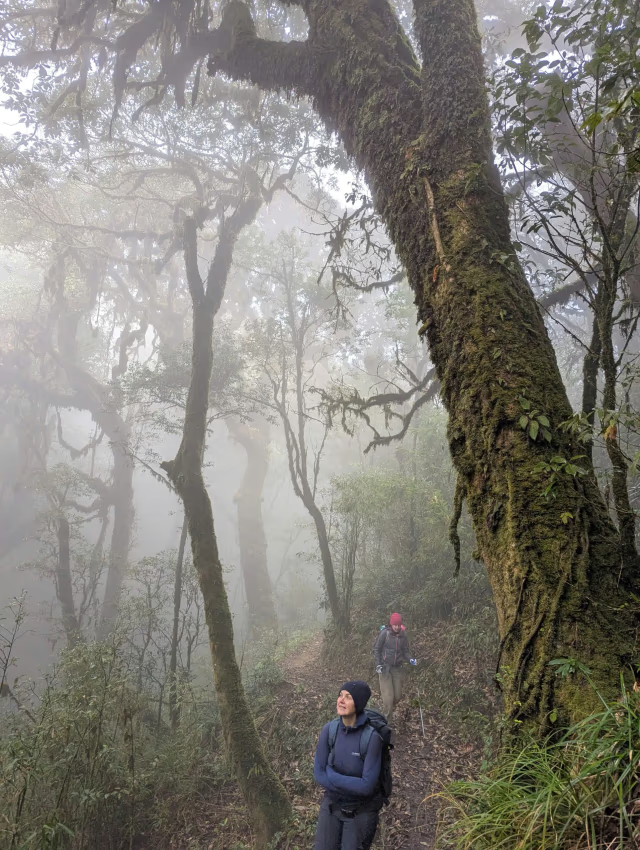
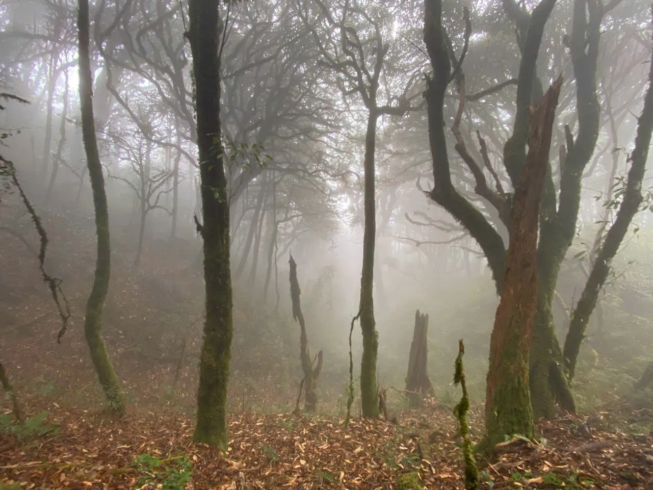
This is the longest day. Walk before dawn to the 2,402 m Chieu Lau Thi summit for the cloud sea. Then traverse east along the upper ridge through open slopes and mossy forest, with no villages, to a second wooden shelter further along the crossing. Finish with hot soup and an early sleep.
Day 3
Ridge → Cao Bo
Walking · Meals · Breakfast · Lunch
13 km · 6 h walking
Make a long descent through cloud forest and ancient Shan tea, including trees over three centuries old, into the Cao Bo valley. Have a hosted lunch with a Dao tea family before the road back to Ha Giang city.
— Field
Frames from the route.
— Accommodation
Where you sleep.
Household, lodge or shelter is confirmed for your travel dates when you enquire — we do not guarantee a fixed hotel brand on multi-night plateau routes unless named below.
Day 1
Wooden mountain shelter near the summit
Typical property
Day 2
Second ridge shelter (Tay Con Linh side)
Typical property
— Highlights
Three-day itinerary using the local name for Chieu Lau Thi (Kieu Lieu Ti)
Two nights above the cloud line on the upper Chieu Lau Thi ridge
Pre-dawn summit walk to 2,402 m on Day 2, then 8 – 9 hours on the exposed ridge
No villages between shelters — full self-contained mountain days
Finish in the Cao Bo tea valley with hosted lunch before road transfer
— Inclusions
What's included.
Included
Private transfers to and from the trail
English-speaking lead guide and 2 local trail guides
Light porter support for shared camp gear
2 nights in wooden mountain shelters
Sleeping bag rated to 0 °C, mat and pillow
All meals from Day 1 lunch to Day 3 lunch
Hot drinks at altitude
Permits and forest entry fees
Personal accident & trekking insurance
Not included
Transfers from outside Ha Giang province
Hotel before/after the trek
Alcoholic beverages
Tips for guides, porters and host families
Personal trekking equipment beyond what is listed
— Practical detail
Packing & good to know.
Pack
Sturdy waterproof trekking boots (broken in)
Daypack (30 L) — main bag stays at the start
Warm hat, gloves, fleece, insulated jacket
Thermal base layers + spare socks
Rain shell, gaiters in shoulder season
Headlamp with spare batteries
Trekking poles strongly recommended
Personal first aid + any prescription medication
Good to know
Day 2 lasts 8 – 9 hours on the exposed spine. A windproof layer is required even in October.
Guide field note: if storms threaten on Day 2, guides use a lower forest contour between shelters. It is slower, but safe.
You spend two shelter nights above the cloud line. Pack duplicate warm socks and a dry base layer for Night 2.
Your main bag meets you at Cao Bo on Day 3. Carry only a daypack on the ridge.
Maximum group size is 6. There are no departures from June to September.
— FAQ
Common questions.
Q · 01
Can I book this route now?
No. Trekking operations on this route are currently unavailable, and we are not accepting bookings for it at present. The detail on this page describes how the route ran when it operated, kept here for research.
Q · 02
How fit did trekkers need to be?
The route required comfort walking 8 – 9 hours on uneven terrain at altitude on Day 2, with previous multi-day trekking experience strongly recommended.
Q · 03
How many shelter nights?
Two, both above the cloud line on the upper Tay Con Linh spine, with sleeping bags and mats provided when the route operated.
Q · 04
Where did it finish?
The route finished in the Cao Bo tea valley on Day 3 afternoon, with road transfer to Ha Giang city.
Q · 05
Looking for a similar experience — what's available now?
For a high-mountain walking and cloud-hunting experience, see our current Chieu Lau Thi programmes. For terrace and village-to-village walking or private multi-day trekking, see Hoang Su Phi.
Local guides
Local trail guides from the communities on the route, with English-speaking trekking leads on every departure. Guide roles & field notes
Community & permits
Homestay payments go directly to host families — we do not take a margin on meals or overnight stays. Community and forest permit fees are included in programme prices where listed and paid to the communes on your behalf. Extended journey and custom permit requirements vary by route.
Insurance & group size
Personal accident and trekking insurance is included on published hub programmes — see each programme's includes list. Extended journeys and custom expeditions do not include trekking insurance. Guide-led programmes run small groups — typically 2–8 trekkers; ridge routes cap at six.
Operator & enquiry
No payment on this site. Enquire by WhatsApp; we usually reply within 24 hours with availability, a clear price and what to pack. Licensed Local Operator · Safety Policy
— Places and routes
Landscape and season articles sit alongside this trek page — open them for place context, then enquire here for dates and price.


 RCE · 022 days · 1 night