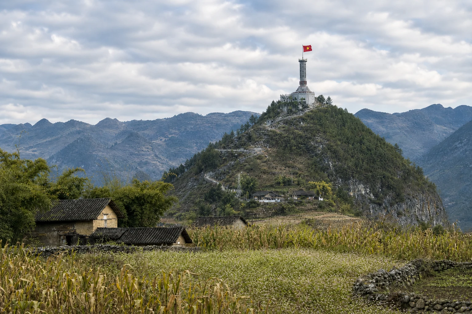
Tay Con Linh: A Complete Guide for Trekkers
Choose between Cao Bo and Tung San 2D1N corridors, read marker vs viewpoint logic, and see how Tay Con Linh differs from Chieu Lau Thi.

Tay Con Linh: 2,428 m — not Chieu Lau Thi.
Tay Con Linh is a separate 2,428 m mountain — not Chieu Lau Thi (2,402 m, also locally called Kieu Lieu Ti). Some datasets cite 2,431 m; the on-trail marker used on treks is 2,428 m. This guide is the primary Tay Con Linh route chooser — it is not a single product page.
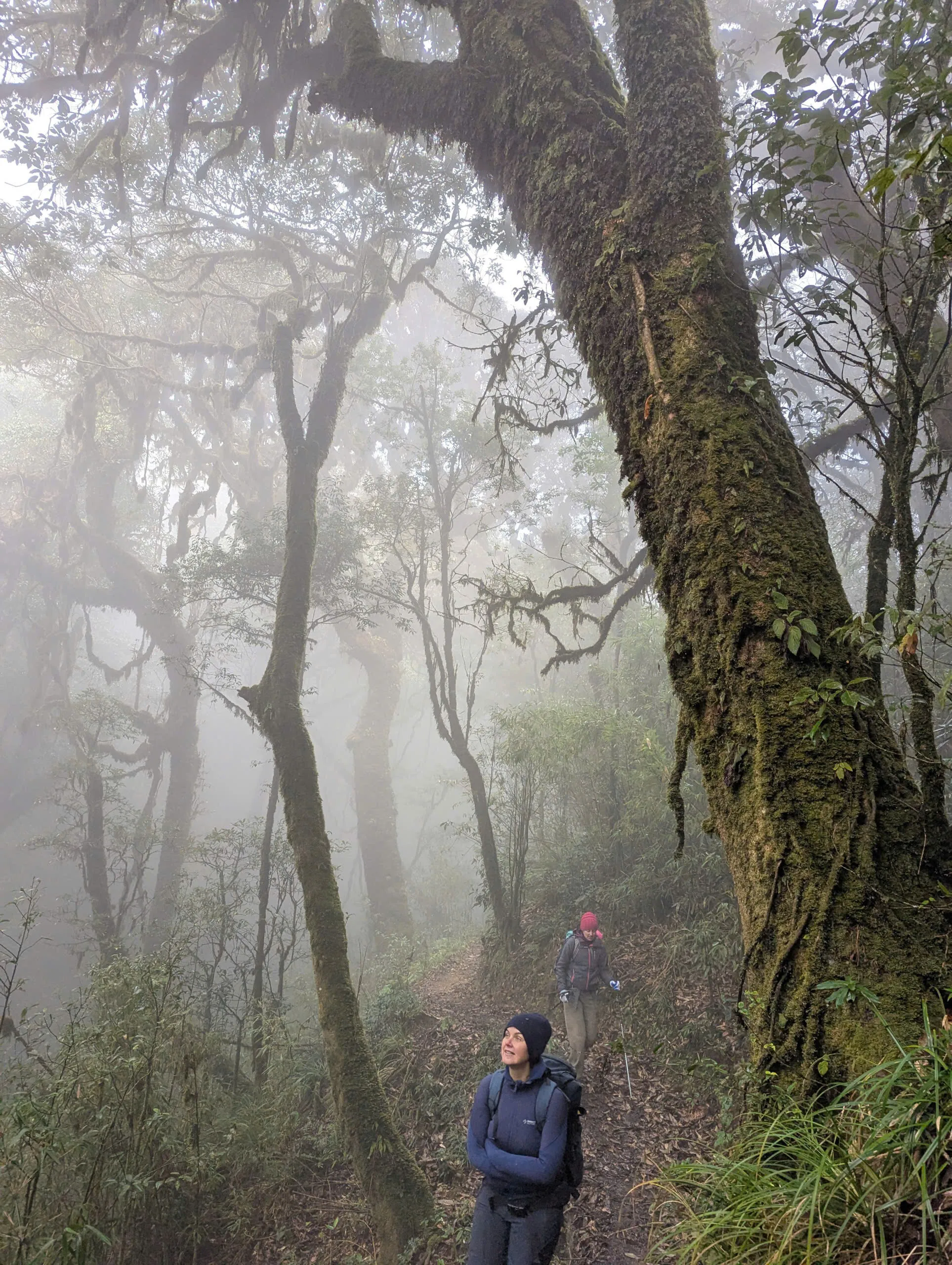
Two 2D1N corridors operate today: (A) Cao Bo → Thuong Son cloud forest — southern / Vi Xuyen-side, point-to-point, lower ridge viewpoint, not the 2,428 m marker. (B) Nam Hong / Tung San access via Tung Quan Lin — Day 1 local-house lunch and forest shelter Night 1 (~1,850 m), Day 2 climb to the 2,428 m marker when conditions allow, picnic on or around the summit when safe, then descent and motorbike transfer toward Tung San (~18 km walking total, not GPX). The former three-day packaged journey on /tours/tay-con-linh-summit is retired and not bookable.
- Tay Con Linh from Tung San (2D1N)
Bookable marker corridor when conditions allow.
- Tay Con Linh cloud forest (Cao Bo 2D1N)
Southern corridor — lower viewpoint, not the marker.
- Cloud forest practical guide
Side-by-side Cao Bo vs Tung San comparison.
- Chieu Lau Thi Trekking Guide
Separate 2,402 m mountain.
- Nam Hong trekking guide
Hoang Su Phi context for the Tung San corridor.
- Tay Con Linh summit routes
Planning guide — links to the live 2D1N programmes.
Trekking operations on this route are currently unavailable, and we are not accepting bookings for it at present.
Which 2D1N fits you?
Choose Cao Bo cloud forest if you want a southern point-to-point through Shan tea and Red Dao villages to Thuong Son — forest immersion and a lower ridge viewpoint, explicitly not the summit marker trek.
Choose from Tung San if you start from the Nam Hong / Hoang Su Phi side and want the marker on Day 2 when the guide judges it safe — approximately 18 km walking over two days, Tung Quan Lin access, local-house lunch on Day 1, simple forest shelter Night 1, summit picnic Day 2 when conditions permit. The marker is not guaranteed in rain, fog or unsafe footing.
Do not merge the two in planning: different starts, finishes, road access and summit status. Chieu Lau Thi programmes remain the bookable 2,402 m mountain experience — a different peak entirely.
Operating Tay Con Linh 2D1N corridors
| Cloud forest (Cao Bo) | From Tung San | |
|---|---|---|
| Start / finish | Cao Bo → Thuong Son | Nam Hong area → Tung San |
| Summit status | Lower viewpoint — not 2,428 m marker | 2,428 m marker when conditions allow |
| Overnight | Ridge / cloud-forest shelter | Forest shelter on massif |
| Day rhythm | Day 1 to shelter · Day 2 viewpoint + descent | Day 1 access + shelter · Day 2 summit + descent |
| Walking total | ~22 km (Cao Bo page) | ~18 km walking (Tung San) |
| Route style | Point-to-point south | Tung Quan Lin access + summit day |
Start / finish
Cloud forest (Cao Bo)
Cao Bo → Thuong Son
From Tung San
Nam Hong area → Tung San
Summit status
Cloud forest (Cao Bo)
Lower viewpoint — not 2,428 m marker
From Tung San
2,428 m marker when conditions allow
Overnight
Cloud forest (Cao Bo)
Ridge / cloud-forest shelter
From Tung San
Forest shelter on massif
Day rhythm
Cloud forest (Cao Bo)
Day 1 to shelter · Day 2 viewpoint + descent
From Tung San
Day 1 access + shelter · Day 2 summit + descent
Walking total
Cloud forest (Cao Bo)
~22 km (Cao Bo page)
From Tung San
~18 km walking (Tung San)
Route style
Cloud forest (Cao Bo)
Point-to-point south
From Tung San
Tung Quan Lin access + summit day
- Practical comparison table
Fitness, kit and season notes.
- Nam Hong to Ho Thau (2 days)
Village context before Tung San access.
Day 1 shelter, Day 2 summit.
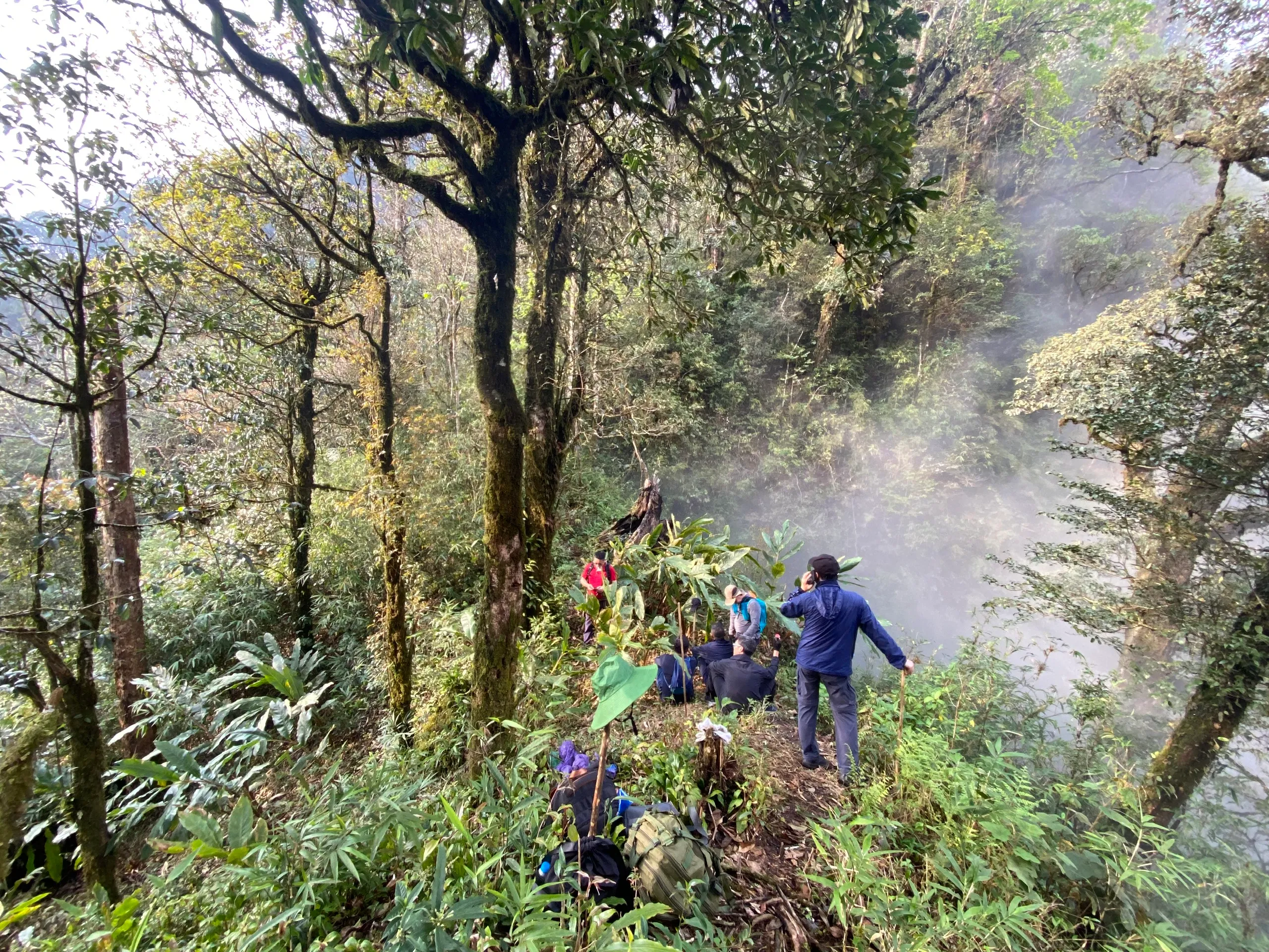
From Tung San the verified operating sequence is not a Day 1 summit push. After breakfast (~08:30 from the Nam Hong area), vehicle access toward Thôn Túng Quán Lìn (about 4 km from the former Tung San commune centre, typically 2–2.5 hours) precedes approximately 4 km walking to a local-house lunch and approximately 3 km to a simple forest shelter around 1,850 m — about 7 km walking on Day 1.
Day 2 climbs from ~1,850 m toward the 2,428 m marker (~4 km, 2–2.5 hours) when safe, picnic on or around the summit when conditions permit, then ~7 km descent to the same local-house area and motorbike transfer toward Tung San (~11 km walking). Typical finish ~16:00–17:00.
If Day 2 summit conditions are unsafe, the guide may abandon the marker and use another line toward Tung San — approximately 6–7 km, around 70% descending. We do not currently publish a verified GPX track; local mountain guides lead from field knowledge.
Operational example for four guests: two guide / local mountain-guide roles and two porter / support roles (lead mountain guide Mr. Phấu). Porters carry shared group kit; guests carry personal items in a daypack. Local motorbike access / support is arranged as required — we do not publish a separate rider headcount.
Communication: three handheld radios on trail; shelter normally without reliable mobile signal; ~500 m uphill toward the summit direction Viettel may often be reached. No satellite communicator is currently carried. Injury evacuation may require assisted foot travel before road access — no guaranteed evacuation time.
- Tay Con Linh from Tung San programme
Full Day 1 / Day 2 schedule and FAQs.
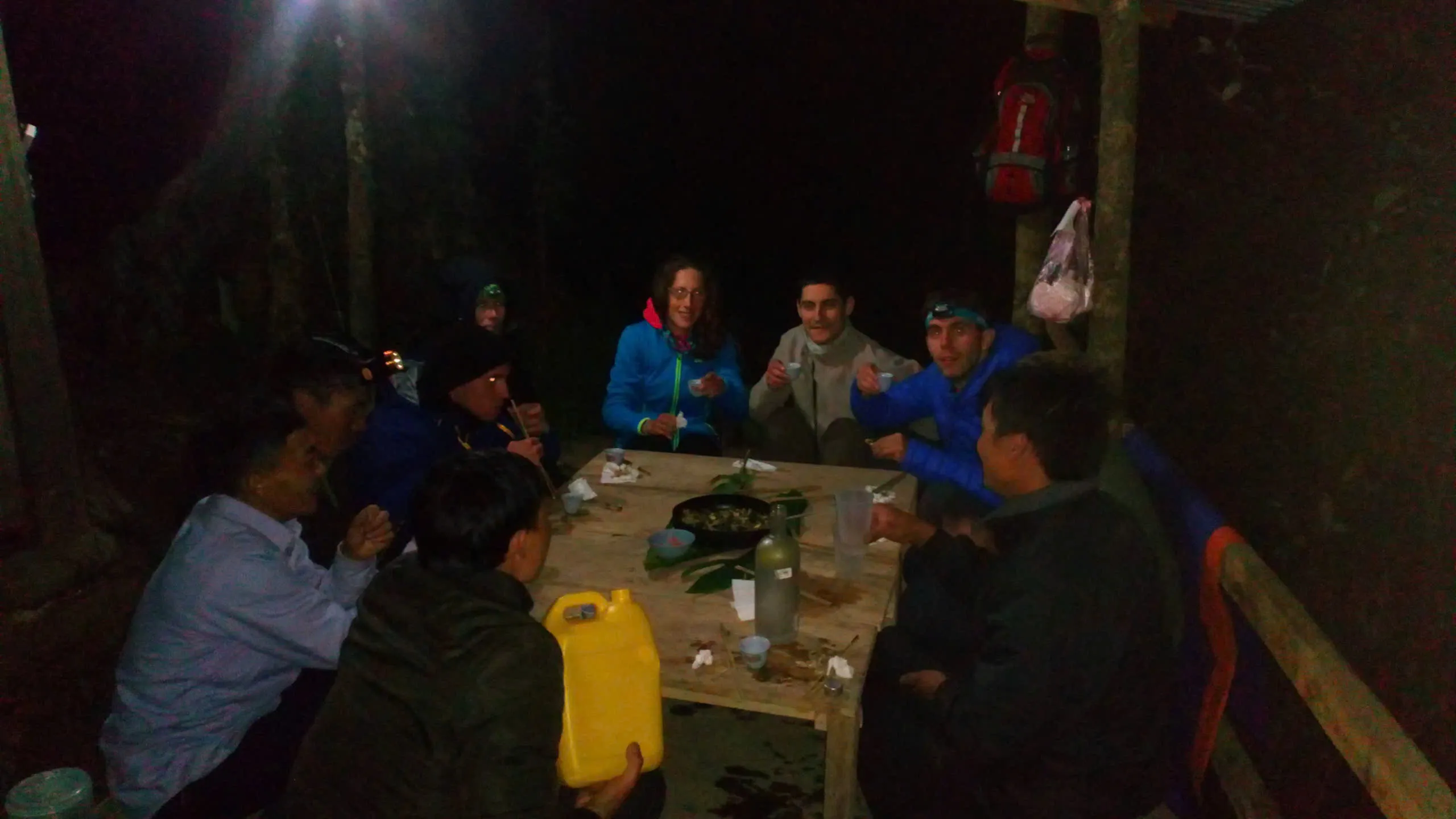
Forest, shelter and long days.
Both operating 2D1Ns are Demanding mountain treks on dirt paths, tea, cultivation and forest — but walking totals and summit logic differ. Cao Bo spreads ~22 km with a lower viewpoint; Tung San is ~18 km walking with the marker on Day 2. Distances and hours are operational averages — not GPX measurements.
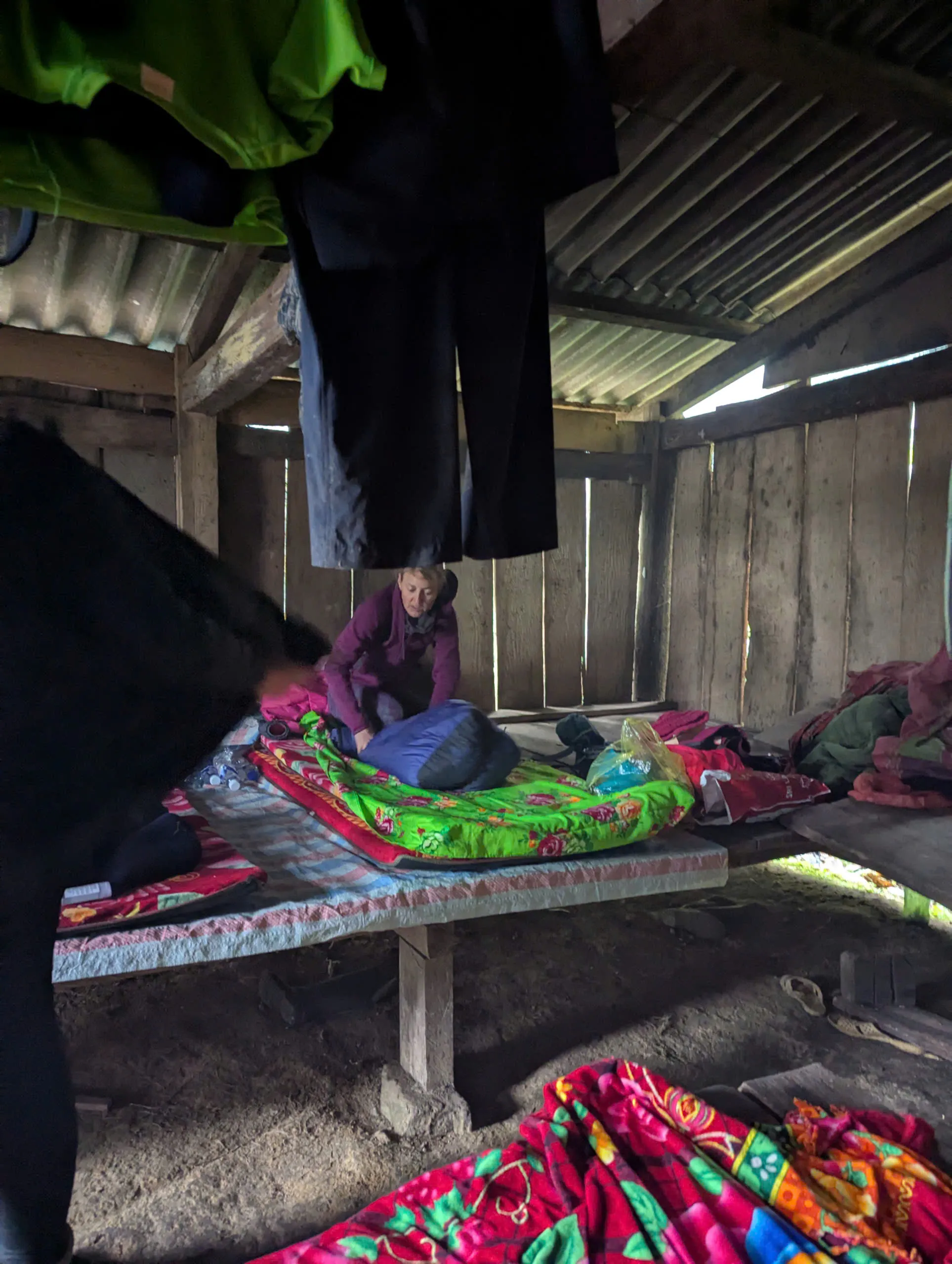
Overnights are simple forest or ridge shelters — sleeping bags are used. Tung San shelter: platform ~40 cm above ground, thin mats, blankets, tarp-screened toilet, no dedicated shower; stream nearby with heated water possible. Do not assume lodge-level facilities, electricity, charging or signal at the shelter.
Local access and administrative arrangements are handled by the local team. Guests are asked to provide their full name, nationality, passport number and a passport image before departure.
Marker logic and season.
October through April is the practical window on the massif; storm-season months are not treated as routine Tay Con Linh operating months. On the Tung San corridor the marker is a Day 2 decision only — Night 1 is always the forest shelter. Guides make the operational safety call, including abandoning the marker for an alternate descent line when rain, fog or trail conditions are unsafe.
Cloud and mist can still make strong walking days worthwhile without a marker visit. Sturdy trekking footwear with good ankle support is strongly recommended on both corridors.
- Best time to trek Ha Giang
- Kieu Lieu Ti traverse
Unavailable Chieu Lau Thi itinerary — not Tay Con Linh.
Trekking operations on this route are currently unavailable, and we are not accepting bookings for it at present.
Common questions.
Does Cao Bo cloud forest reach the 2,428 m marker?
No. It is the southern Cao Bo → Thuong Son crossing with a lower ridge viewpoint — not the Tung San marker corridor.
Is the summit marker guaranteed from Tung San?
No. The marker is attempted on Day 2 only. If conditions are unsafe, the guide may use an alternate line toward Tung San instead of reaching the marker — the forest shelter is Night 1, not a bad-weather substitute for the summit.
Do you publish GPX for the Tung San corridor?
No verified GPX is published. Local mountain guides lead the route; we plan to record and verify a track in future.
How many guides and porters on Tung San?
Staffing scales with group size. A four-guest operational example used two guide roles and two porter / support roles.
Is there phone signal or satellite communication on Tung San?
Shelter: normally no reliable signal; ~500 m uphill Viettel may often be reached. Three handheld radios on trail. No satellite messenger currently carried.
What happened to the three-day Tay Con Linh tour?
The former three-day packaged journey is retired and not operated. The /tours/tay-con-linh-summit page remains indexable for context only.
Is Tay Con Linh the same as Chieu Lau Thi?
No. Tay Con Linh is 2,428 m; Chieu Lau Thi (Kieu Lieu Ti) is 2,402 m — a different mountain with its own bookable programmes.
Who are these treks best for?
Travellers comfortable with long mountain days, steep forest terrain, weather variability and a simple shelter — not ideal if you need guaranteed marker access, lodge comfort or short walking days.
Open the corridor that matches your start.
Use the practical comparison for kit and fitness detail, then enquire on the programme page that matches your geography — Cao Bo vs Nam Hong / Tung San — and dates.
- Tay Con Linh cloud forest
Cao Bo 2D1N.
- Tay Con Linh from Tung San
Marker when safe.
- Chieu Lau Thi — cloud sea
Separate 2,402 m mountain.
Published by Ha Giang Trekking — field knowledge from local trail guides on the routes described, checked against programme schedules and operating notes.
Journal pages are for route research and planning. Dates, prices, day-by-day schedules and enquiry sit on programme and tour pages.
Articles are published under Ha Giang Trekking. Named writer and guide bylines will be added when verified bios and consent are on file.
Operational details on programme and tour pages are published only after being checked against current operating information.
Compare published routes and open the programme or journey page when you are ready to enquire.
- Ridge & Cloud — compare summit programmes
Compare difficulty, seasons and walking style before you enquire.
- Tay Con Linh cloud forest (2 days)
Tay Con Linh cloud forest (2 days) — dates, pricing and enquiry.
- Tay Con Linh from Tung San (2 days)
Tay Con Linh from Tung San (2 days) — dates, pricing and enquiry.
- Tay Con Linh Summit
Trekking operations on this route are currently unavailable, and we are not accepting bookings for it at present.
Trekking operations on this route are currently unavailable, and we are not accepting bookings for it at present.
- Cloud forest route — vs sunrise ridge and cloud-sea trek
Day-by-day walking detail and pacing for Tay Con Linh.
- Hoang Su Phi Rice Terraces: A Complete Guide for Trekkers
Landscape, seasons and routes around Hoang Su Phi.
- Chieu Lau Thi: A Complete Guide for Trekkers
Neighbouring walking country linked to Tay Con Linh.