Ha Giang Trail Surfaces: What You Actually Walk On
See the real trail surfaces on a Ha Giang trek — rice-terrace paths, forest tracks, village concrete, stone and limestone from west to east.
There is no single Ha Giang trail.
A Ha Giang trek is not one prepared path with a consistent surface. On a multi-day walk the ground changes by the hour: a rice-terrace edge, compact dirt, a stretch under trees, a concrete lane through a village, then stone, and later the rougher limestone of the eastern plateau.
This note uses field observations from a private departure on 16–22 October 2026, walking from the terraced west toward Dong Van and Meo Vac. The photographs and two short clips are from that week. They show the character of the footing. They are not a map, and they are not each pinned to a named viewpoint.
If you are choosing a trek, the useful question is not “are Ha Giang trails good?” It is which surfaces you will meet, how long you will be on them, and what that asks of your shoes and your pace. The published day-by-day stays on the journey page. This page is about the ground.
What you actually walk on.
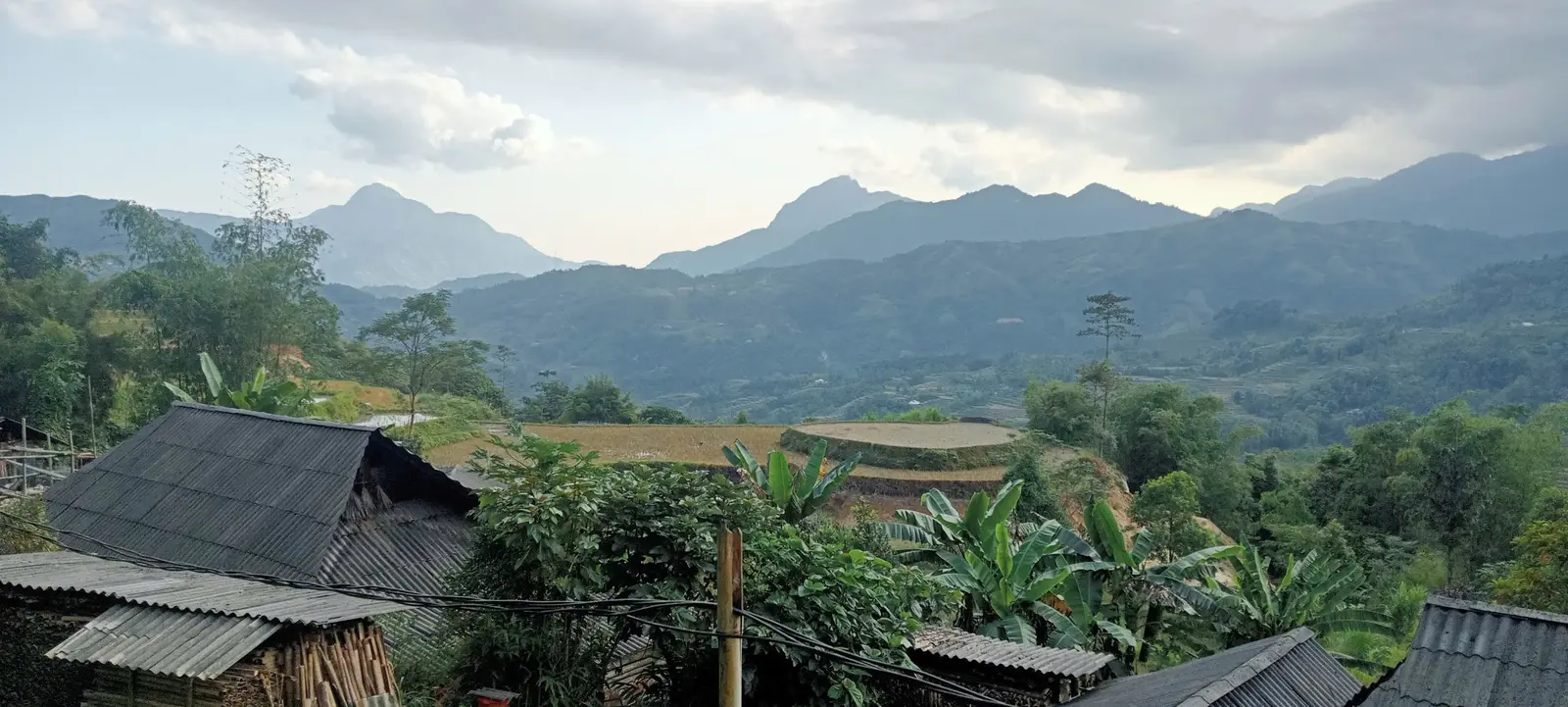
Western Ha Giang, on this departure, was cultivated mountain country. Paths follow terrace lips, farm tracks and village lanes. Eastern Ha Giang replaces the paddies with limestone. The same pair of shoes has to handle both.
None of these is the whole trek. A realistic list, from the surfaces this departure actually used, looks like this:
- Rice-terrace paths and cultivated slopes in the west.
- Compact dirt and farm tracks between those slopes.
- Forest path on the Nam Hong full day — tree cover, not a boardwalk.
- Concrete village paths that connect houses and fields to the footpath.
- Stone and rough limestone once the week is on the eastern plateau.
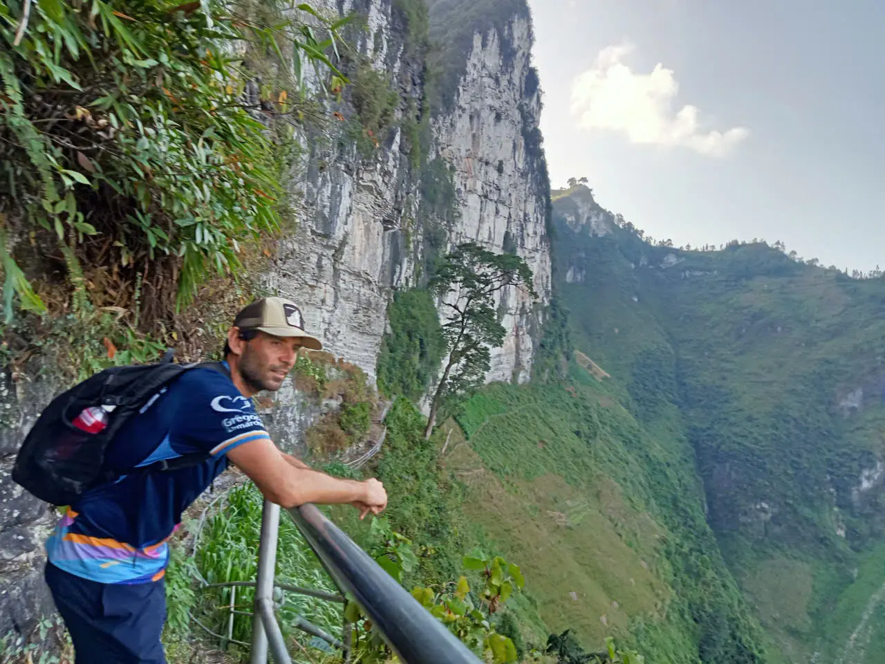
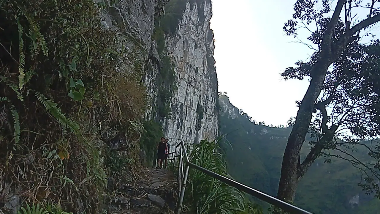
- Exposed mountain path, narrower against the rock.
- Occasional road or vehicle sections where the regions do not join on foot.
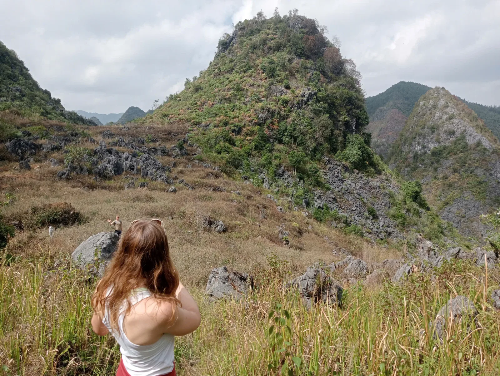
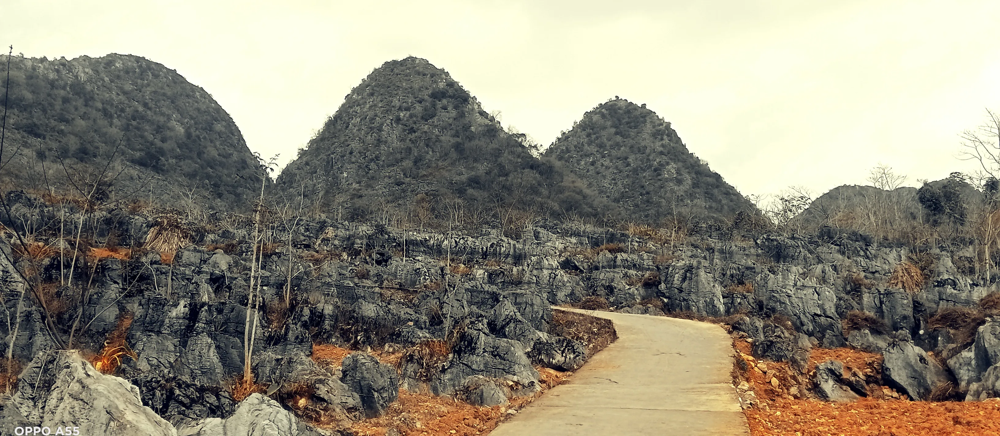
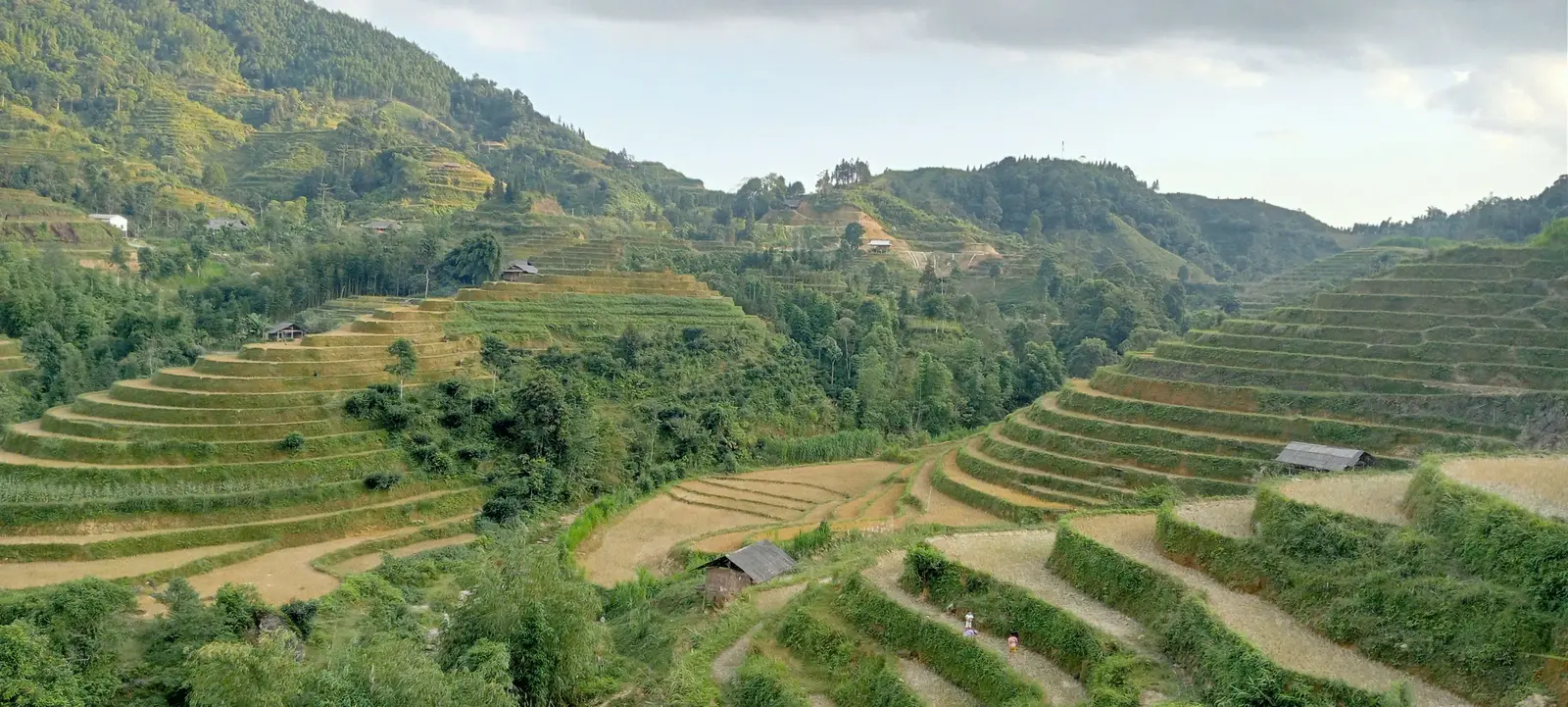
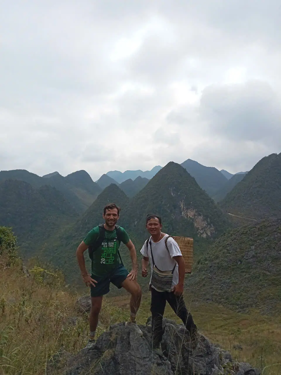
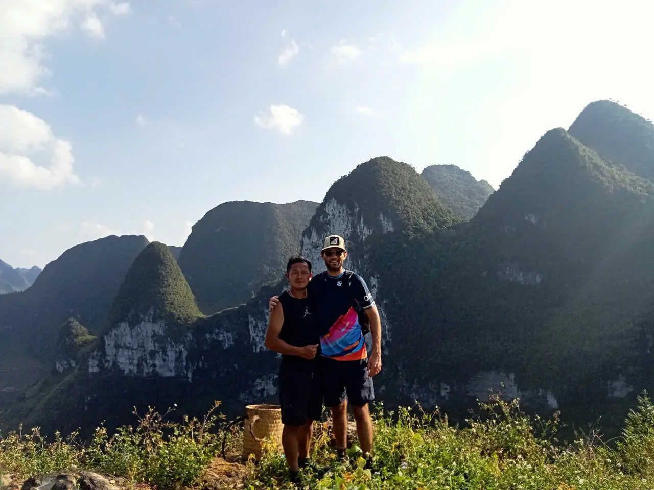
Mud and slick stone appear when it rains. They are a condition of these surfaces, not a separate trail. The two photographs below are the contrast in one glance: terrace slopes in the west, and a rockier eastern valley.
ROUTE REALITY
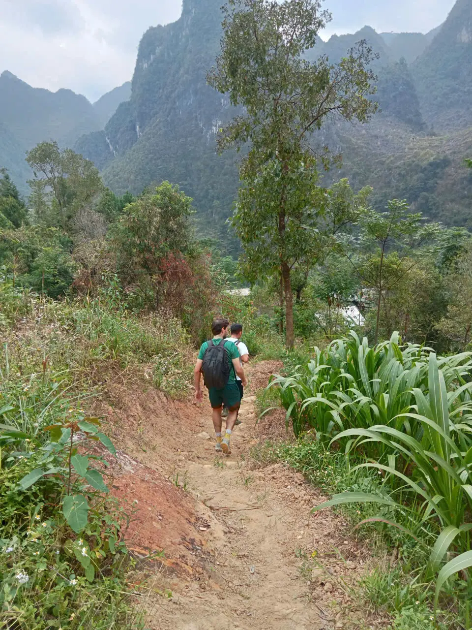
Rice-terrace paths are narrow working ground.
The western walking on this departure sat in Hoang Su Phi country, including a full day out of Nam Hong and a point-to-point day from the Nam Hong area toward Nam Ai. The footing there is agricultural. You walk the lip of a terrace, a compact earth path, or a track that was made for farming and village life rather than for a steady hiking pace.
Terrace edges are narrower than they look in a wide photograph. The tread is often earth, sometimes damp, and it is rarely level for long. Climbs and drops repeat as the path leaves one slope and finds the next. The exposure in these western frames is the ordinary exposure of a hillside path, not a cliff traverse. Where a frame does not show a drop, this article does not add one.
After rain the same earth can smear. In a dry week it can be firm and pleasant. October 2026 is one departure, not a promise about the next one. The people in the terrace photograph are there for scale. The frame is not a portrait, and it does not identify anyone.
FIELD NOTE
- Hoang Su Phi programmes
Compare routes, difficulty and seasons at this collection hub.
Marked trails, GPS and route finding.
That is different from saying every metre is unmarked wilderness, or that a phone app is useless. It means the honest planning question is who knows which fork is open this week — not whether a painted arrow exists every hundred metres.
Farm tracks shift with harvest, irrigation, minor landslides, road works near villages, seasonal access and mud after rain. Those are the same reasons a guide may choose a firmer line on a wet day — see the after-rain section below for what changes underfoot, not repeated here.
Route finding is one reason local guides matter on remote multi-day walks. This page stays about surfaces; the guide-led comparison explains permits, homestays and what a published programme includes.
- Guide-led vs self-guided trekking in Ha Giang
When a guide is practical — not a duplicate of this footing note.
Tree cover changes the feel of the path.
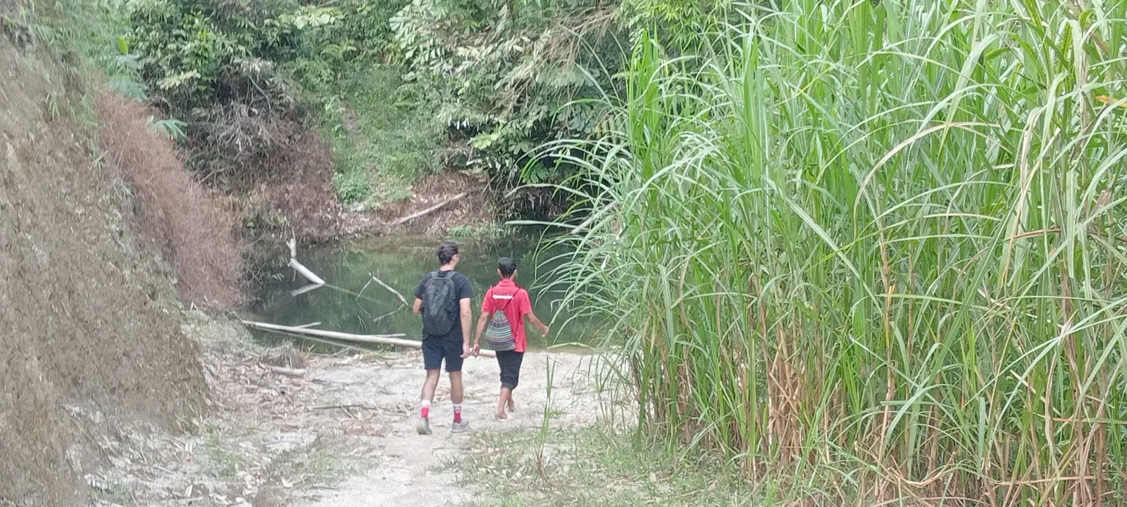
On 17 October, the Nam Hong full day included a forest path. The clip is that path. Under trees the walk is closer, cooler in the shade, and less open than a terrace lip in full light. That is what the clip establishes. It does not establish a species list, and it is not labelled as bamboo, roots or deep leaf litter. Those details show up on some other Hoang Su Phi routes described elsewhere on this site. They are not claimed for a frame that does not show them.
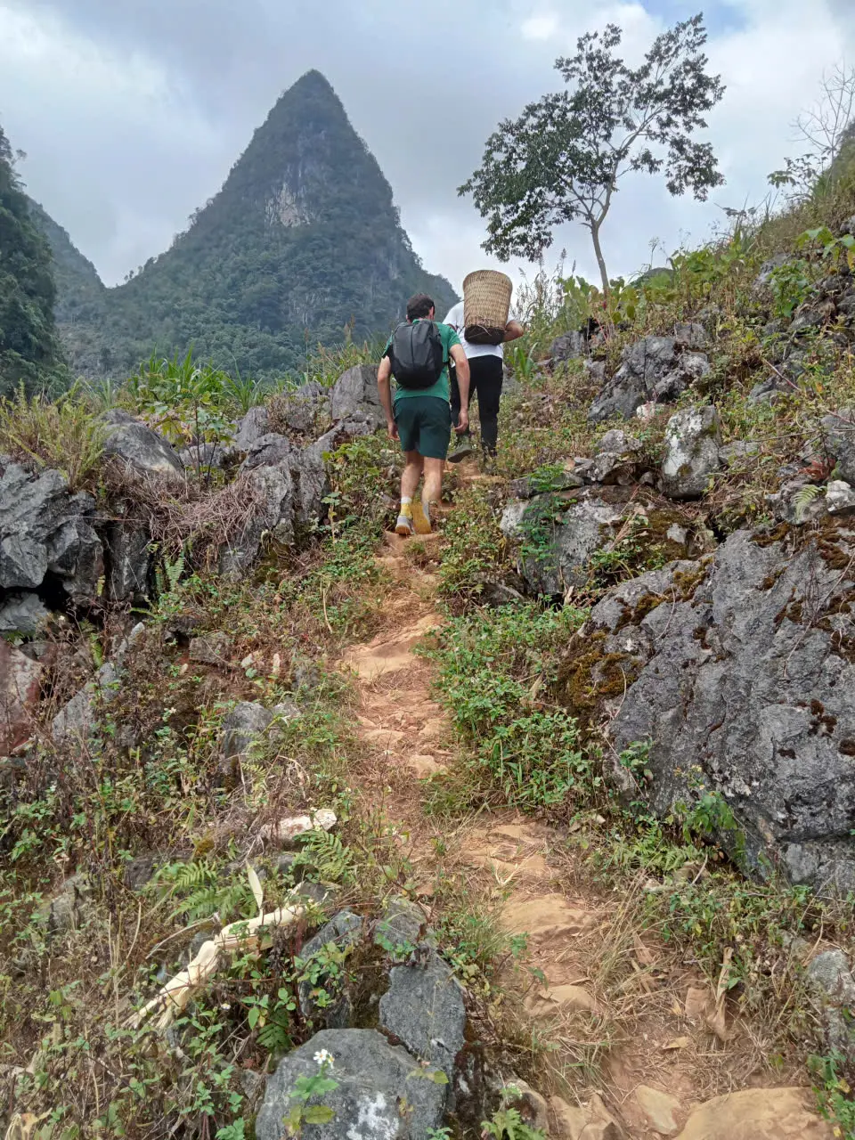
Dirt on the same western days is the farm-track kind: compact earth, grass at the edge, a line that drops into the next field. It can feel more “natural” than a village lane, and it still is not wilderness infrastructure. Nobody has graded it for hikers. Wet ground is the practical issue. Shade keeps some sections damp after a shower that has already dried on the open slope.
Reduced visibility is a weather fact, not a property of the soil. Cloud and rain shorten the view and slow the pace. They do not turn every forest hour into a navigation problem when a local guide is walking with you.
Paved sections are part of the trek.
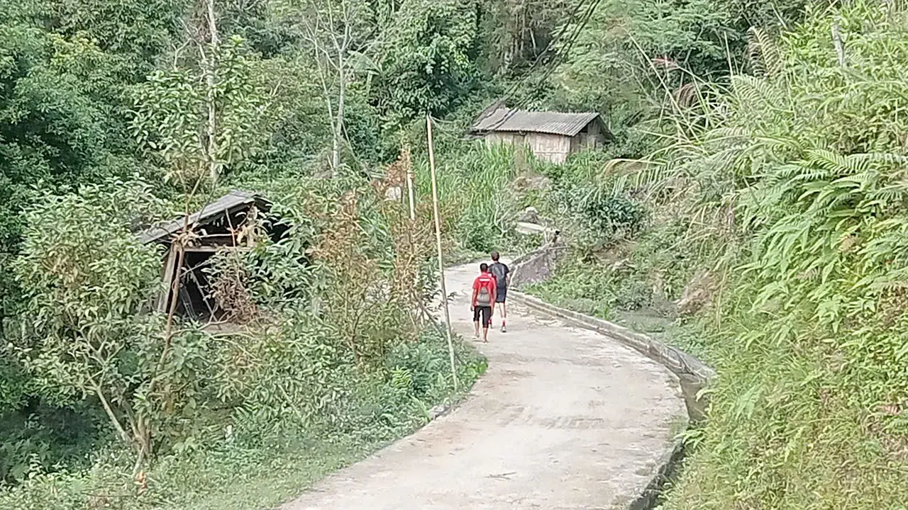
Not every kilometre is remote dirt. Villages in both the west and the east use concrete paths and short road sections to connect houses, schools and fields. A real walking day uses those lanes to leave one footpath and find the next. Pretending the week is continuous off-road trail would be less honest than the week itself.
Concrete is not a rest. Village lanes are often steep, sometimes stepped, and slick when wet. The stride changes — more upright, more attention to the polished patches — but the day is still a walking day. The eastern dirt-track photograph in the next section is dirt. Its field note is the useful contrast: some connectors on that same day are concrete village paths instead. We do not have a frame we are willing to caption as “this is the concrete,” so this section stays in words.
That mix is what “trail conditions” means here. Judging a Ha Giang trek by whether it is paved or not misses the point. You will walk both. The paved parts are access. The unpaved parts are the mountain. Together they are the route.
Stone and limestone ask for a slower pace.
After the western terrace country, the week moves onto the plateau around Dong Van and toward Meo Vac. The ground changes with the mountain. Limestone replaces the paddies. Paths run on rock, on dirt through scrub, and on narrow cultivated shelves. Corn sits where a little soil has collected. Shade is less reliable, and the footing is harder.
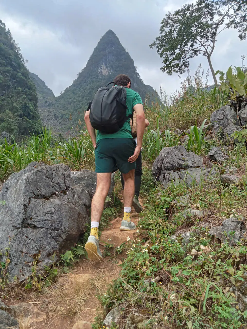
What the frames show is rock underfoot, a dirt track through scrub, an exposed section, a path that narrows against the cliff, and a footpath between limestone peaks. One clip is limestone walking on 20 October, between the Lo Lo Chai area and Dong Van. None of these frames is assigned to a named viewpoint. The published route names those places. A photograph we cannot place that precisely does not.
Loose and rough stone slows people more than the kilometre count suggests. Ankles notice the angle. A short rocky section can take longer than the same distance on compact earth. The pace on the eastern days is set by that footing, plus the climbs, not by a desire to walk slowly for its own sake.
ROUTE REALITY
ROUTE REALITY
- The Dong Van karst plateau
The eastern mountain this part of the week walks through.
- Meo Vac on foot
The eastern town the long limestone day finishes toward.
Why 15 km here is not 15 km flat.
On this departure the long walking days sat at about 15–20 km. That figure is the walking line. It is not 15 km on a towpath, and it is not a road distance copied from a map.
The same kilometre can be a terrace wall, a dirt track, a concrete lane, or rough limestone. Descents and climbs arrive often enough that the legs register them before the watch does. Technical footing — loose stone, a slick patch, a narrow edge — costs time that a smooth trail would not. So do ordinary stops: a junction, a house, a picnic, a photograph, a section that needs care.
Weather changes the number again. Heat, cloud and rain all slow the pace. We do not publish an elevation-gain figure for this departure. It was not measured. A guessed total would sound precise and would be less useful than the surfaces above.
Plan for a full day on your feet, with an early start and a finish in the afternoon or early evening. The main bag stays with the support vehicle. What you carry is a daypack, which matters once the footing asks you to watch your feet.
- Why a walking kilometre is not a road kilometre
How trail distance, vehicle distance and map distance get mixed up.
- What happens to the main bag
Why the daypack is what you carry between the surfaces.
Wet ground slows the same trail.
Rain does not invent a new mountain. It changes the surfaces you were already going to walk. Earth on the terraces smears. Stone and limestone become slick, especially where the rock has been polished by feet or by a short concrete connector. Village concrete, which felt easy when dry, can be the piece that needs the most attention.
Pace drops. A guide will often shorten a photo stop, shift a picnic, or choose the firmer line through a village when the hillside is greasy. That is a normal field decision. It is not an announcement that the day has become dangerous. Light rain does not automatically cancel a walk. The call depends on the path that morning, the group, and what the guide can see — not on a forecast icon.
Visibility is the other change. Cloud on the eastern plateau removes the long view and makes the rocky ground feel more enclosed. In the west, tree cover can hold moisture after the open terraces have started to dry. Neither is a reason to promise mud, or to promise a dry trail, for a departure that has not happened yet.
- Best time for Ha Giang trekking
Season window and storm-season context.
- Is Ha Giang trekking safe?
Weather and field decisions — not footwear lists.
Grip matters more than a heavy boot.
The journey asks for broken-in walking shoes with grip for stone, dirt and slick limestone. That is the practical brief. The week is a mix, so the shoe has to be tolerable on a long terrace day and trustworthy on rough rock the day after.
A comfortable trail runner, or a light hiking shoe with a real lug, is enough for many people on this kind of route. The shoe should already be walked in. New footwear on the first long day is a common way to lose time to blisters. Bring socks that can dry overnight. Carry a spare pair in the daypack when the morning looks wet.
Fully waterproof boots are not automatically better. In warm, humid weather a membrane that keeps rain out also keeps sweat in, and a soaked boot can still be wet the next morning. They earn their place on colder, wetter high-mountain programmes. For this west-to-east mix, grip, fit and a shoe you can walk in for six hours matter more than a waterproof label.
No shoe is right for every foot. If you already have a broken-in pair with decent tread, use that rather than buying a specialist boot for one week. The packing note goes further on layers, rain shells and what stays in the main bag.
- What to pack for a Ha Giang trek
Footwear in the context of the rest of the kit.
Trekking poles are useful, not required.
Poles are not mandatory on this journey. Nothing in the published kit list makes them a condition of joining. Many people walk these surfaces without them.
They help when a descent is steep, when mud or wet stone is slick, when the limestone is angled, or when legs are tired late in the day. They are also a balance tool on a narrow terrace edge. If your knees complain on stairs, bring them. If you have never used poles, a pair you have not tried is less useful than a shoe you trust.
On village lanes, keep the tips low and give way to people carrying loads. The path is a working path. Poles are a guest’s tool, not a right of way.
The surface changes when the mountain changes.
Underfoot, the west of this departure is terrace, dirt, forest path and agricultural track, with concrete where a village interrupts the footpath. The east is limestone, rough stone, hard village surfaces and more exposed mountain path. The photographs above are that difference. A longer comparison of the two regions — culture, season, and which trip fits — already lives on its own page. This one stops at the ground.
You do not need both in one week to meet real Ha Giang footing. A Hoang Su Phi terrace trek is coherent on its own. So is a karst walk around Dong Van. Walking out of one and into the other simply makes the change obvious, because your feet notice it before the guidebook does.
- Hoang Su Phi and Dong Van, compared
The wider regional difference, beyond the surface underfoot.
Uneven ground, not a prepared trail.
These surfaces suit someone who is reasonably fit, likes a full day of walking, and is comfortable when the path is uneven. You do not need polished trekking infrastructure. You do need to accept that the surface will change, that weather will change it again, and that some kilometres are village lanes rather than a continuous dirt trail.
It is a poor fit if you want flat, graded paths, or if uneven stone and the chance of mud are things you would rather avoid. It is also a poor fit if you expect every hour to be remote wilderness. The honesty of the concrete sections cuts both ways: this is not a pavement tour, and it is not an unmarked expedition either.
Homestay nights in the west and simpler town rooms in the east are a separate question from the footing. They matter to whether the week suits you. They are not what this page is for.
- Ha Giang without a motorbike
What changes when the journey is walked rather than ridden.
- Homestay trekking in Ha Giang
Overnight village stays, which are separate from the trail surface.
Judge the day by more than kilometres.
Difficulty on a Ha Giang trek is the combination of distance, surface, weather, ascent and descent, hours on your feet, and whether the next day is a walk or a recovery. A 15 km day on compact terrace paths is a different day from 15 km on rough limestone after rain. The kilometre count alone will not tell you which one you are booking.
Use this page to decide whether the footing sounds like a week you want. Use the field story if you want the shape of one real west-to-east departure — the days, the vehicle, the rooms — without the booking detail. Use the journey page for the published line, the dates and what is included. That page holds the published trip. This one describes the ground underfoot.
- See the 7-Day Hoang Su Phi to Dong Van Hiking Journey
Dates, the day-by-day and what is included live on the journey page.
- Read what a real West-to-East trek looks like
The October 2026 field account of the same kind of week.
- Plan a private Ha Giang trekking journey
The existing enquiry. Tell us the dates and who is walking.
Published by Ha Giang Trekking — field knowledge from local trail guides on the routes described, checked against programme schedules and operating notes.
Journal pages are for route research and planning. Dates, prices, day-by-day schedules and enquiry sit on programme and tour pages.
Articles are published under Ha Giang Trekking. Named writer and guide bylines will be added when verified bios and consent are on file.
Operational details on programme and tour pages are published only after being checked against current operating information.