Dong Van Karst Plateau: A Practical Guide for Trekkers
Trekking and hiking the eastern highlands on foot — limestone, villages and walking rhythm — then choose the journey that fits Dong Van, Meo Vac and Ma Pi Leng.

Dong Van Karst Plateau: on foot.
Dong Van Karst Plateau is not a single pass or a motorbike loop. On foot, it is a connected highland of limestone summits, hidden valleys, village paths and long views between the northern plateau’s settlements — trekking and hiking the eastern highlands at walking pace.
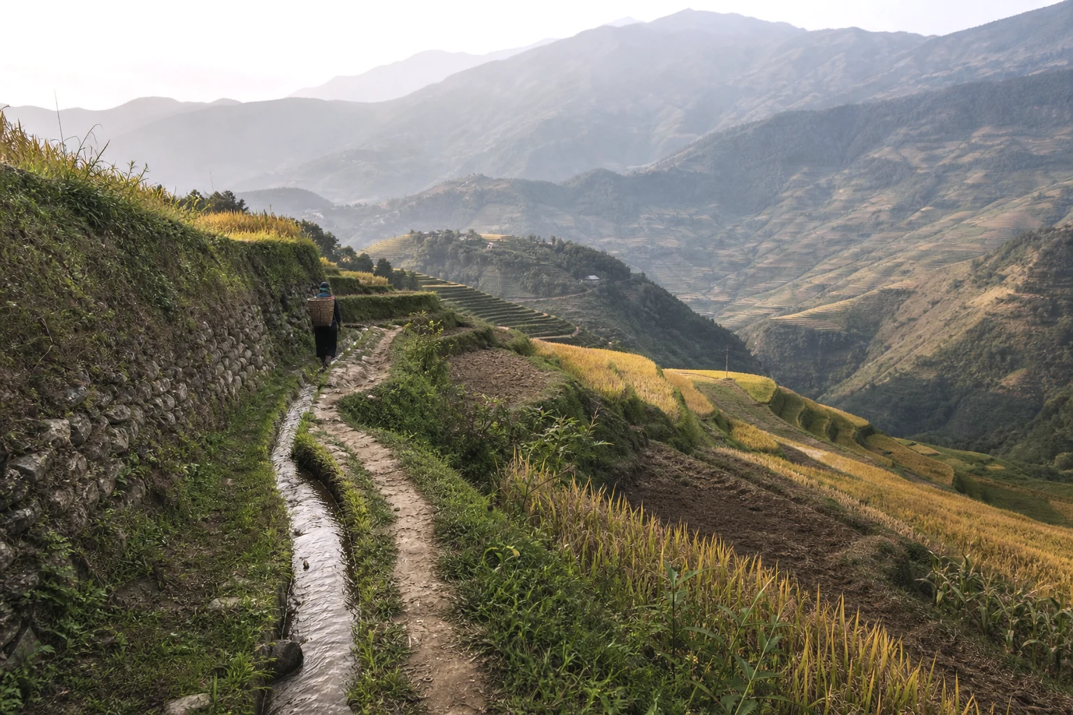
Walking changes the scale. A route can move from a ridge into a Hmong or Lo Lo village, follow the edge of black limestone and arrive in Dong Van town slowly enough for the landscape and its working communities to stay connected.
Use this guide to place Dong Van within Ha Giang, then choose the journey that gives it the right amount of time. The complete guide shows the wider province; Plan Your Ha Giang Trek explains the common difficulty scale and route collections.
- The complete guide to trekking Ha Giang
Place the plateau within the wider province.
- Plan Your Ha Giang Trek
Compare collection, season and difficulty.
- Programme vs Extended Journey
Choose the shape of the trip before the exact route.
- Village treks
Compare routes, difficulty and seasons at this collection hub.
- Eastern Ha Giang Village Trek
Four-day eastern walking-led journey.
- Dong Van Karst Traverse
Five walking days on the plateau.
- Hoang Su Phi to Dong Van hiking journey
Terrace country then the karst.
- Ha Giang without a motorbike
Walking-first Eastern days without riding the Loop.
- Luggage on Ha Giang treks
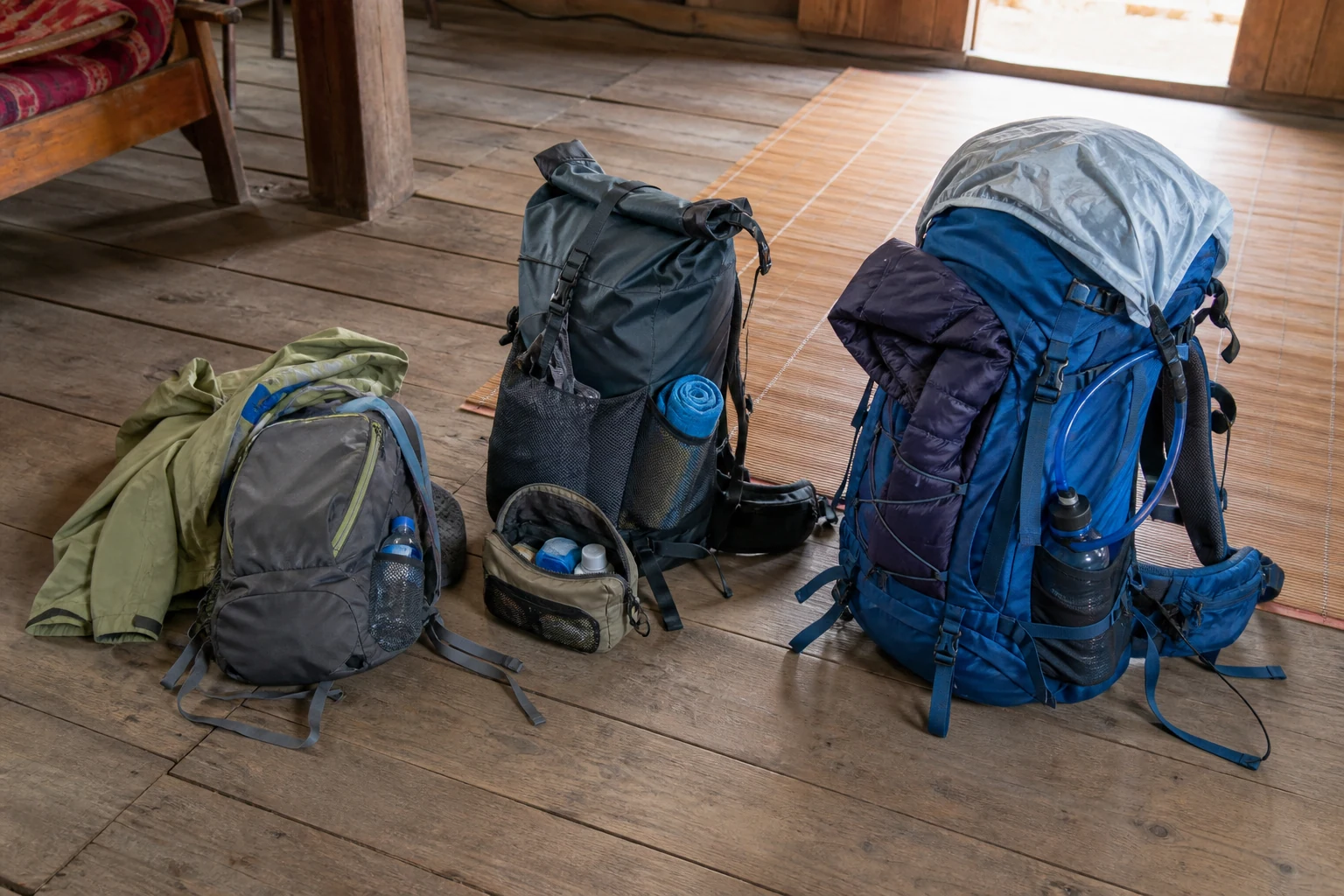
Daypack versus support-vehicle main bag.
- Ha Giang trekking itineraries
Compare 4-, 5- and 7-day published journeys.
Trekking the plateau vs riding the Loop.
The motorbike Loop is a road itinerary — viewpoints, café stops and hotel nights tied to kilometres on asphalt. Trekking here means consecutive walking days, homestay or guesthouse rhythm and trailhead transfers only where walking every metre would waste a day on logistics.
You can combine a short walk with a Loop holiday, but that is not the same product as a multi-day guided trek. Published walking journeys start from Ha Giang City or a defined trailhead, carry a daypack on foot and treat the vehicle as support — not as the main experience.
When a road transfer is the honest way to reach the next walking block — long Nho Que gorge connections, Meo Vac toward Du Gia, or a plateau reposition — operators use it. When village paths, limestone connectors or rim walking are worthwhile, the day stays on foot.
- The Ha Giang loop on foot
Loop vs trekking intent.
- Ha Giang without a motorbike
Walking-first discovery.
Eastern Ha Giang as a wider frame.
Dong Van sits inside eastern Ha Giang — the northern karst plateau that also includes Quan Ba’s gateway country, Yen Minh forest approaches, Meo Vac district toward Ma Pi Leng and Du Gia’s southern valley walking.
Quan Ba and Nam Dam crossings belong to western Village Treks hub lines; the four-day Eastern Ha Giang Village Trek links Quan Ba, plateau, Meo Vac and Du Gia in one walking-led block. Meo Vac and Ma Pi Leng are eastern walking country on extended journeys — read Meo Vac trekking guide for district context.
This guide keeps Dong Van as the informational owner for plateau trekking research. Commercial depth lives on published programmes — not on a second Dong Van sales URL.
- Eastern Ha Giang Village Trek
Four-day eastern multi-zone walking journey.
- Quan Ba trekking guide
Western gateway before plateau tours.
- Meo Vac trekking guide
District walking east of Dong Van.
Programme choice by calendar length.
Two days: Lo Lo Chai to Then Pa — northern village overnight toward Then Pa and Lung Cu, not a full plateau traverse.
Four days: Eastern Ha Giang Village Trek — walking-led eastern journey with passenger motorbike trailhead logistics, Ha Giang City start and finish.
Five days: Dong Van Karst Traverse — slower plateau walking from Ha Giang City through homestay nights, Lung Cu and Ma Pi Leng rim country.
Seven days: Hoang Su Phi to Dong Van hiking journey — west-to-east terrace and plateau walking with support-vehicle logistics.
Custom: Custom Expeditions when no published line fits dates, pacing or geography.
- Lo Lo Chai to Then Pa
Two-day northern plateau village trek.
- Eastern Ha Giang Village Trek
Four-day eastern walking journey.
- Dong Van Karst Traverse
Five-day plateau walking journey.
- Hoang Su Phi to Dong Van hiking journey
Seven-day west-to-east flagship.
- Custom expeditions
Tailor-made when no published SKU fits.
- Ha Giang trekking itineraries
Duration compare across published journeys.
Can you trek in Dong Van?
Yes. Dong Van is walkable: village-to-village limestone days, published extended journeys, and Lo Lo Chai as a possible walking start — not only a motorbike-loop town.
Lo Lo Chai can be used as a walking start. One reference corridor walks toward Dong Van rather than toward Then Pa and Lung Cu — those are different intents.
Lo Lo Chai as a start toward Dong Van can follow Lo Lo Chai → Khia Lia / Khe Lia → Thai Phin Tung → Ha De → Dong Van. Reference walking is 15–18 km and 6–8 hours, upper Moderate — still the public Moderate grade. Reference corridor and walking band only — guide and conditions can adjust individual sections. Used as Day 5 of the Private Hoang Su Phi to Dong Van Hiking Journey, not as a standalone Field A URL.
Arriving in Lo Lo Chai or Dong Van by road is a stop. Walking the limestone between villages is slower, mixed underfoot, and uses a daypack while main luggage can travel separately by support vehicle where a journey is supported.
A private English-speaking trekking guide may lead walking sections, coordinate timing with the support vehicle, arrange picnic lunches on remote days, and adapt individual trail sections for weather or access. An additional local guide is not claimed on every trek.
Lodging on a longer Eastern line can mix a local homestay near Lo Lo Chai with a hotel or guesthouse in Dong Van or Meo Vac. Do not copy Hoang Su Phi bathroom, hot-water or wifi facts across the plateau.
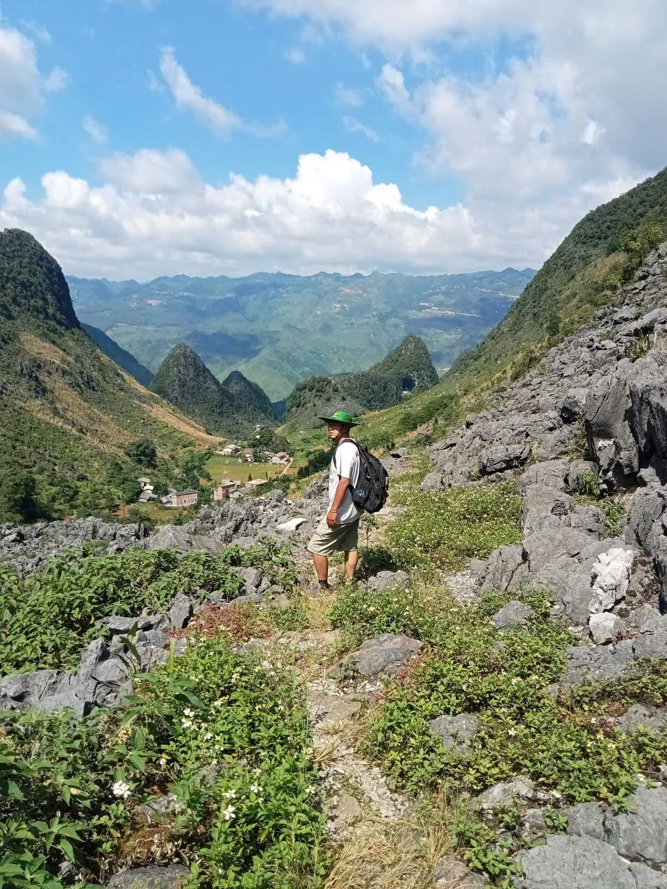
Khia Lia / Khe Lia, Thai Phin Tung and Ha De appear here as progression points on that walking line toward Dong Van — landscape and trail role only. This page does not invent population, altitude or facilities for those hamlets.
Dong Van can be a walking base and an overnight after arriving on foot. Road sightseeing treats the old quarter as a stop. Trekking uses village connectors and limestone underfoot, then a hotel or guesthouse night before the next plateau day toward Meo Vac.
- Lo Lo Chai to Then Pa
Published trek toward Then Pa and Lung Cu.
- Private Hoang Su Phi to Dong Van Hiking Journey
7-day west-to-east walking product using this corridor as Day 5.
- Dong Van Karst Traverse
Five-day Moderate plateau journey — not this village corridor day.
- Custom expeditions
Private dates or pacing when a published SKU does not fit.
- Lo Lo Chai practical guide
- Meo Vac trekking guide
What limestone walking feels like.
Eastern plateau walking uses limestone trail, stone path, agricultural path, concrete village path — concrete village roads sit beside dirt agricultural tracks and limestone trail. This is not Hoang Su Phi terrace or forest walking.
Eastern walking mixes limestone trail, stone path, agricultural track, concrete village path, rocky mountain path and, in places, narrow uneven sections.
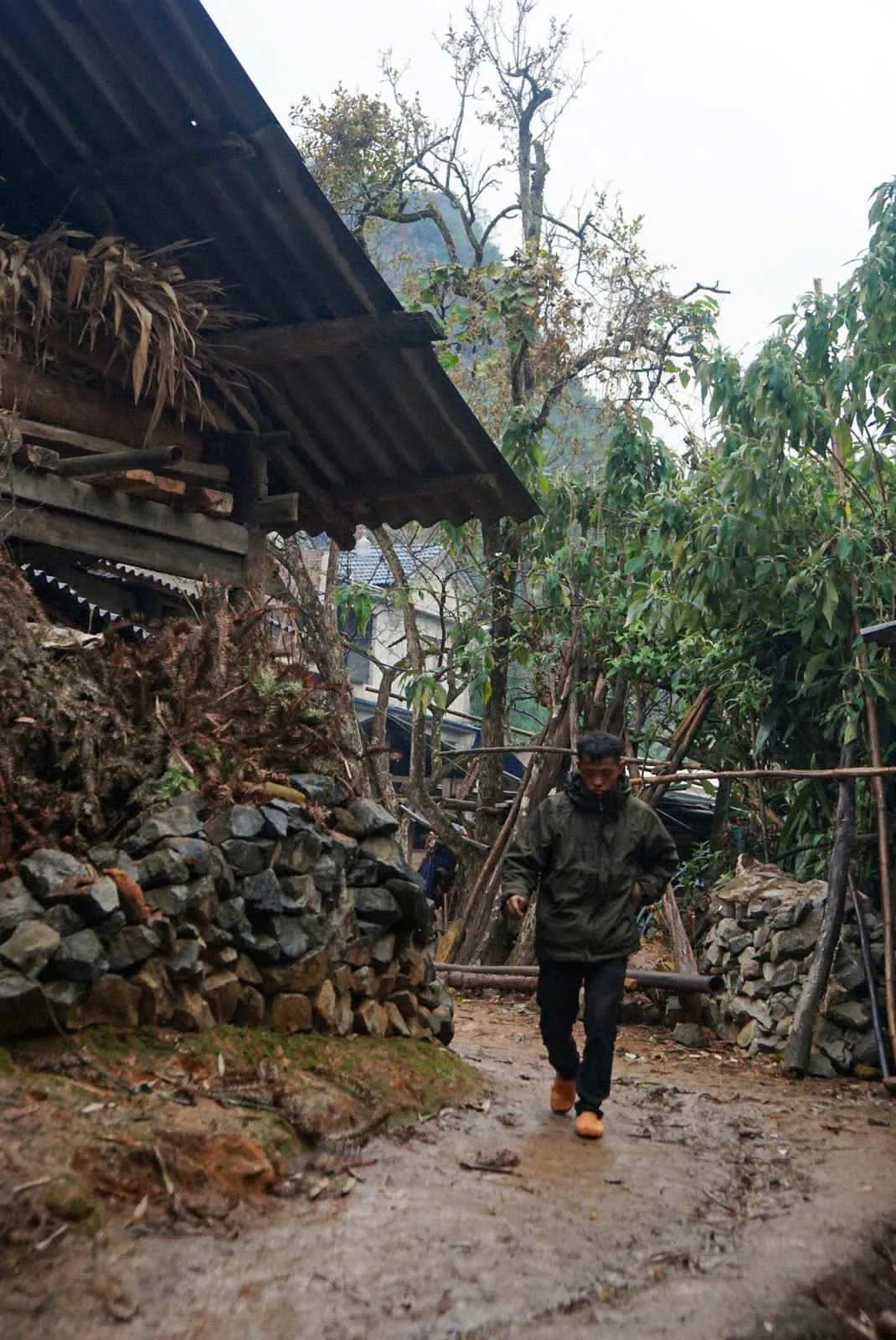
After rain, village connectors and bare limestone can turn slick while mud collects on lower concrete sections — pace and footwear matter as much as distance.
A support vehicle can assist with main luggage and longer road connections. The vehicle does not follow every walking section.
Stone, valleys and open ridges.
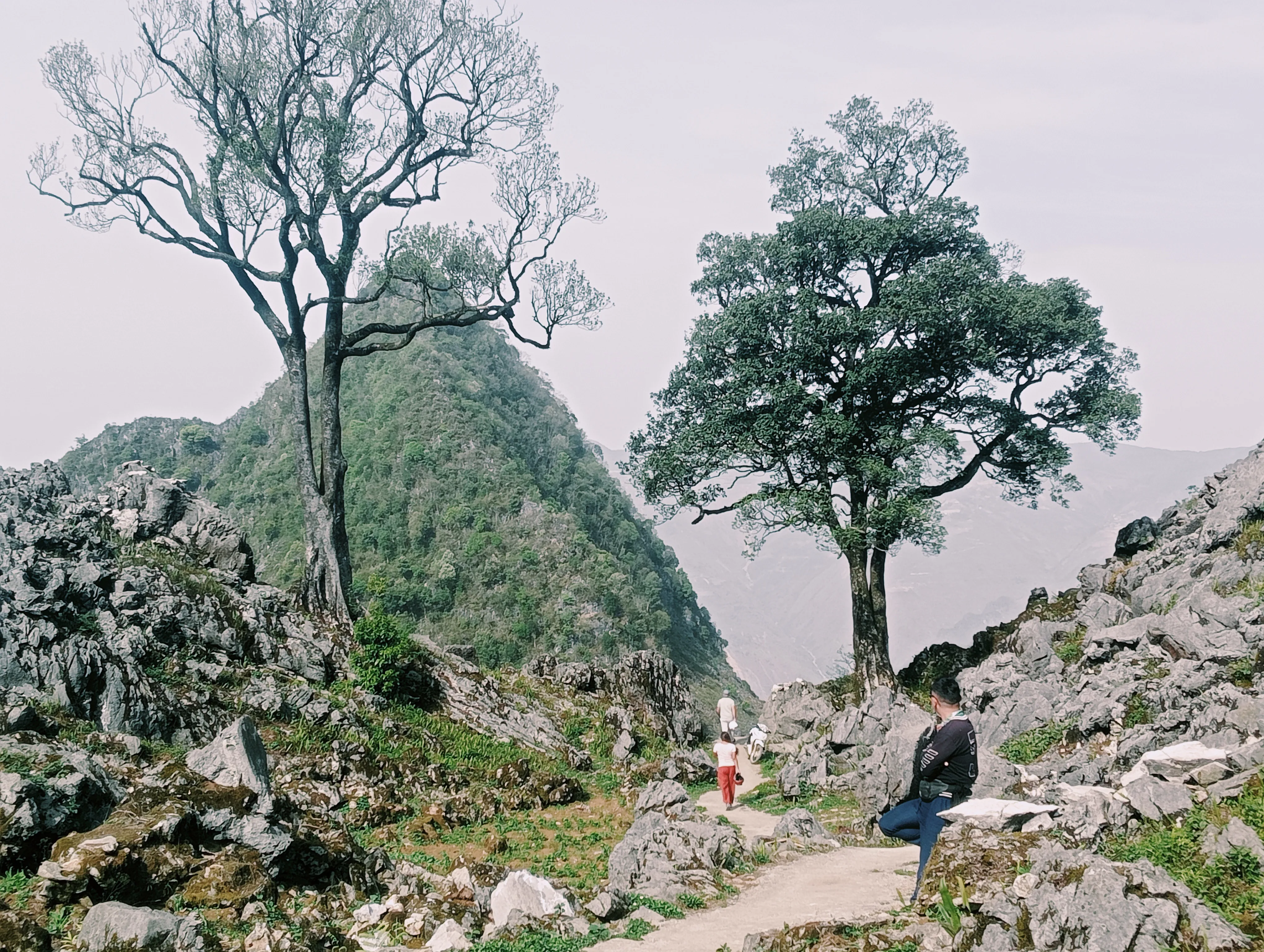
The plateau is limestone country. Black rock appears beside footpaths and fields, while summits and folded ridges frame valleys that can look close on a map but take time to cross on foot.
The walking is not continuous ridge travel. It alternates between exposed ground, village approaches, farm paths and town or homestay stops. After rain, stone paths can be slick; in drier months, open sections can feel colder or more exposed than the valley below.
Buckwheat season changes the colour of parts of the plateau, but it does not change the underlying terrain. Choose the month for walking conditions first, then treat flowering fields as part of the landscape rather than the reason for the route.
On the trail, sharp limestone often sits beside smoother path sections — the contrast is normal on long Dong Van walking days, not a sign you left the route.
- Best time to trek Ha Giang
Match plateau conditions to your dates.
- Packing for Ha Giang
Footwear and layers for exposed, uneven ground.
Walk between places, not just through scenery.
The northern plateau’s villages give a trekking route its rhythm. Lo Lo Chai sits below the Lung Cu flagpole, while Then Pa and the Hmong hamlets beyond it make the ground feel inhabited rather than scenic in isolation.
A walking day may finish with a homestay, or lead into Dong Van’s old quarter after forest paths and buckwheat fields. Those transitions matter: meals, shared space and the pace of a village evening are as much part of the journey as the limestone underfoot.
Markets and food belong to the same setting. Men men is a high-karst staple where rice struggles, and market visits work best as part of a route and a local week rather than a hurried stop.
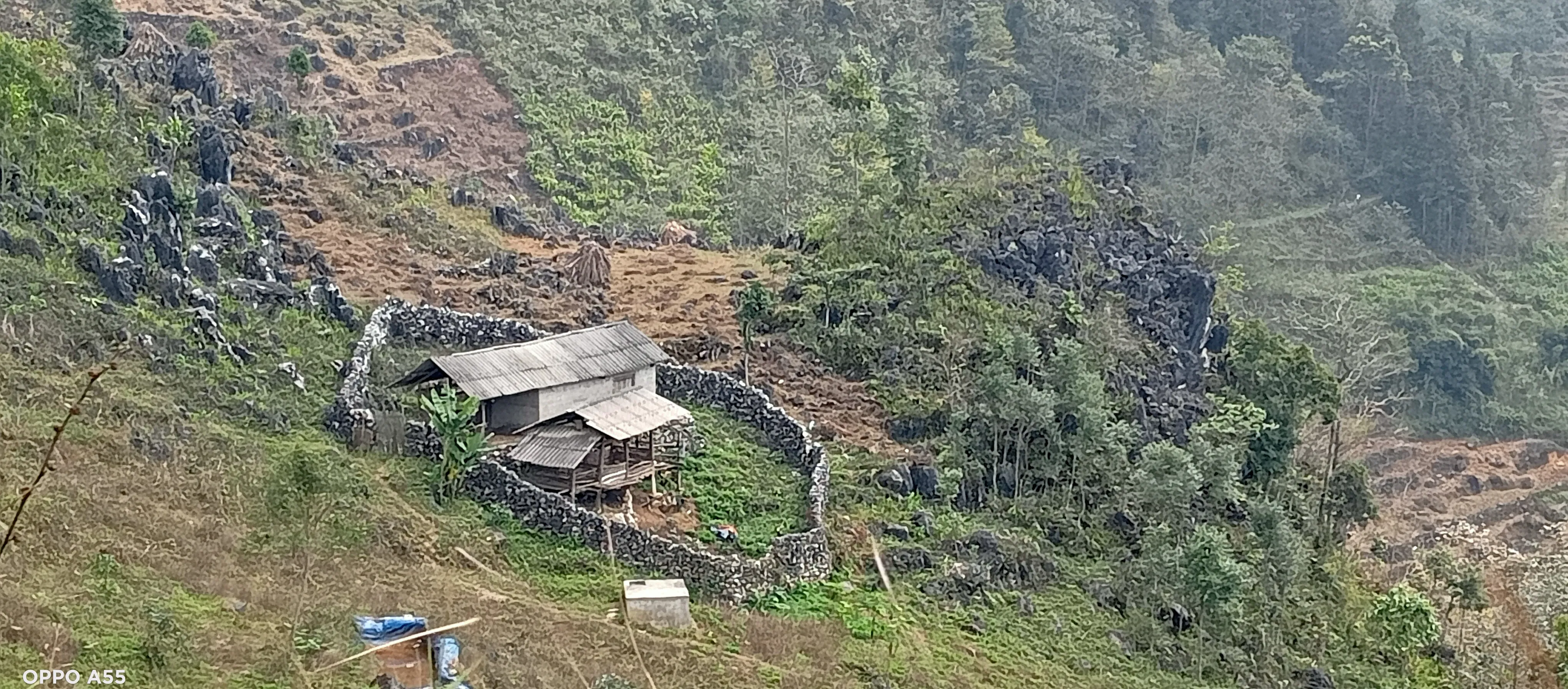
Dry-stone walls and small homestead gardens sit directly on the karst — walking between villages is as much about these working landscapes as about summit views.
- Lo Lo Chai to Then Pa
A two-day Moderate village programme on the northern plateau.
- Lo Lo Chai practical guide
Plan the village route in more detail.
- Homestay etiquette
Arrive well at a family home.
- Eating with the Hmong
Read the food context before a homestay meal.
- Sunday markets of the north
Understand the market rhythm of the plateau.
Ma Pi Leng and Lung Cu, different edges of the same region.
Ma Pi Leng sits on the plateau’s canyon edge. A short rim walk gives a focused view above the Nho Que river; the five-day Dong Van Karst Traverse includes one canyon-rim day within a wider plateau route.
The seven-day Ma Pi Leng Canyon Expedition uses the same wider region differently. It turns the canyon into the centre of the week, with a rim day, descent to the river, boat crossing and remote hamlet nights.
Lung Cu draws the route north to the flagpole, Lo Lo Chai and border-ridge walking. The six-day Lung Cu Northern Frontier gives that northern edge more time than a short village programme, while the Dong Van traverse connects it to the rest of the plateau.
- Trekking Ma Pi Leng: What to Expect on Foot
Decide whether the full canyon week fits.
- Walking Ma Pi Leng — not riding it
A field note on the canyon rim.
- Lung Cu border walking
A closer look at the northern plateau edge.
- Dong Van Karst Traverse
A five-day Moderate journey through the plateau.
- Ma Pi Leng Canyon Expedition
A seven-day Demanding canyon journey.
- Lung Cu Northern Frontier
A six-day Moderate northern journey.
Choose by the ground you want to cover.
Choose Lo Lo Chai to Then Pa when two days of northern-plateau village walking is enough. It is a Moderate programme centred on Lo Lo and Hmong settlements, rather than a journey across the broader plateau.
Choose Eastern Ha Giang Village Trek when four walking-led days should cover Quan Ba, plateau, Meo Vac and Du Gia with trailhead transfers — broader eastern geography without a full five-day plateau traverse.
Choose Dong Van Karst Traverse for a Moderate five-day line from Ha Giang City through homestay nights, Lung Cu, Lo Lo Chai walking and a Ma Pi Leng rim day. It is the clearest choice when you want a broad plateau walk without making the canyon the entire itinerary.
Choose Hoang Su Phi to Dong Van hiking journey when seven days should link terrace country to the eastern plateau west-to-east. Choose Ma Pi Leng Canyon Expedition only when a Demanding canyon-centred week is the point of the trip — not as a generic seven-day Ha Giang trek.
Choose Custom Expeditions when dates, pacing or a village corridor need designing from scratch.
- Programme vs Extended Journey
Compare focused programmes and longer route lines.
- Plan Your Ha Giang Trek
Use the shared difficulty scale.
- Ha Giang trekking itineraries
4 vs 5 vs 7 day compare.
- Lo Lo Chai to Then Pa
A two-day Moderate programme.
- Eastern Ha Giang Village Trek
Four-day eastern walking journey.
- Dong Van Karst Traverse
A five-day Moderate plateau journey.
- Hoang Su Phi to Dong Van hiking journey
Seven-day west-to-east flagship.
- Ma Pi Leng Canyon Expedition
A seven-day Demanding canyon journey.
- Custom expeditions
Tailor-made route design.
Keep the practical details separate.
The plateau needs a realistic arrival buffer before the first walking day. Plan your road journey and permit requirements before you choose the route, rather than fitting them around a fixed start time.
Foreign travellers on the northern plateau may encounter passport checks. The dedicated permit guide holds the current practical detail, while the packing and cold-night guides cover the conditions that change most between open ridges and homestays.
- Getting to Ha Giang for Trekkers
Plan the road and buffer before the walk.
- Ha Giang trekking permits
Read the current northern-plateau guidance.
- Packing for Ha Giang
Prepare for plateau walking conditions.
- Northern plateau cold nights
What changes at a winter homestay.
Common questions.
Can you trek in Dong Van?
Yes. Dong Van is walkable: village-to-village limestone days, published extended journeys, and Lo Lo Chai as a possible walking start — not only a motorbike-loop town.
Can you hike from Dong Van to Meo Vac?
Yes, selected plateau corridors can be walked between Dong Van and Meo Vac. That is not the same as walking every kilometre of the motorbike Loop.
Do you need a motorbike?
No. Eastern Ha Giang can be explored walking-first, with private transfers and, on supported journeys, a vehicle for main luggage and road connections.
How long can an Eastern Ha Giang hiking day be?
A full Eastern walking day can run about 6–8 hours and 15–20 km on upper Moderate ground — reference bands, not a guarantee for every departure.
What terrain is involved on Eastern walking days?
Eastern walking mixes limestone trail, stone path, agricultural track, concrete village path, rocky mountain path and, in places, narrow uneven sections.
What happens to luggage on an Eastern walking day?
On supported Eastern walking days, main luggage can travel separately by support vehicle while you walk with a light daypack. The support vehicle does not accompany every footpath. It meets the route only where access permits.
Does the support vehicle follow the whole trail?
The support vehicle does not accompany every footpath. It meets the route only where access permits.
HSP or Dong Van trekking?
Hoang Su Phi is terrace, forest and cultivated-slope walking. Dong Van and Meo Vac are limestone plateau walking. Neither is universally better; they can be combined with a private vehicle recovery day between walking systems.
Is the Dong Van Karst Plateau only for motorbike travellers?
No. The plateau has village paths, limestone ridges and homestay routes that work as walking journeys. A trek uses the ground between settlements rather than treating the road and viewpoints as the whole experience.
Do I need a permit to trek on the northern plateau?
Foreign travellers may encounter permit and passport checks on northern-plateau routes. Read the current Ha Giang permits guide before you travel and confirm route-specific arrangements with the team.
How does Lo Lo Chai to Then Pa compare with Dong Van Karst Traverse?
Lo Lo Chai to Then Pa is a two-day Moderate village programme. Dong Van Karst Traverse is a five-day Moderate extended journey across wider plateau ground, including a canyon-rim day.
When is buckwheat season on the Dong Van plateau?
Buckwheat commonly appears from October to November. Use the best-time guide to choose for walking conditions first, then check how the seasonal landscape fits your dates.
How does Ma Pi Leng Canyon Expedition differ from a canyon-rim day?
Dong Van Karst Traverse includes one rim day above the Nho Que. Ma Pi Leng Canyon Expedition is a seven-day Demanding journey with a rim day, river descent, boat crossing and remote hamlet nights.
Can I combine Lung Cu with Ma Pi Leng in one trip?
The Dong Van, Lung Cu and Ma Pi Leng journeys cover different parts of the northern plateau and canyon edge. Send your dates and walking experience so the team can help assess the right route and sequence.
Choose the right plateau line.
Decide whether your trip needs a village programme, a wider plateau traverse, a northern frontier route or a full canyon week. Then use the individual journey page for the exact itinerary.
Send your dates and recent walking experience. We will help match the journey to your arrival plan and the ground you want to cover.
- Explore extended journeys
Compare the multi-day collection.
- Enquire about a departure
Share your dates and walking experience with the team.
Published by Ha Giang Trekking — field knowledge from local trail guides on the routes described, checked against programme schedules and operating notes.
Journal pages are for route research and planning. Dates, prices, day-by-day schedules and enquiry sit on programme and tour pages.
Articles are published under Ha Giang Trekking. Named writer and guide bylines will be added when verified bios and consent are on file.
Operational details on programme and tour pages are published only after being checked against current operating information.
Compare published routes and open the programme or journey page when you are ready to enquire.
- Extended journeys — multi-day loops
Compare difficulty, seasons and walking style before you enquire.
- Lo Lo Chai to Then Pa (2 days)
Lo Lo Chai to Then Pa (2 days) — dates, pricing and enquiry.
- Private Hoang Su Phi to Dong Van Hiking Journey
Private Hoang Su Phi to Dong Van Hiking Journey — full itinerary and enquiry.
- Dong Van Karst Traverse
Dong Van Karst Traverse — full itinerary and enquiry.
- Ma Pi Leng Canyon Expedition
Ma Pi Leng Canyon Expedition — full itinerary and enquiry.
- Lung Cu Northern Frontier
Lung Cu Northern Frontier — full itinerary and enquiry.
- Ha Giang trekking permits: a guide for foreign travellers
Day-by-day walking detail and pacing for Dong Van Karst Plateau.
- Ha Giang trekking permits update: current guidance for foreign travellers
Day-by-day walking detail and pacing for Dong Van Karst Plateau.
- Trekking Ma Pi Leng: What to Expect on Foot
Neighbouring walking country linked to Dong Van Karst Plateau.
- Meo Vac trekking guide: villages, markets and Ma Pi Leng access
Neighbouring walking country linked to Dong Van Karst Plateau.