
Walking Ma Pi Leng — not riding it
Why the canyon reveals itself only to those who slow down.
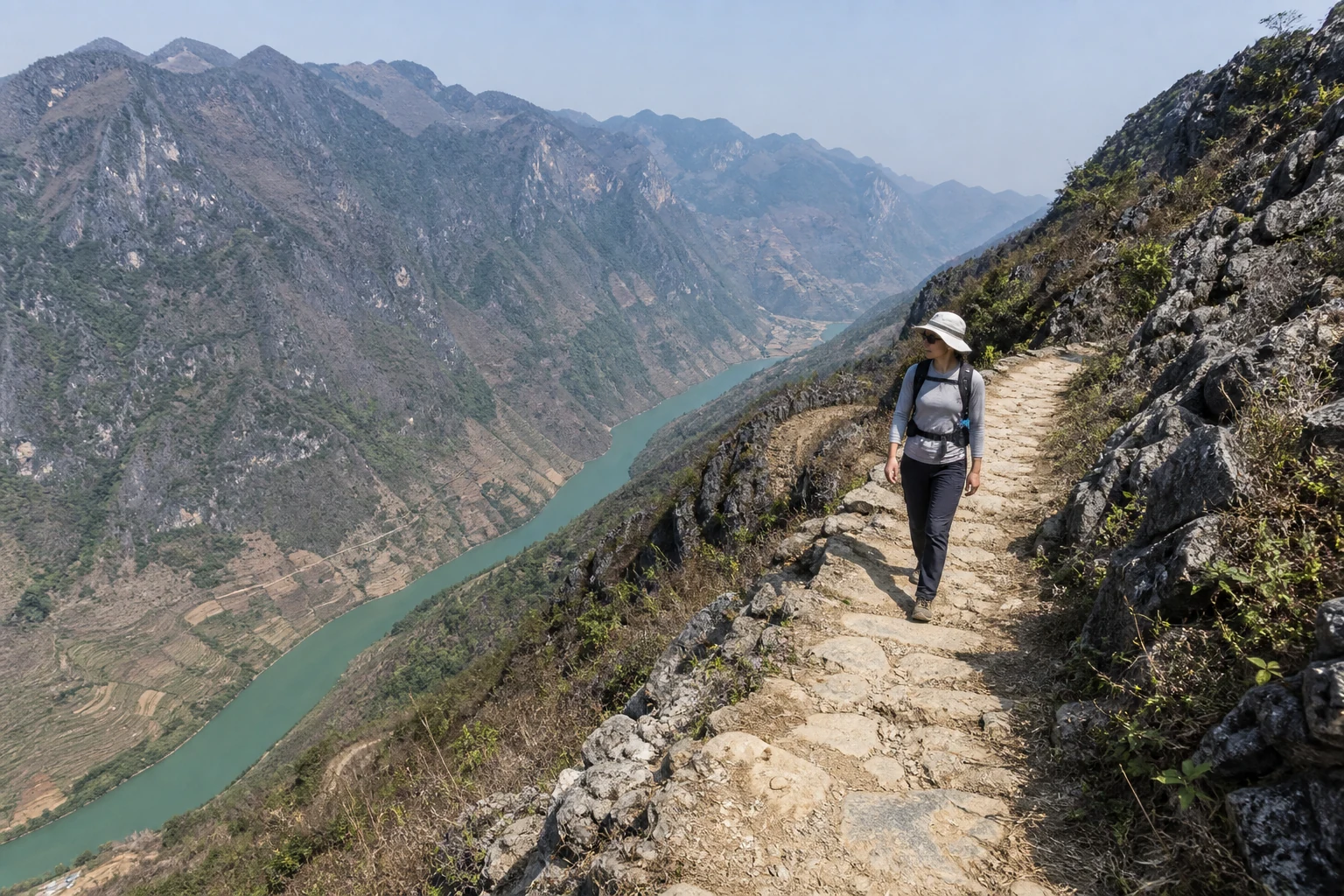
Walking Ma Pi Leng — not riding it.
Can you hike Ma Pi Leng without a motorbike? Yes. You do not need to ride the Happiness Road pass to experience the walking sections — a support vehicle can reach trailheads and carry main luggage where access allows, while your day is on rim path, connectors and shorter rocky walks.
Three shapes of foot travel share this canyon country but are not the same product. Short rim and Sky Path–style walking is a slow half-day on the eastern lip — Pai Lung toward the Skywalk with long pauses, not a race along the motorbike carriageway. White Cliff (Vách Đá Trắng) is a separate Moderate rocky walk in the Ma Pi Leng area — useful after long plateau days, not a label for every rim stroll. Multi-day canyon and plateau journeys weave Meo Vac, Lo Lo corridors and a dedicated rim day inside a longer walking week — one option among several, not the only way to walk here.
Most travellers still see Ma Pi Leng from the back of a motorbike: a viewpoint, a photo, then dinner in Dong Van. On foot, the scale changes — the Nho Que river a thin jade ribbon below, folded limestone blackened by lichen. This note is for trekkers who already plan plateau time on foot, not a traffic report on the pass road.
- Lo Lo Chai village evening
Northern plateau walking pace before the canyon.
- Meo Vac trekking guide
District walking around the canyon edge.
- Dong Van Karst Plateau guide
Plateau walking context, including Lo Lo Chai toward Dong Van.
- Ha Giang without a motorbike
Walking-first Eastern days with vehicle-supported luggage.
- Ma Pi Leng Canyon Expedition
Seven-day Demanding canyon week — not this half-day rim note.
- Dong Van Karst Traverse
Five-day plateau walk with a Ma Pi Leng rim day.
- Custom expeditions
Shorter rim or canyon add-ons when a published week does not fit.
- Hoang Su Phi to Dong Van hiking journey
Seven-day west-to-east walking journey — generic 7-day owner, not canyon-only.
- Eastern Ha Giang Village Trek
Shorter four-day eastern walking option.
- Village treks hub
Compare routes, difficulty and seasons at this collection hub.
Why the canyon needs slow feet.
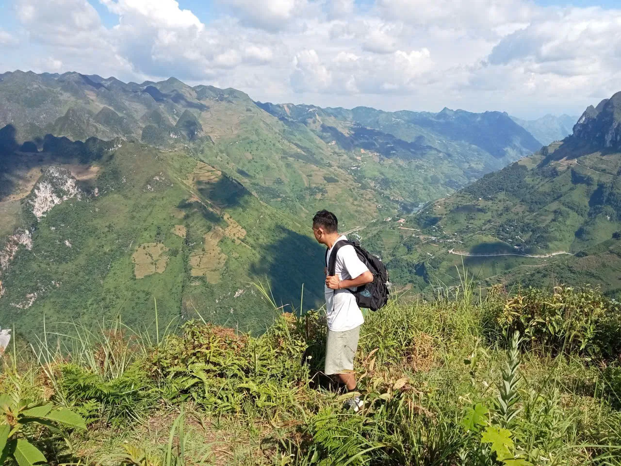
Motorbike stops compress Ma Pi Leng into three viewpoints and a coffee stall. Walking lets the rim unfold: side gullies, goat paths and river colour shifting as cloud shadow moves.
Grassy shoulders and side paths on the rim put your boots beside the gorge rather than only beside a crash barrier — still exposed, still hot, but a different texture from a pullout photo.
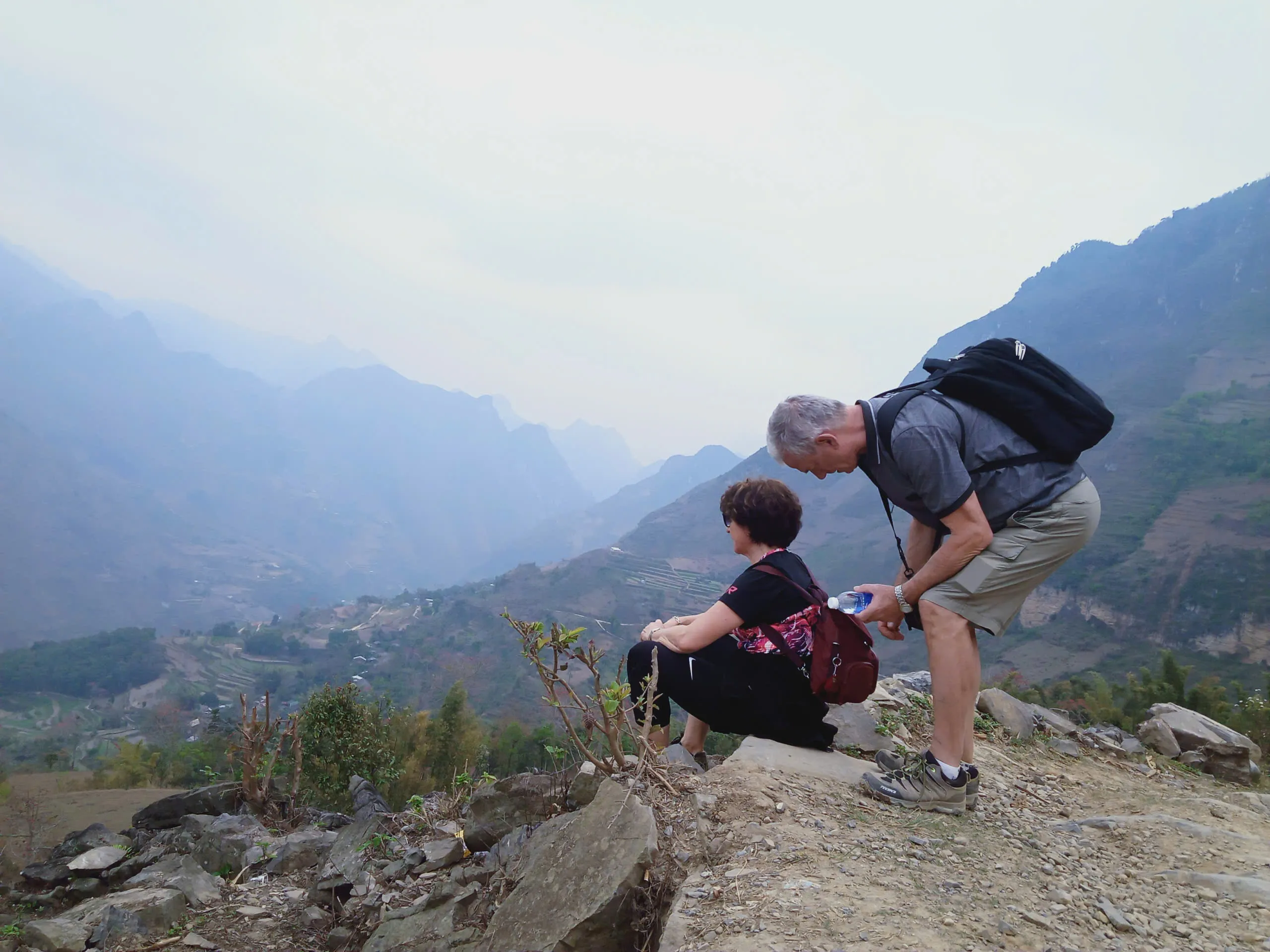
The eastern rim from Pai Lung to the Skywalk takes roughly a half-day at trekking pace, including pauses. It is not a race to tick the pass. There is no shade on the ridge, so heat and haze matter as much as distance.
Du Gia and longer loop itineraries sometimes pair southern valley days with a northern extension after Meo Vac. A canyon day fits between homestay trekking and loop driving if dates allow; tell us the full itinerary when you enquire.
Pai Lung to the Skywalk.
The eastern rim from Pai Lung to the Skywalk faces east, open to morning light before haze builds. We pause at safe, wide points, and guides set the pace for heat rather than Strava. Sky Path and Panorama sit in the same Ma Pi Leng walking country as Pai Lung and Cay Doi — named places on a walking line, not separate public pages.
A steep, loose path drops toward the river and earns the view back up. We use it only when group fitness and dry footing align, never after overnight rain on limestone grit.
Exact kilometre figures vary by side path, so treat this as a half-day rim walk rather than a measured race. If you need a fixed distance for training, use Lo Lo Day 1 at 11 km as your plateau benchmark.
Ma Pi Leng can be experienced on foot, but not every road or viewpoint section is a continuous trekking trail. Coach pullouts and the developed Skywalk are stops; the walking lives on rim path, village connectors and shorter rocky walks such as White Cliff.
Sky Path and the Panorama area sit in the same walking country as Pai Lung and Cay Doi — useful names on a Dong Van toward Meo Vac line, not official standalone trail pages and not a claim that every scenic lip joins as one continuous public path. A support vehicle can carry main luggage and meet walkers only where access permits; it cannot follow every rim or rocky section.
White Cliff / Vach Da Trang on foot.
Yes. White Cliff — Vach Da Trang — is a Moderate walk of about 2–3 hours on the White Cliff trail in the Ma Pi Leng area, on rocky, stone and dirt ground that can be narrow or uneven. It is not universally easy.
Use the name White Cliff trail in the Ma Pi Leng area. Reference walking is 2–3 hours at Moderate — terrain can include rocky mountain path, stone path, narrow or uneven mountain section. Do not treat it as universally easy.
This page owns White Cliff hike and Vach Da Trang walking questions. There is no standalone White Cliff URL. Trailhead geometry and one-way versus return are not published here. After several long plateau days it works as a shorter final mountain walk — still Moderate.
- Meo Vac trekking guide
District context around White Cliff and the canyon edge.
- Private Hoang Su Phi to Dong Van Hiking Journey
Published 7-day product using White Cliff as the final walk.
- Custom expeditions
Private Eastern sequencing when the published journey does not fit.
Dong Van toward Meo Vac is not this rim note.
Dong Van → Ta Lung → Pai Lung Village → Cay Doi → Sky Path → Panorama → Meo Vac is a reference walking corridor of 15–20 km and 6–8 hours, mapped as upper Moderate on this site — still the public Moderate grade, not a fourth difficulty label.
This is a walking corridor through part of the plateau — not the Ha Giang motorbike Loop walked kilometre-for-kilometre.
Pai Lung, Cay Doi, Sky Path and Panorama belong in that walking context. This article remains the Ma Pi Leng on-foot owner; the Meo Vac guide holds district sequencing. The Private Hoang Su Phi to Dong Van Hiking Journey uses this corridor as Day 6 and White Cliff as Day 7 — those days are the product, not a new Ma Pi Leng URL.
The Nho Que from above.
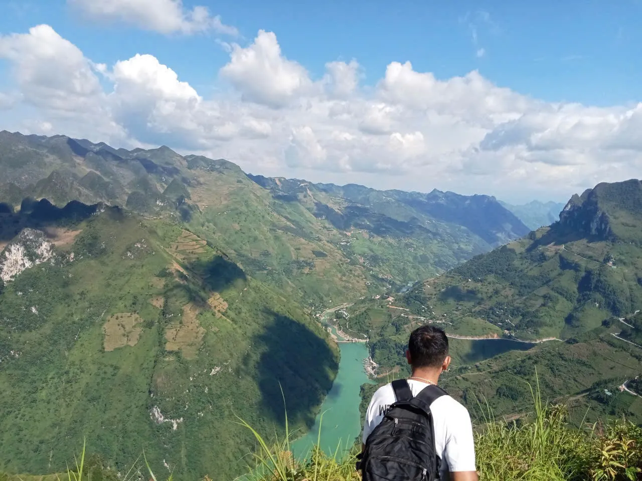
The Nho Que river reads as a thin jade ribbon from the rim — roughly a kilometre below on clear mornings. Limestone is folded, blackened by lichen, cut with goat tracks you will not follow without a local guide.
Haze is predictable by mid-morning — early light is the photography window, not golden-hour fantasy at noon. Wind on the open rim is constant; hat retention matters.
This is karst country continuous with Lo Lo Chai and Lung Cu geology — walking the canyon after northern village days gives scale to the same stone you slept beside.
- Lo Lo Chai to Then Pa
Northern plateau two-day — pairs with canyon timing.
Best months for the rim.
October through April matches our village-trek operating window on the plateau — dry paths, cold mornings, clear river colour. Buckwheat season on nearby ridges is October – November; canyon day does not need bloom but shares the same dry air.
May through August: heat and monsoon mud on limestone — we adjust pace on village routes; open canyon rim without shade is harder in afternoon rain and humidity. Start pre-dawn if your dates sit in green season.
Winter frost is less extreme on the rim than on Lo Lo homestay nights, but wind chill on an exposed edge is real — same warm layer you packed for Then Pa.
Water, sun and footing.
Bring water — more than a terrace day. No stream on the open rim. Hat, SPF 50, light rain shell if monsoon moisture builds from the valley.
Trail shoes with grip on dry limestone; poles optional on the steep loose descent toward the river if we take it. Sandals are not rim footwear.
Headlamp not required for a standard morning rim walk — keep one in the bag if you travel the loop with pre-dawn starts elsewhere.
Permits, Dong Van and loop pacing.
Foreign travellers need the Ha Giang province entry permit for the northern plateau — passport checked on loop routes. Community permits on guided programmes are handled by your guide.
Most canyon walks start from a road drop near Pai Lung — exact pickup depends on that day's loop traffic and construction (road conditions change; we confirm locally before you walk).
Pairing with Lo Lo Chai to Then Pa: Day 2 finishes toward Dong Van — canyon day fits as extension if legs and dates allow, not stacked after Day 1’s 11 km ridge without a rest night.
People above the gorge.
Lo Lo, Hmong and Giay communities live above and below the rim — the canyon is farmland and pasture, not a park. Goat tracks are livelihood paths, not adventure routes.
Sunday Meo Vac market sits one valley over — livestock and traders, not canyon viewpoints. Walking the rim connects you to the same plateau economy you see in Then Pa stone-walled fields.
Do not throw litter over the edge — there is no collection on the limestone. Pack out everything you pack in.
Canyon mistakes we see.
Midday start in clear sun — haze and heat win by 11:00; far walls gone.
Flip-flops from the loop café to the rim path — limestone grit and no railing on natural track sections.
Drone over the river without thought for goat herders below — same rule as markets: if you would not at home, do not here.
Common questions.
Is Ma Pi Leng a guided programme on your site?
This page is field knowledge for walking Ma Pi Leng — rim path, Sky Path / Panorama context and White Cliff. Book the Ma Pi Leng Canyon Expedition when a Demanding canyon week is the product; enquire on Custom if you want a shorter walking day added to a private Eastern line.
Can you hike White Cliff?
Yes. White Cliff — Vach Da Trang — is a Moderate walk of about 2–3 hours on the White Cliff trail in the Ma Pi Leng area, on rocky, stone and dirt ground that can be narrow or uneven. It is not universally easy.
How long is the White Cliff hike?
About 2–3 hours is the reference walking time. It is Moderate, not universally easy. Exact trailhead geometry is not published here.
How hard is the rim walk?
Moderate if you start early and carry water — exposure and sun matter more than elevation gain. The optional river descent is demanding and conditional.
Can I walk Ma Pi Leng in monsoon?
Possible with early start and caution on loose stone when wet. We prioritise village routes with shade and homestay recovery in heavy rain weeks.
Is the Skywalk the same as the historic path?
The Skywalk is a developed viewpoint. Our walk uses the eastern rim path from Pai Lung — slower, quieter, less railing.
Do I need the plateau permit?
Yes — foreign travellers on the Dong Van loop need the Ha Giang province entry permit. Passport required.
Slow down; look down.
Ma Pi Leng from a motorbike proves the road engineers were bold. On foot, the canyon proves you were patient enough to let depth register — river colour, lichen, silence between coach engines.
Build it into a northern trek with Lo Lo Chai or a rest day after Lung Cu — start early, carry water, and ask us to sequence driving so the rim is walked, not glimpsed.
Published by Ha Giang Trekking — field knowledge from local trail guides on the routes described, checked against programme schedules and operating notes.
Journal pages are for route research and planning. Dates, prices, day-by-day schedules and enquiry sit on programme and tour pages.
Articles are published under Ha Giang Trekking. Named writer and guide bylines will be added when verified bios and consent are on file.
Operational details on programme and tour pages are published only after being checked against current operating information.
Compare published routes and open the programme or journey page when you are ready to enquire.
- Extended journeys — multi-day loops
Compare difficulty, seasons and walking style before you enquire.
- Private Hoang Su Phi to Dong Van Hiking Journey
Private Hoang Su Phi to Dong Van Hiking Journey — full itinerary and enquiry.
- Dong Van Karst Traverse
Dong Van Karst Traverse — full itinerary and enquiry.
- Ma Pi Leng Canyon Expedition
Ma Pi Leng Canyon Expedition — full itinerary and enquiry.
- Trekking Ma Pi Leng: What to Expect on Foot
Main walking guide for Ma Pi Leng Pass.
- Dong Van Karst Plateau: A Practical Guide for Trekkers
Landscape, seasons and routes around Dong Van Karst Plateau.
- Dong Van Karst Plateau: A Practical Guide for Trekkers
Neighbouring walking country linked to Ma Pi Leng Pass.
- Meo Vac trekking guide: villages, markets and Ma Pi Leng access
Neighbouring walking country linked to Ma Pi Leng Pass.

