Day 2 — the long crossing to Nam Ai
Fifteen kilometres from Ho Thau to Nam Ai on village paths — pacing, water and weather on the middle day.
The long crossing.
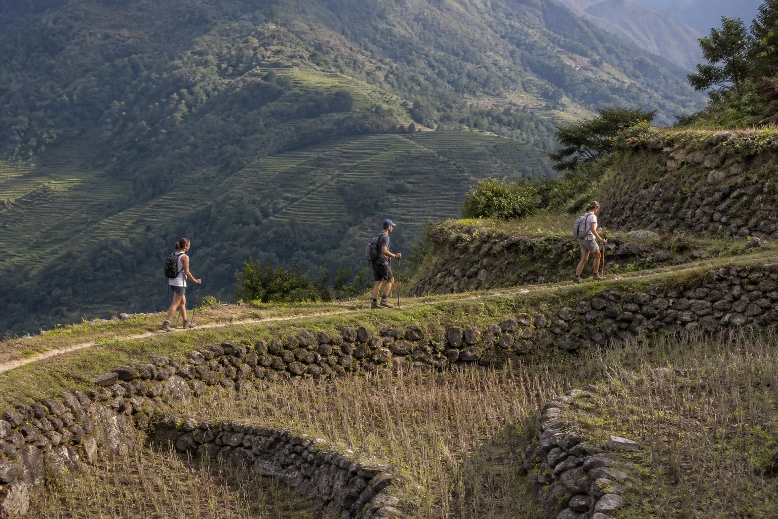
Day 2 of the Ban Luoc traverse is a published 15 km walking day from Ho Thau to the Nam Ai area — usually about five to six hours on foot. It is not one continuous dirt trail.
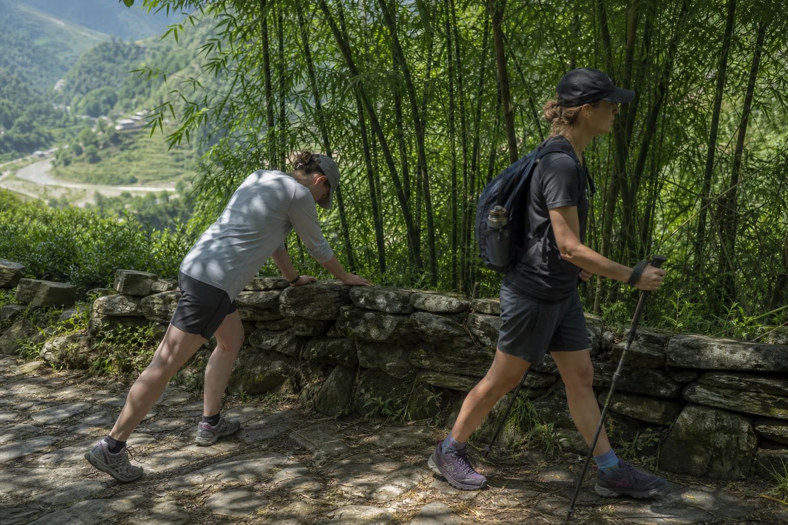
Verified surfaces on this stage include terrace paths, a narrow ridge path above paddies, shaded forest or bamboo, village tracks, and a short paved mountain-road link between footpath sections. A paved link can still be part of a trekking day without making the whole day a road walk.
You carry a daypack on the trail. Your main luggage travels separately by motorbike where access allows — that transfer line is not the same as the walking line. For district context read the Ban Luoc trekking guide; for times, meals and booking use the programme page.
- Ban Luoc — the long traverse (3 days)
Full programme page with day-by-day schedule, pricing and enquiry via Contact.
- Ban Luoc trekking guide
Landscape, seasons and route choice — research before you book.
- Hoang Su Phi programme hub
Compare routes, difficulty and seasons at this collection hub.
Day 2 at a glance.
- Walking distance vs road distance
Why a paved link on this day is still walking km, not Google driving km.
- Luggage on Ha Giang treks
How the main bag and daypack split works on multi-day routes.
Leave Ho Thau.
Leave Ho Thau after breakfast. Main bag is labelled for motorbike transfer toward Nam Ai when road access allows. The English-speaking lead holds group pace against trail conditions — if you arrive after dark, dinner and recovery both suffer.
Water stops are planned in shade, not on the most exposed crests. In hot weeks, guides carry extra bottles; still bring at least two litres capacity in your daypack.
Guests often push hard in the morning to bank time — then struggle on the afternoon village paths into Nam Ai. Guides set a steady pace. Stay behind the local lead on narrow sections.
- Ban Luoc — the long traverse (3 days)
Full programme page with day-by-day schedule, pricing and enquiry via Contact.
What the trail actually looks like.
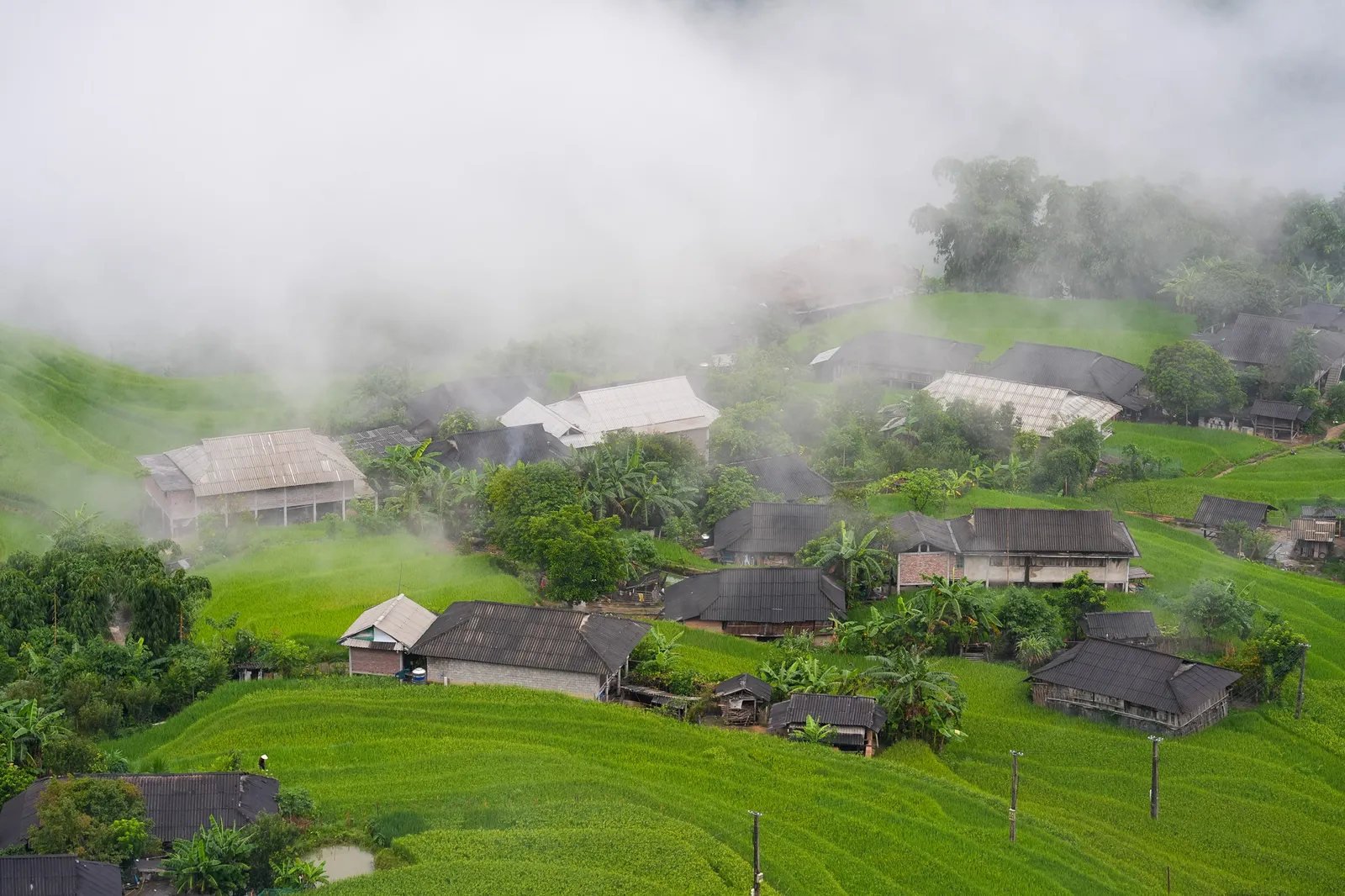
After leaving Ho Thau the line moves through working terrace country — farm margins and village tracks, not an engineered hiking trail. A narrow ridge path above paddies is a typical mid-morning section: exposed to wind, uneven underfoot, with terraces dropping away on one side.
Where the path enters shade you walk forest or bamboo footpaths — humidity rises after rain and roots show on clay. Village paths link farmhouses and irrigation channels. Surfaces change several times in one day; boots with grip matter more than a single trail type.
Ban Phung's La Chi terrace amphitheatre is a different one-day programme. Day 2 of Ban Luoc finishes in the Nam Ai area, not in Ban Phung.
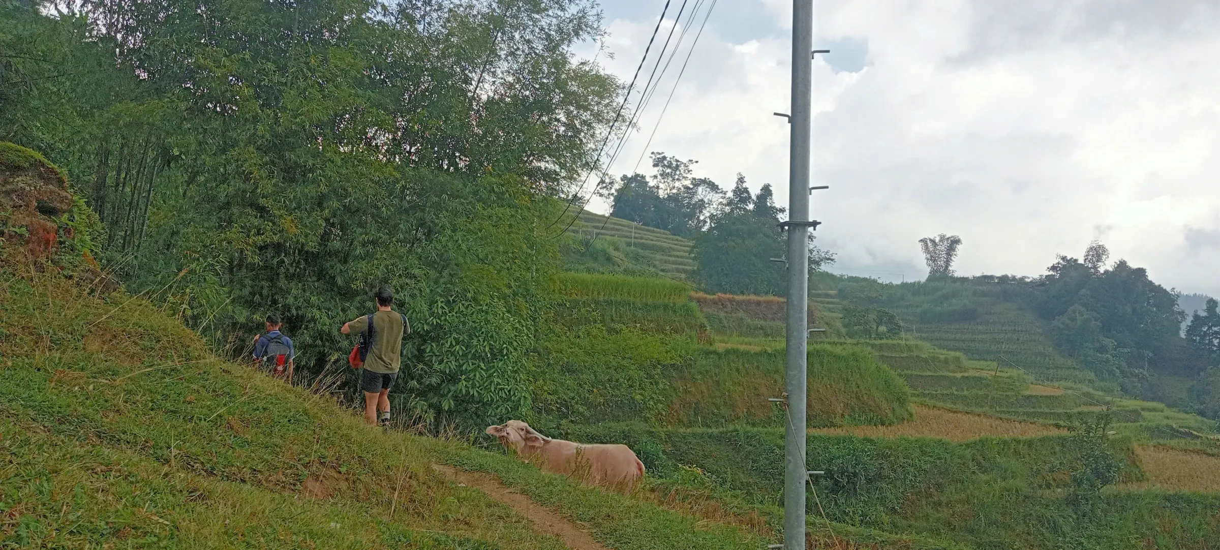
- Terrace farming in Hoang Su Phi
Working agriculture on the walls you pass.
Why a paved section is still trekking.
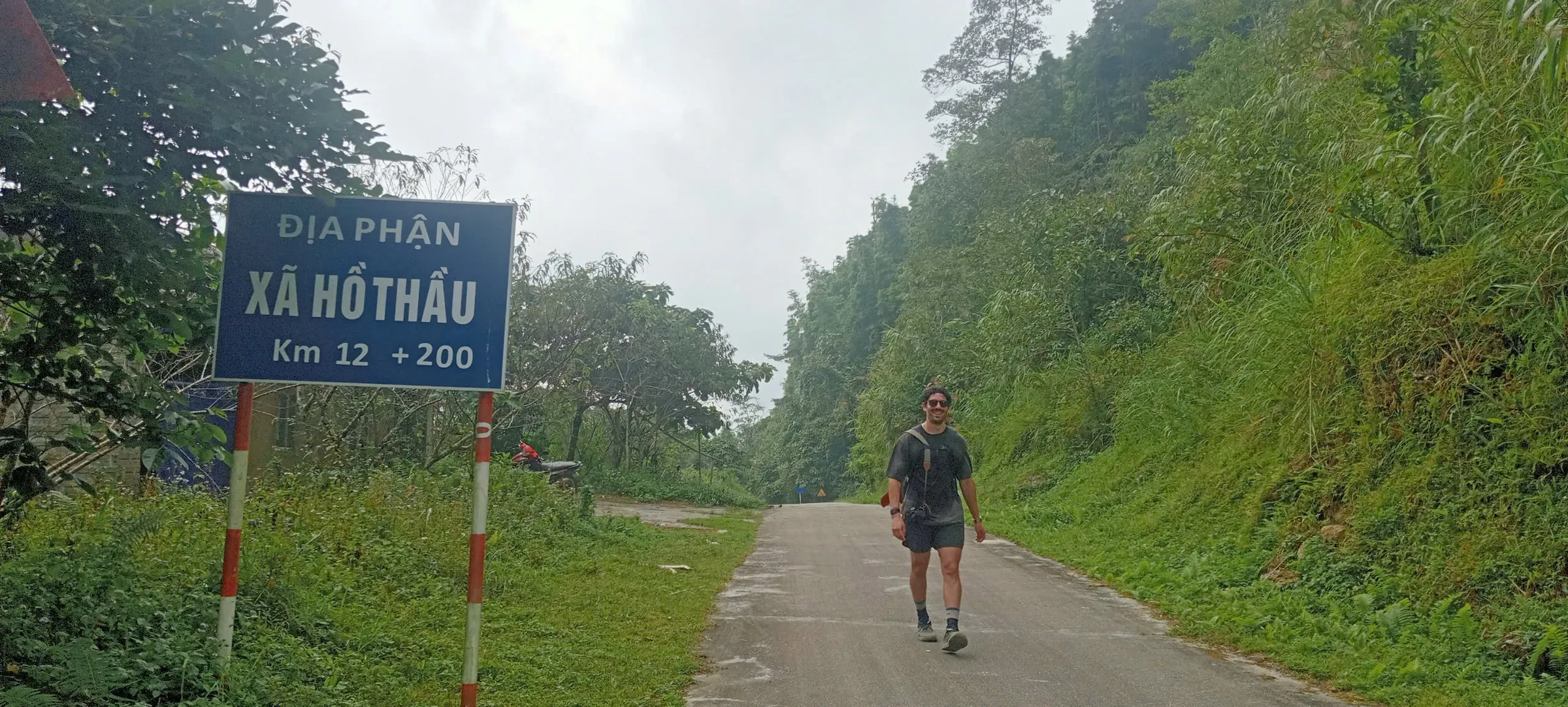
On Ho Thau → Nam Ai, walkers sometimes use a paved mountain-road link between village or terrace sections. That link is part of the published 15 km walking day — it does not mean the day is a road walk or that Google Maps driving distance between two pins equals your trek.
The motorbike line that carries your main bag may follow a different track again. Three lines often touch western Hoang Su Phi: the walking path, vehicle access, and luggage transfer. They are related but not automatically the same route or distance.
For the full explanation — with a field photo of the paved link — read walking distance vs road distance on Ha Giang treks. This note stays with how Day 2 feels underfoot.
- Walking distance vs road distance
Walking line, vehicle access, and luggage transfer explained.
Toward Nam Ai.
The afternoon continues on village paths toward the Nam Ai area. Poles help on rooty sections and stone steps slick after rain.
Your main bag is already heading to the overnight when access allows — you carried camera kit and layers in the daypack. Keep one lens accessible; stopping to dig through the bag delays the group.
If Day 2 ran long because of rain or photography stops, guides still aim for village arrival before dark. They may shorten a photo stop rather than rush the last hour.
- Ban Luoc — the long traverse (3 days)
Full programme page with day-by-day schedule, pricing and enquiry via Contact.
Nam Ai evening.
Day 2 ends with village accommodation in the Nam Ai area — not a terrace sunset timed on the Ban Phung ridge. Light on western Hoang Su Phi terraces can still be good when weather allows; shoot from paths, not planted rows.
You carry full camera kit in your daypack. Morning of Day 3 is another long walking window into Phin Ho — do not burn card space only on Day 2 evening.
- Photography across the traverse
Light, gear and etiquette on the western corridor.
- Photography guide — Ban Phung
Terrace light on the one-day route.
Water, rest and rhythm.
Day 2 is 15 km — operator-confirmed — with a planning range of roughly five to six hours. Main bag travels by motorbike where access allows; poles help on wet clay. Hydrate at dinner on Night 1. Eat breakfast on Day 2 even if appetite is low.
Rest stops are set off the most exposed crests. Wind picks up on open sections after midday. Shell layer ready in the pack, not buried deep. Guides do not compress Day 1 to rest more at Ho Thau — Day 2 timing starts with how fresh your legs are at first light.
Tell us at booking if you have knee or back concerns — we adjust pace to the slowest walker. We can lend trekking poles if you ask when you enquire.
- Recovery pacing on a multi-day trek
How Night 1 habits affect Day 2 performance.
October and shoulder season.
October is generally dry and the most beautiful month for the traverse. We monitor weather daily and re-route around any unsafe section. November mist slows photography but rarely stops the walk. July and August bring daily rain — we monitor slippery descents closely.
Hoang Su Phi town forecasts understate ridge wind and overstate valley rain. Your guide reads cloud movement in the morning and may slow pace if visibility drops. The published corridor does not change for light cloud — only pace and photo stops adjust.
Is the route safe in October rains? October is generally dry. Shoulder-season clay on Day 2 is why gaiters and broken-in boots are on the kit list.
- Seasons and packing
When to walk and what to bring.
Trail lunch on Day 2.
Lunch on Day 2 is hosted on trail — timing shifts with pace and weather. Guides watch the clock because a late photo stop pushes the hardest hours into afternoon heat or rain.
Eat even if appetite is muted after the morning — a 15 km day is glycogen-heavy. Water at lunch matters more than coffee. Snacks between meals are provided on trail; still carry two litres capacity in your daypack.
Hosted family dinners on Nights 1 and 2 are substantial — do not skip breakfast on Day 2 to compensate for a large Night 1 meal.
- Ban Luoc — the long traverse (3 days)
Full programme page with day-by-day schedule, pricing and enquiry via Contact.
Day 2 as the filter.
How fit do you need to be? Comfortable walking five to six hours on uneven farm and terrace paths for 15 km after a 17 km Day 1. We move at the slowest walker's pace. Day 2 is why the traverse is Demanding — not altitude, not exposure, but consecutive long days on village paths.
If three long walking days feel ambitious, book Nam Hong to Ho Thau first. Book after Nam Hong or Ban Phung if this is your first multi-day walk in the district.
Previous multi-day trekking helps but is not required. Broken-in boots are essential — blisters on Day 1 ruin Day 2.
- Nam Hong to Ho Thau (2 days)
The two-day Red Dao crossing — a different corridor from the Ban Luoc → Ho Thau → Nam Ai → Phin Ho traverse.
- Ban Luoc — the long traverse (3 days)
Full programme page with day-by-day schedule, pricing and enquiry via Contact.
What this walking day is not.
This is not the Nam Hong Red Dao ridge programme — a different corridor and a two-day rhythm. It is not Ban Phung's one-day La Chi terrace circuit. It is not a motorbike touring day with occasional photo stops.
It is not a continuous dirt singletrack from bungalow door to village door. Paved links, terrace walls and farm paths alternate. Nor is the 15 km figure the same as pin-to-pin driving distance on a map.
For the full three-day arc — including the approximately 17 km Day 3 into Phin Ho — read the Ban Luoc three-day traverse field note and the long traverse programme page.
- The Ban Luoc three-day traverse
Full rhythm, fitness and Day 3 context.
Common questions.
How early do we leave on Day 2?
After breakfast at Ho Thau — typically around 07:00–07:30. Exact time shifts slightly by season and trail conditions.
Can Day 2 be shortened in bad weather?
The published Ho Thau → Nam Ai line is walked in most conditions. Severe weather may delay start or shorten photo stops; safety decisions stay with the lead guide.
Do I need trekking poles?
Recommended on wet clay and rooty forest sections. We can lend a pair if you ask when you enquire.
What if I cannot finish Day 2?
Guides carry emergency contact protocol. Prevention is pacing and honest fitness disclosure at booking — we adjust groups when we know knee or ankle history in advance.
Published by Ha Giang Trekking — field knowledge from local trail guides on the routes described, checked against programme schedules and operating notes.
Journal pages are for route research and planning. Dates, prices, day-by-day schedules and enquiry sit on programme and tour pages.
Articles are published under Ha Giang Trekking. Named writer and guide bylines will be added when verified bios and consent are on file.
Operational details on programme and tour pages are published only after being checked against current operating information.
Ready to walk with local guides?
Dates, pricing and the day-by-day itinerary are on the programme page. Enquire about a departure when you are ready — we usually reply within 24 hours with availability, a clear price and what to pack.
Ban Luoc — the long traverse (3 days) — dates, pricing and itinerary